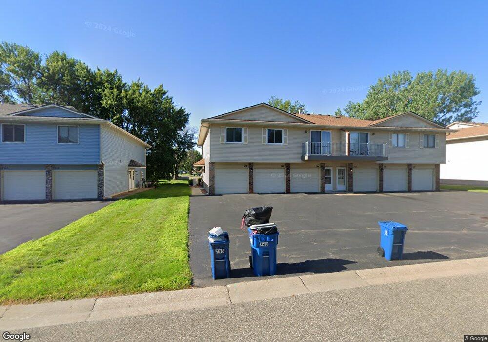
748 Parkside Dr Unit 748F Saint Paul, MN 55127
Estimated Value: $194,497 - $210,000
2
Beds
1
Bath
1,015
Sq Ft
$198/Sq Ft
Est. Value
About This Home
This home is located at 748 Parkside Dr Unit 748F, Saint Paul, MN 55127 and is currently estimated at $200,624, approximately $197 per square foot. 748 Parkside Dr Unit 748F is a home located in Ramsey County with nearby schools including Vadnais Heights Elementary School, Sunrise Park Middle School, and AFSA High School.
Ownership History
Date
Name
Owned For
Owner Type
Purchase Details
Closed on
Jan 30, 2023
Sold by
Carter Debora K and Carter John P
Bought by
Carter John P and Carter Debora K
Current Estimated Value
Home Financials for this Owner
Home Financials are based on the most recent Mortgage that was taken out on this home.
Original Mortgage
$140,400
Outstanding Balance
$135,979
Interest Rate
6.31%
Mortgage Type
New Conventional
Estimated Equity
$64,645
Purchase Details
Closed on
Dec 8, 2021
Sold by
Carter Debora K
Bought by
Carter Debora K and Griffin Sebastian
Create a Home Valuation Report for This Property
The Home Valuation Report is an in-depth analysis detailing your home's value as well as a comparison with similar homes in the area
Home Values in the Area
Average Home Value in this Area
Purchase History
| Date | Buyer | Sale Price | Title Company |
|---|---|---|---|
| Carter John P | $485 | Lendserv National Title | |
| Carter Debora K | -- | None Listed On Document | |
| Carter Debora K | $500 | Terrie Lewis Law Office Pa |
Source: Public Records
Mortgage History
| Date | Status | Borrower | Loan Amount |
|---|---|---|---|
| Open | Carter John P | $140,400 |
Source: Public Records
Tax History Compared to Growth
Tax History
| Year | Tax Paid | Tax Assessment Tax Assessment Total Assessment is a certain percentage of the fair market value that is determined by local assessors to be the total taxable value of land and additions on the property. | Land | Improvement |
|---|---|---|---|---|
| 2025 | $1,692 | $193,700 | $1,000 | $192,700 |
| 2023 | $1,692 | $174,000 | $1,000 | $173,000 |
| 2022 | $1,318 | $155,900 | $1,000 | $154,900 |
| 2021 | $1,174 | $143,200 | $1,000 | $142,200 |
| 2020 | $1,136 | $136,100 | $1,000 | $135,100 |
| 2019 | $892 | $127,400 | $1,000 | $126,400 |
| 2018 | $830 | $115,400 | $1,000 | $114,400 |
| 2017 | $566 | $111,700 | $1,000 | $110,700 |
| 2016 | $598 | $0 | $0 | $0 |
| 2015 | $492 | $87,900 | $13,200 | $74,700 |
| 2014 | $430 | $0 | $0 | $0 |
Source: Public Records
Map
Nearby Homes
- 697 Parkside Dr Unit 697H
- 3300 Greenbrier St Unit 3300C
- 832 Woodgate Dr Unit 107
- 3329 Greenbrier St
- 696 Monn Ave
- 731 Berwood Ave
- 3120 Greenbrier St
- 3230 Edgerton St
- 963 E Berwood Ave
- 3003 Greenbrier St
- 3000 Ontario Rd
- 3028 Edgerton St
- 3172 Centerville Rd
- 3092 Vanderbie St
- 3015 Basswood St
- Revere Plan at Pioneer Commons - Colonial Manor Collection
- Franklin Plan at Pioneer Commons - Colonial Manor Collection
- Raleigh Plan at Pioneer Commons - Liberty Collection
- St.Clair Plan at Pioneer Commons - Liberty Collection
- 3309 Nathaniel Ct
- 740 Parkside Dr Unit 740G
- 746 Parkside Dr Unit 746G
- 744 Parkside Dr Unit 744H
- 742 Parkside Dr Unit 742H
- 738 Parkside Dr Unit 738F
- 756 756 Parkside Dr
- 752 752 Parkside Dr
- 750 Parkside Dr Unit 750F
- 756 Parkside Dr Unit 756H
- 752 Parkside Dr Unit 752G
- 760 Parkside Dr Unit 760F
- 758 Parkside Dr Unit 758G
- 754 Parkside Dr Unit 754H
- 762 762 Parkside-Drive-
- 762 Parkside Dr Unit 762F
- 772 Parkside Dr Unit 772F
- 766 Parkside Dr Unit 766H
- 770 Parkside Dr Unit 770G
- 768 Parkside Dr Unit 768H
- 764 Parkside Dr Unit 764G