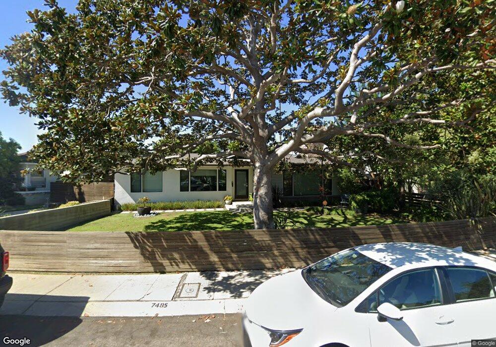
7485 Denrock Ave Los Angeles, CA 90045
Westchester NeighborhoodEstimated Value: $1,808,301 - $2,068,000
3
Beds
3
Baths
1,650
Sq Ft
$1,174/Sq Ft
Est. Value
About This Home
This home is located at 7485 Denrock Ave, Los Angeles, CA 90045 and is currently estimated at $1,937,575, approximately $1,174 per square foot. 7485 Denrock Ave is a home located in Los Angeles County with nearby schools including Cowan Avenue Elementary School, Wright Middle School STEAM Magnet, and Westchester Enriched Sciences Magnets.
Ownership History
Date
Name
Owned For
Owner Type
Purchase Details
Closed on
Apr 21, 2008
Sold by
Santoni Mark and Santoni Tami
Bought by
Winkeljohn Bradford M and Owen Amy
Current Estimated Value
Home Financials for this Owner
Home Financials are based on the most recent Mortgage that was taken out on this home.
Original Mortgage
$648,000
Interest Rate
6%
Mortgage Type
Purchase Money Mortgage
Purchase Details
Closed on
Jul 8, 2002
Sold by
Belton Robert J and Belton Claudia R
Bought by
Santoni Mark and Santoni Tami
Home Financials for this Owner
Home Financials are based on the most recent Mortgage that was taken out on this home.
Original Mortgage
$460,000
Interest Rate
6%
Create a Home Valuation Report for This Property
The Home Valuation Report is an in-depth analysis detailing your home's value as well as a comparison with similar homes in the area
Home Values in the Area
Average Home Value in this Area
Purchase History
| Date | Buyer | Sale Price | Title Company |
|---|---|---|---|
| Winkeljohn Bradford M | $810,000 | Equity Title Los Angeles | |
| Santoni Mark | $575,000 | Fidelity National Title |
Source: Public Records
Mortgage History
| Date | Status | Borrower | Loan Amount |
|---|---|---|---|
| Previous Owner | Winkeljohn Bradford M | $648,000 | |
| Previous Owner | Santoni Mark | $460,000 | |
| Closed | Santoni Mark | $86,250 |
Source: Public Records
Tax History Compared to Growth
Tax History
| Year | Tax Paid | Tax Assessment Tax Assessment Total Assessment is a certain percentage of the fair market value that is determined by local assessors to be the total taxable value of land and additions on the property. | Land | Improvement |
|---|---|---|---|---|
| 2025 | $13,387 | $1,111,266 | $838,151 | $273,115 |
| 2024 | $13,387 | $1,089,477 | $821,717 | $267,760 |
| 2023 | $13,026 | $1,059,344 | $805,605 | $253,739 |
| 2022 | $12,424 | $1,038,573 | $789,809 | $248,764 |
| 2021 | $11,846 | $982,916 | $774,323 | $208,593 |
| 2019 | $11,493 | $953,764 | $751,357 | $202,407 |
| 2018 | $11,420 | $935,064 | $736,625 | $198,439 |
| 2016 | $10,924 | $898,757 | $708,022 | $190,735 |
| 2015 | $10,764 | $885,257 | $697,387 | $187,870 |
| 2014 | $10,486 | $842,000 | $664,000 | $178,000 |
Source: Public Records
Map
Nearby Homes
- 7456 Denrock Ave
- 7501 Agnew Ave
- 7403 Stewart Ave
- 7833 Denrock Ave
- 7831 Beland Ave
- 7733 Henefer Ave
- 7920 Anise Ave Unit 1
- 12655 Bluff Creek Dr Unit 129
- 7841 Stewart Ave
- 7809 Mcconnell Ave
- 6427 Hedding St
- 5904 Village Dr
- 8000 Westlawn Ave
- 7449 Kentwood Ave
- 7404 Kentwood Ave
- 8044 Cowan Ave
- 6534 Kentwood Bluffs Dr
- 8004 El Manor Ave
- 8008 El Manor Ave
- 6606 W 80th Place
- 7501 Denrock Ave
- 7507 Denrock Ave
- 7410 Agnew Ave
- 7500 Agnew Ave
- 7402 Agnew Ave
- 7506 Agnew Ave
- 7511 Denrock Ave
- 7500 Denrock Ave
- 7494 Denrock Ave
- 7478 Denrock Ave
- 7506 Denrock Ave
- 7472 Denrock Ave
- 7510 Agnew Ave
- 7488 Denrock Ave
- 7466 Denrock Ave
- 7482 Denrock Ave
- 7517 Denrock Ave
- 7462 Denrock Ave
- 7518 Agnew Ave
- 7516 Denrock Ave