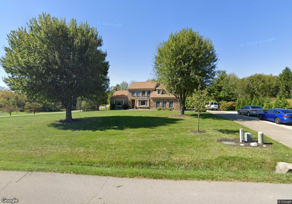
749 Brittany Trail Florence, KY 41042
Estimated Value: $375,000 - $509,000
4
Beds
4
Baths
2,364
Sq Ft
$191/Sq Ft
Est. Value
About This Home
This home is located at 749 Brittany Trail, Florence, KY 41042 and is currently estimated at $450,677, approximately $190 per square foot. 749 Brittany Trail is a home located in Boone County with nearby schools including Ockerman Elementary School, Gray Middle School, and Larry A. Ryle High School.
Ownership History
Date
Name
Owned For
Owner Type
Purchase Details
Closed on
Nov 13, 2013
Sold by
Green Donald E and Green Nancy J
Bought by
Green Donald J and Green Nancy J
Current Estimated Value
Purchase Details
Closed on
Aug 26, 2013
Sold by
Green Donald E and Green Nancy J
Bought by
Green Donald E and Green Nancy J
Home Financials for this Owner
Home Financials are based on the most recent Mortgage that was taken out on this home.
Original Mortgage
$232,000
Outstanding Balance
$171,862
Interest Rate
4.37%
Mortgage Type
New Conventional
Estimated Equity
$278,815
Purchase Details
Closed on
Jun 25, 2012
Sold by
Wolfe Lenny R and Wolfe Mary Kathryn
Bought by
Green Donald E and Green Nancy J
Home Financials for this Owner
Home Financials are based on the most recent Mortgage that was taken out on this home.
Original Mortgage
$229,290
Interest Rate
3.86%
Mortgage Type
Purchase Money Mortgage
Create a Home Valuation Report for This Property
The Home Valuation Report is an in-depth analysis detailing your home's value as well as a comparison with similar homes in the area
Home Values in the Area
Average Home Value in this Area
Purchase History
| Date | Buyer | Sale Price | Title Company |
|---|---|---|---|
| Green Donald J | -- | None Available | |
| Green Donald E | -- | None Available | |
| Green Donald E | $255,000 | Kentucky Land Title Agency |
Source: Public Records
Mortgage History
| Date | Status | Borrower | Loan Amount |
|---|---|---|---|
| Open | Green Donald E | $232,000 | |
| Closed | Green Donald E | $229,290 |
Source: Public Records
Tax History
| Year | Tax Paid | Tax Assessment Tax Assessment Total Assessment is a certain percentage of the fair market value that is determined by local assessors to be the total taxable value of land and additions on the property. | Land | Improvement |
|---|---|---|---|---|
| 2025 | $3,538 | $322,900 | $55,000 | $267,900 |
| 2024 | $3,477 | $322,900 | $55,000 | $267,900 |
| 2023 | $3,057 | $279,700 | $50,000 | $229,700 |
| 2022 | $3,070 | $279,700 | $50,000 | $229,700 |
| 2021 | $3,152 | $279,700 | $50,000 | $229,700 |
| 2020 | $3,132 | $279,700 | $50,000 | $229,700 |
| 2019 | $2,898 | $256,850 | $40,000 | $216,850 |
| 2018 | $2,877 | $256,850 | $40,000 | $216,850 |
| 2017 | $2,820 | $256,850 | $40,000 | $216,850 |
| 2015 | $2,723 | $256,850 | $40,000 | $216,850 |
| 2013 | -- | $255,000 | $28,000 | $227,000 |
Source: Public Records
Map
Nearby Homes
- 650 Elyse Way
- 810 Skyline Dr
- 3 Lots Tiburon Dr
- 10756 Station Ln
- 10282 Hempsteade Dr
- 10138 Ash Creek Dr
- 648 Friars Ln Unit 7
- 943 Lakepointe Ct
- 612 Friars Ln Unit 8
- 10260 Crossbow Ct Unit 10
- 10272 Crossbow Ct Unit 10
- 10070 Cedarwood Dr
- 2011 Holderness Dr
- 287 White Pine Cir Unit l
- 9899 Burleigh Ln
- 1253 Edinburgh Ln
- 176 Maher Rd
- 10281 Cardigan Dr
- 854 Hancock Ct
- 809 Hancock Ct
- 743 Brittany Trail
- 10382 Tiburon Dr
- 759 Brittany Trail
- 746 Brittany Trail
- 752 Brittany Trail
- 737 Brittany Trail
- 740 Brittany Trail
- 758 Brittany Trail
- 10383 Tiburon Dr
- 122 Brittany Trail
- 736 Brittany Trail
- 761 Brittany Trail
- 10358 Tiburon Dr
- 731 Brittany Trail
- 10375 Tiburon Dr
- 754 Brittany Trail
- 764 Brittany Trail
- 10386 Lanes End Cir
- 760 Brittany Trail
- 767 Brittany Trail
Your Personal Tour Guide
Ask me questions while you tour the home.