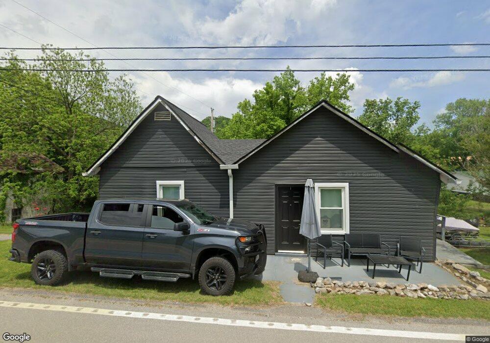
749 Lancaster Hwy Lancaster, TN 38569
Estimated Value: $146,000 - $201,000
2
Beds
1
Bath
900
Sq Ft
$201/Sq Ft
Est. Value
About This Home
This home is located at 749 Lancaster Hwy, Lancaster, TN 38569 and is currently estimated at $180,572, approximately $200 per square foot. 749 Lancaster Hwy is a home located in Smith County with nearby schools including Gordonsville Elementary School and Gordonsville High School.
Ownership History
Date
Name
Owned For
Owner Type
Purchase Details
Closed on
Jul 18, 2008
Sold by
Katherine Short Fannie
Bought by
Gochcoff Vergil C
Current Estimated Value
Home Financials for this Owner
Home Financials are based on the most recent Mortgage that was taken out on this home.
Original Mortgage
$61,750
Outstanding Balance
$40,438
Interest Rate
6.37%
Estimated Equity
$140,134
Purchase Details
Closed on
Jul 28, 2005
Bought by
Short Fannie Katherine
Purchase Details
Closed on
Jan 13, 2005
Bought by
Citizens Bank
Purchase Details
Closed on
Sep 25, 1993
Bought by
Hall George
Purchase Details
Closed on
Jun 7, 1991
Bought by
Sampson Dick W and Sampson Barbara A
Purchase Details
Closed on
Jul 17, 1982
Bought by
Sampson John
Create a Home Valuation Report for This Property
The Home Valuation Report is an in-depth analysis detailing your home's value as well as a comparison with similar homes in the area
Home Values in the Area
Average Home Value in this Area
Purchase History
| Date | Buyer | Sale Price | Title Company |
|---|---|---|---|
| Gochcoff Vergil C | $65,000 | -- | |
| Short Fannie Katherine | $32,000 | -- | |
| Citizens Bank | $35,000 | -- | |
| Hall George | $13,000 | -- | |
| Sampson Dick W | $9,000 | -- | |
| Sampson John | -- | -- |
Source: Public Records
Mortgage History
| Date | Status | Borrower | Loan Amount |
|---|---|---|---|
| Open | Sampson John | $61,750 |
Source: Public Records
Tax History Compared to Growth
Tax History
| Year | Tax Paid | Tax Assessment Tax Assessment Total Assessment is a certain percentage of the fair market value that is determined by local assessors to be the total taxable value of land and additions on the property. | Land | Improvement |
|---|---|---|---|---|
| 2024 | $503 | $29,025 | $2,500 | $26,525 |
| 2023 | $503 | $29,025 | $0 | $0 |
| 2022 | $503 | $29,025 | $2,500 | $26,525 |
| 2021 | $409 | $16,475 | $1,250 | $15,225 |
| 2020 | $312 | $16,475 | $1,250 | $15,225 |
| 2019 | $312 | $11,425 | $1,250 | $10,175 |
| 2018 | $245 | $11,425 | $1,250 | $10,175 |
| 2017 | $245 | $11,425 | $1,250 | $10,175 |
| 2016 | $244 | $10,525 | $1,250 | $9,275 |
| 2015 | $244 | $10,525 | $1,250 | $9,275 |
| 2014 | $244 | $10,525 | $1,250 | $9,275 |
Source: Public Records
Map
Nearby Homes
- 742 Lancaster Hwy
- 6 Bay Dr
- 732 Lancaster Hwy
- 43 Moss Bend Ln
- 0 Harbor Dr Unit RTC3001271
- 0 Harbor Dr Unit RTC2996114
- 12 Congo Bottom Ln
- 584 Lancaster Hwy
- 678 Love Valley Rd
- 84 Judd Ln
- 10 Temperance Cir
- 0 Temperance Cir
- 642 Club Springs Rd
- 7775 Medley Amonette Rd
- 0 Medley Amonette Rd Unit RTC2209108
- 6285 Medley Amonette Rd
- 9 Johnnie Woods Ln
- 0 Nabors Hollow Ln
- 22 Judkins Ln
- 697 Club Springs Rd
- 746 Lancaster Hwy
- 745 Lancaster Hwy
- 58 Lancaster Cir
- 61 Lancaster Cir
- 754 Lancaster Hwy
- 5 Maple St E
- 56 Lancaster Cir
- 756 Lancaster Hwy
- 11 Maple St E
- 3 Maple St E
- 57 Lancaster Cir
- 47 Lancaster Cir
- 7 Park Dr
- 3 Bettys Bend Rd
- 13 Maple St E
- 758 Lancaster Hwy
- 43 Lancaster Cir
- 740 Lancaster Hwy
- 8 Maple St E
- 4 Depot Ln