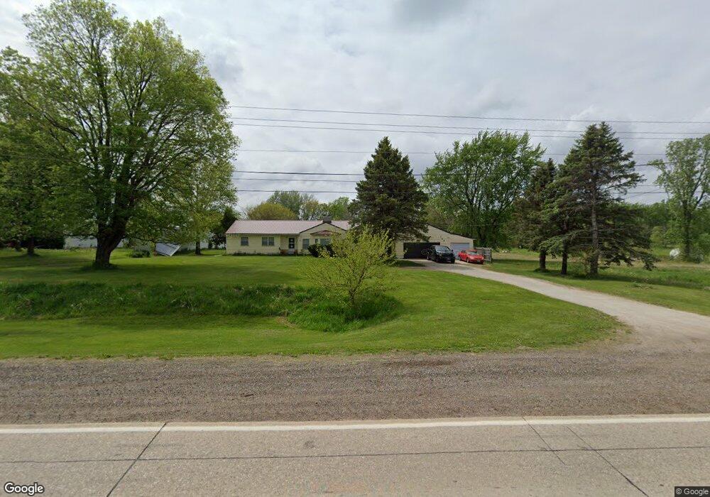
749 W Airline Hwy Waterloo, IA 50703
Estimated Value: $262,000 - $325,924
4
Beds
2
Baths
2,150
Sq Ft
$132/Sq Ft
Est. Value
About This Home
This home is located at 749 W Airline Hwy, Waterloo, IA 50703 and is currently estimated at $284,481, approximately $132 per square foot. 749 W Airline Hwy is a home located in Black Hawk County with nearby schools including Lincoln Elementary School, George Washington Carver Academy, and East High School.
Ownership History
Date
Name
Owned For
Owner Type
Purchase Details
Closed on
May 14, 2009
Sold by
Radue Bruce P and Radue Mary Ann
Bought by
Hoskins James W
Current Estimated Value
Home Financials for this Owner
Home Financials are based on the most recent Mortgage that was taken out on this home.
Original Mortgage
$158,000
Outstanding Balance
$99,344
Interest Rate
4.84%
Mortgage Type
New Conventional
Estimated Equity
$185,137
Create a Home Valuation Report for This Property
The Home Valuation Report is an in-depth analysis detailing your home's value as well as a comparison with similar homes in the area
Home Values in the Area
Average Home Value in this Area
Purchase History
| Date | Buyer | Sale Price | Title Company |
|---|---|---|---|
| Hoskins James W | $162,500 | None Available |
Source: Public Records
Mortgage History
| Date | Status | Borrower | Loan Amount |
|---|---|---|---|
| Open | Hoskins James W | $158,000 |
Source: Public Records
Tax History Compared to Growth
Tax History
| Year | Tax Paid | Tax Assessment Tax Assessment Total Assessment is a certain percentage of the fair market value that is determined by local assessors to be the total taxable value of land and additions on the property. | Land | Improvement |
|---|---|---|---|---|
| 2025 | $5,644 | $323,700 | $43,040 | $280,660 |
| 2024 | $5,644 | $292,520 | $43,040 | $249,480 |
| 2023 | $4,382 | $292,520 | $43,040 | $249,480 |
| 2022 | $4,522 | $211,800 | $43,040 | $168,760 |
| 2021 | $4,262 | $211,800 | $43,040 | $168,760 |
| 2020 | $4,188 | $200,090 | $31,330 | $168,760 |
| 2019 | $4,188 | $200,090 | $31,330 | $168,760 |
| 2018 | $4,192 | $200,090 | $31,330 | $168,760 |
| 2017 | $4,192 | $200,090 | $31,330 | $168,760 |
| 2016 | $4,492 | $210,020 | $31,330 | $178,690 |
| 2015 | $4,492 | $210,020 | $31,330 | $178,690 |
| 2014 | $3,890 | $180,230 | $31,330 | $148,900 |
Source: Public Records
Map
Nearby Homes
- 3355 Logan Ave
- 2556 Logan Ave
- Lot 7 North Crossing
- Lot 6 North Crossing
- Lot 3 North Crossing
- Lot 2 North Crossing
- Lot 9 North Crossing
- Lot 8 North Crossing
- Lot 5 North Crossing
- Lot 4 North Crossing
- Lot 1 North Crossing
- Lot 13 North Crossing
- Lot 10 North Crossing
- Lot 11 North Crossing
- Lot 12 North Crossing
- 2133 Logan Ave Unit 1
- 503 W Dale St
- Lot 3 N Crossing 2nd Addition
- 231 Mckay Ave Unit 235
- 657 Sherman Ave
- 729 W Airline Hwy
- 730 W Airline Hwy
- 775 W Airline Hwy
- 843 W Airline Hwy
- 861 W Airline Hwy
- 929 W Airline Hwy Unit 921
- 560 W Airline Hwy
- 3045 Burton Ave
- 437 W Airline Hwy Unit 429
- 3051 Burton Ave
- 438 W Airline Hwy
- 3151 Burton Ave
- 1058 W Airline Hwy
- 2920 Janet Dr
- 2904 Janet Dr
- 2904 Janet Dr
- 3165 Burton Ave
- 3173 Burton Ave
- 3233 Burton Ave
- 537 Grover Ct