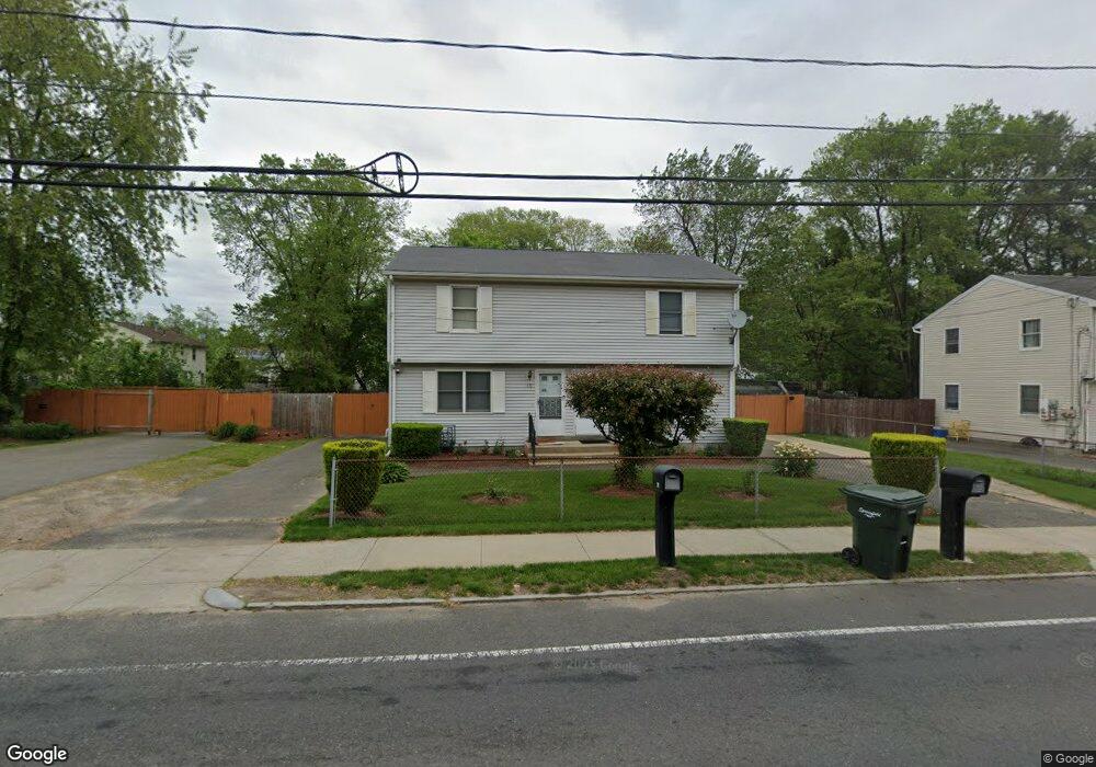
75 Harvey St Unit 77 Springfield, MA 01119
Pine Point NeighborhoodEstimated Value: $360,216 - $448,000
4
Beds
2
Baths
1,836
Sq Ft
$219/Sq Ft
Est. Value
About This Home
This home is located at 75 Harvey St Unit 77, Springfield, MA 01119 and is currently estimated at $401,304, approximately $218 per square foot. 75 Harvey St Unit 77 is a home located in Hampden County with nearby schools including Frank H. Freedman School, John F. Kennedy Academy, and Springfield Central High School.
Ownership History
Date
Name
Owned For
Owner Type
Purchase Details
Closed on
Mar 25, 2011
Sold by
Hinds Millicent A
Bought by
Hinds Colin A
Current Estimated Value
Purchase Details
Closed on
Mar 17, 2011
Sold by
Hines Ivan J and Hines Michael A
Bought by
Hines Joe L
Purchase Details
Closed on
Jan 26, 1989
Sold by
Charista Re Invest
Bought by
Hinds Millicent A
Home Financials for this Owner
Home Financials are based on the most recent Mortgage that was taken out on this home.
Original Mortgage
$100,000
Interest Rate
10.66%
Mortgage Type
Purchase Money Mortgage
Create a Home Valuation Report for This Property
The Home Valuation Report is an in-depth analysis detailing your home's value as well as a comparison with similar homes in the area
Home Values in the Area
Average Home Value in this Area
Purchase History
| Date | Buyer | Sale Price | Title Company |
|---|---|---|---|
| Hinds Colin A | -- | -- | |
| Hines Joe L | -- | -- | |
| Hinds Millicent A | $139,900 | -- |
Source: Public Records
Mortgage History
| Date | Status | Borrower | Loan Amount |
|---|---|---|---|
| Previous Owner | Hinds Millicent A | $102,400 | |
| Previous Owner | Hinds Millicent A | $100,000 |
Source: Public Records
Tax History
| Year | Tax Paid | Tax Assessment Tax Assessment Total Assessment is a certain percentage of the fair market value that is determined by local assessors to be the total taxable value of land and additions on the property. | Land | Improvement |
|---|---|---|---|---|
| 2025 | $5,207 | $332,100 | $39,400 | $292,700 |
| 2024 | $4,715 | $293,600 | $39,400 | $254,200 |
| 2023 | $4,673 | $274,100 | $34,900 | $239,200 |
| 2022 | $4,114 | $218,600 | $32,600 | $186,000 |
| 2021 | $3,689 | $195,200 | $29,600 | $165,600 |
| 2020 | $3,742 | $191,600 | $29,600 | $162,000 |
| 2019 | $3,269 | $166,100 | $30,700 | $135,400 |
| 2018 | $3,182 | $161,700 | $30,700 | $131,000 |
| 2017 | $3,081 | $156,700 | $33,800 | $122,900 |
| 2016 | $3,037 | $154,500 | $33,800 | $120,700 |
| 2015 | $2,301 | $117,000 | $33,800 | $83,200 |
Source: Public Records
Map
Nearby Homes
- 83 Harvey St Unit 85
- 83-85 Harvey St
- 6 Hutchinson St
- 82 Harvey St
- 61 Harvey St
- 90 Harvey St
- 24 Hutchinson St Unit 26
- 100 Harvey St
- 35 Hutchinson St
- 3-5 Hutchinson St
- 15 Davenport St Unit 17
- 60 Harvey St
- 25 Davenport St
- 15 Hutchinson St Unit 17
- 15-17 Hutchinson St
- 32 Hutchinson St Unit 34
- 58 Harvey St
- 29 Davenport St
- 108 Harvey St
- 46 Joseph St
Your Personal Tour Guide
Ask me questions while you tour the home.