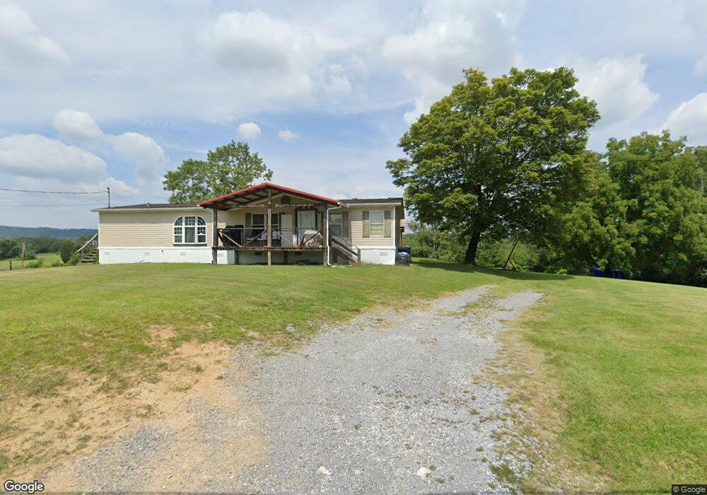
75 Paul Pettit Rd Mohawk, TN 37810
Estimated Value: $140,012 - $181,000
Studio
2
Baths
1,620
Sq Ft
$101/Sq Ft
Est. Value
About This Home
This home is located at 75 Paul Pettit Rd, Mohawk, TN 37810 and is currently estimated at $163,503, approximately $100 per square foot. 75 Paul Pettit Rd is a home located in Greene County with nearby schools including McDonald Elementary School, West Greene Middle Schools, and West Greene High School.
Ownership History
Date
Name
Owned For
Owner Type
Purchase Details
Closed on
Jun 14, 2016
Sold by
Burgin Stacey P
Bought by
Key Gary
Current Estimated Value
Purchase Details
Closed on
Jun 15, 2004
Sold by
Waits Patricia A
Bought by
Burgin Stacey P
Home Financials for this Owner
Home Financials are based on the most recent Mortgage that was taken out on this home.
Original Mortgage
$37,800
Interest Rate
6.3%
Purchase Details
Closed on
Feb 23, 2004
Sold by
Lowe Mary Jo
Bought by
Waits Kenneth W
Purchase Details
Closed on
Jul 7, 2003
Bought by
Waits Kenneth W Patricia Waits
Create a Home Valuation Report for This Property
The Home Valuation Report is an in-depth analysis detailing your home's value as well as a comparison with similar homes in the area
Purchase History
| Date | Buyer | Sale Price | Title Company |
|---|---|---|---|
| Key Gary | -- | -- | |
| Burgin Stacey P | $44,700 | -- | |
| Waits Kenneth W | $32,000 | -- | |
| Waits Kenneth W Patricia Waits | $37,000 | -- |
Source: Public Records
Mortgage History
| Date | Status | Borrower | Loan Amount |
|---|---|---|---|
| Previous Owner | Waits Kenneth W Patricia Waits | $37,800 |
Source: Public Records
Tax History
| Year | Tax Paid | Tax Assessment Tax Assessment Total Assessment is a certain percentage of the fair market value that is determined by local assessors to be the total taxable value of land and additions on the property. | Land | Improvement |
|---|---|---|---|---|
| 2025 | $707 | $42,850 | $3,750 | $39,100 |
| 2024 | $707 | $42,850 | $3,750 | $39,100 |
| 2023 | $707 | $42,850 | $0 | $0 |
| 2022 | $41,800 | $20,750 | $2,500 | $18,250 |
| 2021 | $418 | $20,750 | $2,500 | $18,250 |
| 2020 | $418 | $20,750 | $2,500 | $18,250 |
| 2019 | $418 | $20,750 | $2,500 | $18,250 |
| 2018 | $415 | $20,600 | $2,500 | $18,100 |
| 2017 | $325 | $16,450 | $2,500 | $13,950 |
| 2016 | $308 | $16,450 | $2,500 | $13,950 |
| 2015 | $308 | $16,450 | $2,500 | $13,950 |
| 2014 | $308 | $16,450 | $2,500 | $13,950 |
Source: Public Records
Map
Nearby Homes
- 1550 Mount Hope Rd Unit 2
- 1550 Mount Hope Rd Unit 1
- 1550 Mount Hope Rd
- 1550 Mount Hope #2 Rd
- 1550 Mount Hope #1 Rd
- Tbd Copperhead Hollow Rd Unit LotWP001
- 4250 N Mohawk Rd
- 0 Dyer Hollow Rd Unit 9992070
- 480 Obe Kirk Loop
- 750 Tom White Hollow Rd
- 310 Tom White Hollow Rd
- Tbd Democrat Rd
- 2750 Mountain Rd
- 7 W Andrew Johnson Hwy
- 15460 W Andrew Johnson Hwy
- 330 Oasis Rd
- 3456 Warrensburg
- 3456 Warrensburg Rd
- 860 Yellow Springs Rd
- 100 Democrat Rd
- 35 Paul Pettit Rd
- 70 Paul Pettit Rd
- 25 Paul Pettit Rd
- 155 Paul Pettit Rd
- 751 Paul Pettit Rd
- 1625 Mount Hope Rd
- 1605 Mount Hope Rd
- 66 Josie Rd
- Lots2&3 Mount Hope Rd
- Lot 9 Mount Hope Rd
- #8 Mount Hope Rd
- 0 Mount Hope Rd
- Lot 5 Mount Hope Rd
- Lots 2&3 Mount Hope Rd
- TBD Mount Hope Rd
- 1795 Mount Hope Rd
- 1850 Mount Hope Rd
- 305 Paul Pettit Rd
- 1930 Mount Hope Rd
- 350 Paul Pettit Rd
Your Personal Tour Guide
Ask me questions while you tour the home.