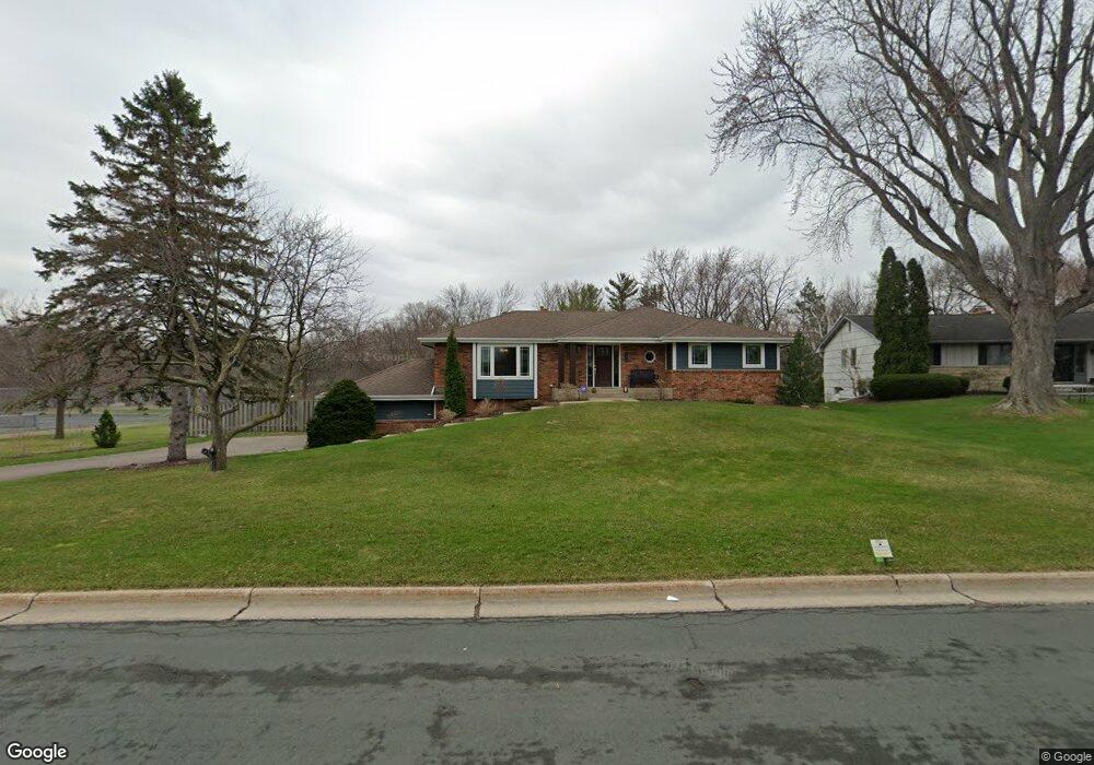
750 Upper Colonial Dr Saint Paul, MN 55118
Estimated Value: $592,029 - $698,000
3
Beds
3
Baths
3,031
Sq Ft
$210/Sq Ft
Est. Value
About This Home
This home is located at 750 Upper Colonial Dr, Saint Paul, MN 55118 and is currently estimated at $636,507, approximately $209 per square foot. 750 Upper Colonial Dr is a home located in Dakota County with nearby schools including Somerset Elementary School, Heritage E-STEM Magnet School, and Two Rivers High School.
Ownership History
Date
Name
Owned For
Owner Type
Purchase Details
Closed on
Dec 20, 2011
Sold by
Stasny Allen J and Stasny Denise L
Bought by
Nordin Brian T and Nordin Jamie D E
Current Estimated Value
Home Financials for this Owner
Home Financials are based on the most recent Mortgage that was taken out on this home.
Original Mortgage
$353,400
Interest Rate
4.01%
Mortgage Type
New Conventional
Create a Home Valuation Report for This Property
The Home Valuation Report is an in-depth analysis detailing your home's value as well as a comparison with similar homes in the area
Home Values in the Area
Average Home Value in this Area
Purchase History
| Date | Buyer | Sale Price | Title Company |
|---|---|---|---|
| Nordin Brian T | $275,000 | Premier Title |
Source: Public Records
Mortgage History
| Date | Status | Borrower | Loan Amount |
|---|---|---|---|
| Closed | Nordin Brian T | $353,400 |
Source: Public Records
Tax History Compared to Growth
Tax History
| Year | Tax Paid | Tax Assessment Tax Assessment Total Assessment is a certain percentage of the fair market value that is determined by local assessors to be the total taxable value of land and additions on the property. | Land | Improvement |
|---|---|---|---|---|
| 2024 | $5,394 | $602,100 | $183,500 | $418,600 |
| 2023 | $5,394 | $566,500 | $179,400 | $387,100 |
| 2022 | $4,482 | $538,500 | $179,000 | $359,500 |
| 2021 | $4,482 | $450,100 | $155,600 | $294,500 |
| 2020 | $4,346 | $442,200 | $148,200 | $294,000 |
| 2019 | $4,114 | $413,300 | $119,400 | $293,900 |
| 2018 | $3,881 | $374,400 | $111,500 | $262,900 |
| 2017 | $3,833 | $367,100 | $106,200 | $260,900 |
| 2016 | -- | $351,600 | $106,200 | $245,400 |
Source: Public Records
Map
Nearby Homes
- 1320 Riverside Ln Unit 303
- 1320 Riverside Ln Unit 112
- 1328 Riverside Ln
- 13XX Clement St
- 685 Hidden Creek Trail
- 1626 Diane Rd
- 648 Sunset Ln
- 600 Wentworth Ave
- 672 Ivy Falls Ct
- 1774 Dodd Rd
- 679 Marie Ave W
- XXX Barbara Ct
- 614 Hidden Creek Trail
- 679 Maple Park Dr
- 625 Ivy Falls Ave
- 884 Marie Ave W
- 792 Hilltop Rd
- 1759 Lilac Ln
- 8 Dorset Rd
- 1174 Dodd Rd
- 754 Upper Colonial Dr
- 751 Upper Colonial Dr
- 1480 Cherry Hill Rd
- 757 Upper Colonial Dr
- 766 Upper Colonial Dr
- 763 Upper Colonial Dr
- 1472 Cherry Hill Rd
- 1465 Cherry Hill Rd
- 769 Upper Colonial Dr
- 723 3rd Ave
- 762 Lower Colonial Dr
- 770 Upper Colonial Dr
- 1464 Cherry Hill Rd
- 755 Wentworth Ave
- 768 Lower Colonial Dr
- 721 3rd Ave
- 773 Upper Colonial Dr
- 776 Upper Colonial Dr
- 774 Lower Colonial Dr
- 719 3rd Ave