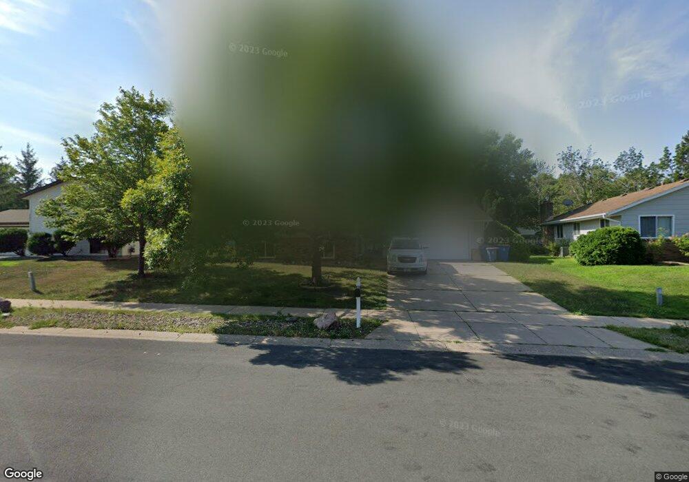
7509 W 102nd St Bloomington, MN 55438
West Bloomington NeighborhoodEstimated Value: $440,052 - $460,000
4
Beds
2
Baths
2,065
Sq Ft
$220/Sq Ft
Est. Value
About This Home
This home is located at 7509 W 102nd St, Bloomington, MN 55438 and is currently estimated at $453,763, approximately $219 per square foot. 7509 W 102nd St is a home located in Hennepin County with nearby schools including Ridgeview Elementary School, Olson Middle School, and Jefferson Senior High School.
Ownership History
Date
Name
Owned For
Owner Type
Purchase Details
Closed on
May 23, 2019
Sold by
Walsh Patrick W and Walsh Hannah K Theisen
Bought by
Gartland Grant and Gartland Jackie
Current Estimated Value
Home Financials for this Owner
Home Financials are based on the most recent Mortgage that was taken out on this home.
Original Mortgage
$284,000
Outstanding Balance
$249,186
Interest Rate
4.1%
Mortgage Type
New Conventional
Estimated Equity
$204,577
Purchase Details
Closed on
Jan 5, 2017
Sold by
Anderson Jeff M
Bought by
Walsh Patrick W and Walsh Hannah K Theisen
Home Financials for this Owner
Home Financials are based on the most recent Mortgage that was taken out on this home.
Original Mortgage
$252,000
Interest Rate
4.03%
Mortgage Type
New Conventional
Purchase Details
Closed on
Apr 28, 2006
Sold by
Brickles Richard L
Bought by
Anderson Jeff M
Create a Home Valuation Report for This Property
The Home Valuation Report is an in-depth analysis detailing your home's value as well as a comparison with similar homes in the area
Home Values in the Area
Average Home Value in this Area
Purchase History
| Date | Buyer | Sale Price | Title Company |
|---|---|---|---|
| Gartland Grant | $355,000 | Trademark Title Services Inc | |
| Walsh Patrick W | $315,000 | Trademark Title Services Inc | |
| Anderson Jeff M | $302,000 | -- |
Source: Public Records
Mortgage History
| Date | Status | Borrower | Loan Amount |
|---|---|---|---|
| Open | Gartland Grant | $284,000 | |
| Previous Owner | Walsh Patrick W | $252,000 |
Source: Public Records
Tax History Compared to Growth
Tax History
| Year | Tax Paid | Tax Assessment Tax Assessment Total Assessment is a certain percentage of the fair market value that is determined by local assessors to be the total taxable value of land and additions on the property. | Land | Improvement |
|---|---|---|---|---|
| 2024 | $5,291 | $412,800 | $145,500 | $267,300 |
| 2023 | $5,121 | $422,000 | $154,700 | $267,300 |
| 2022 | $4,190 | $396,400 | $136,300 | $260,100 |
| 2021 | $3,955 | $330,100 | $120,100 | $210,000 |
| 2020 | $3,800 | $315,900 | $121,700 | $194,200 |
| 2019 | $3,881 | $296,800 | $121,700 | $175,100 |
| 2018 | $3,448 | $288,300 | $114,900 | $173,400 |
| 2017 | $3,046 | $236,000 | $91,600 | $144,400 |
| 2016 | $2,999 | $222,500 | $84,400 | $138,100 |
| 2015 | $2,851 | $205,700 | $82,900 | $122,800 |
| 2014 | -- | $195,100 | $80,300 | $114,800 |
Source: Public Records
Map
Nearby Homes
- 10170 Utah Ave S
- 7501 W 101st St Unit 310
- 7501 W 101st St Unit 107
- 10433 Utah Rd
- 8149 W 103rd St
- 7534 Landau Dr
- 7920 W 107th Street Cir
- 7401 Landau Dr Unit 12
- 10561 Maryland Rd
- 7256 Woodstock Dr
- 7321 Woodstock Curve
- 7651 Bush Lake Dr
- 10707 Yukon Ave S
- 7325 Bush Lake Dr
- 10405 Decatur Ave S
- 10907 Rhode Island Ave S
- 10911 Rhode Island Ave S
- 10462 Decatur Ave S
- 10434 Decatur Ave S
- 7518 W 110th St
- 7501 W 102nd St
- 7517 W 102nd St
- 10306 Rhode Island Cir
- 10312 Rhode Island Cir
- 10300 Rhode Island Cir
- 7525 W 102nd St
- 10318 Rhode Island Cir
- 7433 W 102nd St
- 7432 W 103rd St
- 7601 W 102nd St
- 10324 Rhode Island Cir
- 7425 W 102nd St
- 7514 W 103rd St
- 10348 Rhode Island Cir
- 7609 W 102nd St
- 7508 W 103rd St
- 10354 Rhode Island Cir
- 10342 Rhode Island Cir
- 7424 W 103rd St
- 10326 Rhode Island Cir