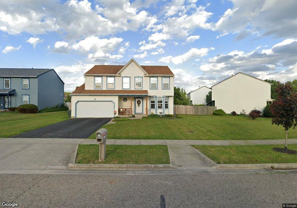
7548 Swindon St Blacklick, OH 43004
East Broad NeighborhoodEstimated Value: $352,000 - $373,452
4
Beds
3
Baths
2,198
Sq Ft
$164/Sq Ft
Est. Value
About This Home
This home is located at 7548 Swindon St, Blacklick, OH 43004 and is currently estimated at $359,613, approximately $163 per square foot. 7548 Swindon St is a home located in Franklin County with nearby schools including Olde Orchard Elementary School, Sherwood Middle School, and Walnut Ridge High School.
Ownership History
Date
Name
Owned For
Owner Type
Purchase Details
Closed on
Jan 11, 2006
Sold by
Hud
Bought by
Emrick Keith and Emrick Carrie
Current Estimated Value
Home Financials for this Owner
Home Financials are based on the most recent Mortgage that was taken out on this home.
Original Mortgage
$110,000
Outstanding Balance
$65,704
Interest Rate
7.35%
Mortgage Type
Fannie Mae Freddie Mac
Estimated Equity
$293,909
Purchase Details
Closed on
Oct 24, 2005
Sold by
Bailey Kenny A and Citimortgage Inc
Bought by
Hud
Purchase Details
Closed on
May 31, 2002
Sold by
Maronda Homes Inc Of Ohio
Bought by
Bailey Kenny A
Create a Home Valuation Report for This Property
The Home Valuation Report is an in-depth analysis detailing your home's value as well as a comparison with similar homes in the area
Home Values in the Area
Average Home Value in this Area
Purchase History
| Date | Buyer | Sale Price | Title Company |
|---|---|---|---|
| Emrick Keith | $140,000 | Lakeside | |
| Hud | $140,000 | -- | |
| Bailey Kenny A | $160,500 | Chicago Title |
Source: Public Records
Mortgage History
| Date | Status | Borrower | Loan Amount |
|---|---|---|---|
| Open | Emrick Keith | $110,000 |
Source: Public Records
Tax History Compared to Growth
Tax History
| Year | Tax Paid | Tax Assessment Tax Assessment Total Assessment is a certain percentage of the fair market value that is determined by local assessors to be the total taxable value of land and additions on the property. | Land | Improvement |
|---|---|---|---|---|
| 2024 | $5,143 | $114,600 | $30,980 | $83,620 |
| 2023 | $5,077 | $114,590 | $30,975 | $83,615 |
| 2022 | $3,652 | $70,420 | $17,500 | $52,920 |
| 2021 | $3,659 | $70,420 | $17,500 | $52,920 |
| 2020 | $3,664 | $70,420 | $17,500 | $52,920 |
| 2019 | $3,349 | $55,200 | $14,000 | $41,200 |
| 2018 | $3,100 | $55,200 | $14,000 | $41,200 |
| 2017 | $3,248 | $55,200 | $14,000 | $41,200 |
| 2016 | $3,149 | $47,530 | $7,420 | $40,110 |
| 2015 | $2,858 | $47,530 | $7,420 | $40,110 |
| 2014 | $2,865 | $47,530 | $7,420 | $40,110 |
| 2013 | $1,570 | $52,815 | $8,260 | $44,555 |
Source: Public Records
Map
Nearby Homes
- 7589 Swindon St
- 7645 Swindon St
- 192 Strathsprey Dr
- 160 Strathsprey Dr
- 417 Hannifin Dr
- 7831 Fairfax Loop Dr
- 466 Hannifin Dr
- 7452 Call Rd Unit 99F
- 7883 Grandlin Park Ct
- 208 Glenkirk Dr Unit 104B
- 447 Grandlin Park Dr
- 625 Streamwater Dr
- 186 Malloy Ln Unit 25c
- 184 Malloy Ln Unit 25D
- 7781 Hazelton St
- 240 MacEnroe Dr Unit 71D
- 170 Malloy Ln Unit 24C
- 108 Kingsmeadow Ln
- 201 MacEnroe Dr Unit 66C
- 167 MacEnroe Dr Unit 32B
- 7532 Swindon St
- 7564 Swindon St
- 7524 Swindon St
- 7580 Swindon St
- 211 Calderdale Ct
- 7687 Liddesdale Blvd
- 227 Calderdale Ct
- 7516 Swindon St
- 7684 Liddesdale Blvd
- 7588 Swindon St
- 7557 Swindon St
- 235 Calderdale Ct
- 7565 Swindon St
- 7573 Swindon St
- 7508 Swindon St
- 7671 Liddesdale Blvd
- 7596 Swindon St
- 7581 Swindon St
- 7517 Swindon St
- 7676 Liddesdale Blvd