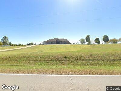
7550 Shawneetown Trail Ellis Grove, IL 62241
Estimated Value: $113,000 - $473,268
--
Bed
--
Bath
--
Sq Ft
4.16
Acres
About This Home
This home is located at 7550 Shawneetown Trail, Ellis Grove, IL 62241 and is currently estimated at $240,756. 7550 Shawneetown Trail is a home located in Randolph County with nearby schools including Chester Elementary School and Chester High School.
Ownership History
Date
Name
Owned For
Owner Type
Purchase Details
Closed on
Apr 17, 2020
Sold by
Lingle Nathaniel L and Hepp Ashlee
Bought by
Dethrow Trust
Current Estimated Value
Home Financials for this Owner
Home Financials are based on the most recent Mortgage that was taken out on this home.
Original Mortgage
$25,000
Outstanding Balance
$22,996
Interest Rate
5%
Mortgage Type
New Conventional
Estimated Equity
$221,692
Purchase Details
Closed on
Jun 27, 2019
Sold by
Dethrow Michael J and Dethrow Rosemarie Ann
Bought by
Dethrow Trust
Purchase Details
Closed on
May 12, 2008
Sold by
Dethrow Michael J and Dethrow Rosemarie Ann
Bought by
Dethrow Michael J and Dethrow Rosemarie Ann
Create a Home Valuation Report for This Property
The Home Valuation Report is an in-depth analysis detailing your home's value as well as a comparison with similar homes in the area
Home Values in the Area
Average Home Value in this Area
Purchase History
| Date | Buyer | Sale Price | Title Company |
|---|---|---|---|
| Dethrow Trust | $32,000 | None Available | |
| Dethrow Trust | -- | None Available | |
| Dethrow Michael J | -- | None Available |
Source: Public Records
Mortgage History
| Date | Status | Borrower | Loan Amount |
|---|---|---|---|
| Open | Dethrow Trust | $25,000 | |
| Previous Owner | Dethrow Michael J | $308,000 |
Source: Public Records
Tax History Compared to Growth
Tax History
| Year | Tax Paid | Tax Assessment Tax Assessment Total Assessment is a certain percentage of the fair market value that is determined by local assessors to be the total taxable value of land and additions on the property. | Land | Improvement |
|---|---|---|---|---|
| 2023 | $7,670 | $150,090 | $19,415 | $130,675 |
| 2022 | $7,266 | $141,445 | $18,295 | $123,150 |
| 2021 | $7,029 | $138,050 | $17,855 | $120,195 |
| 2020 | $7,272 | $141,374 | $18,285 | $123,089 |
| 2019 | $7,050 | $126,530 | $16,365 | $110,165 |
| 2018 | $6,550 | $139,499 | $18,042 | $121,457 |
| 2017 | $6,401 | $125,280 | $16,205 | $109,075 |
| 2016 | $6,868 | $123,670 | $15,995 | $107,675 |
| 2015 | $6,713 | $121,245 | $15,680 | $105,565 |
| 2014 | $6,713 | $121,245 | $15,680 | $105,565 |
| 2013 | $6,331 | $121,245 | $15,680 | $105,565 |
Source: Public Records
Map
Nearby Homes
- 1 Murdach Estates
- 5208 Walsh Rd
- 8901 Bodeker Rd
- 530 W Holmes St
- 611 Palestine Rd
- 2311 State St
- 500 Church St
- 319 W Holmes St
- 2830 State St
- 205 Dixie Dr
- 1718 Swanwick St
- 767 Oak St
- 5 Prairie Ln
- 1998 State St
- 760 Swanwick St
- 24 Washington Blvd
- 126 Opdyke St
- 806 Cedar St
- 804 State St
- 3061 State Route 150