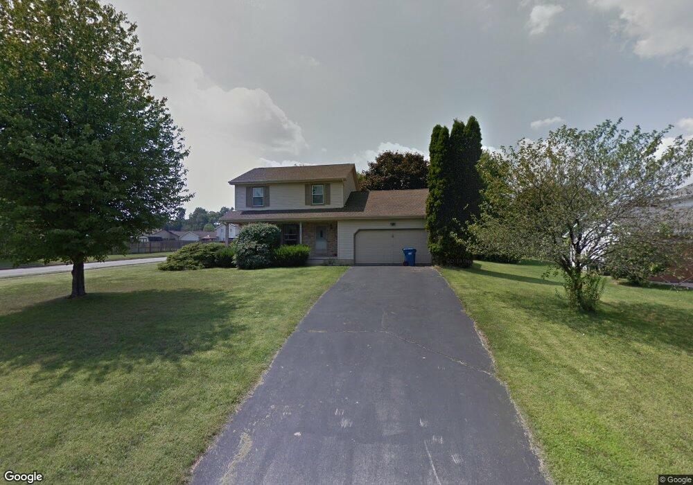
7561 Buchanan Dr Youngstown, OH 44512
Estimated Value: $231,000 - $248,630
3
Beds
2
Baths
1,542
Sq Ft
$157/Sq Ft
Est. Value
About This Home
This home is located at 7561 Buchanan Dr, Youngstown, OH 44512 and is currently estimated at $241,908, approximately $156 per square foot. 7561 Buchanan Dr is a home located in Mahoning County with nearby schools including Robinwood Lane Elementary School, Boardman Glenwood Junior High School, and Boardman High School.
Ownership History
Date
Name
Owned For
Owner Type
Purchase Details
Closed on
Jul 13, 2009
Sold by
Reves Sherri Lynn and Lane Sherri Lynn
Bought by
Awad Rami S and Ilain Lana
Current Estimated Value
Home Financials for this Owner
Home Financials are based on the most recent Mortgage that was taken out on this home.
Original Mortgage
$80,000
Outstanding Balance
$52,240
Interest Rate
5.32%
Mortgage Type
New Conventional
Estimated Equity
$189,668
Purchase Details
Closed on
Jan 28, 2006
Sold by
Estate Of Robert R Reves
Bought by
Reves Sherri Lynn and Lane Sherri Lynn
Purchase Details
Closed on
Nov 18, 2004
Sold by
Estate Of Shirley J Reves
Bought by
Reves Robert R
Purchase Details
Closed on
Apr 4, 1985
Bought by
Reves Robert R and Reves Shirley
Create a Home Valuation Report for This Property
The Home Valuation Report is an in-depth analysis detailing your home's value as well as a comparison with similar homes in the area
Home Values in the Area
Average Home Value in this Area
Purchase History
| Date | Buyer | Sale Price | Title Company |
|---|---|---|---|
| Awad Rami S | $100,000 | Attorney | |
| Reves Sherri Lynn | -- | None Available | |
| Reves Robert R | -- | -- | |
| Reves Robert R | $66,000 | -- |
Source: Public Records
Mortgage History
| Date | Status | Borrower | Loan Amount |
|---|---|---|---|
| Open | Awad Rami S | $80,000 |
Source: Public Records
Tax History Compared to Growth
Tax History
| Year | Tax Paid | Tax Assessment Tax Assessment Total Assessment is a certain percentage of the fair market value that is determined by local assessors to be the total taxable value of land and additions on the property. | Land | Improvement |
|---|---|---|---|---|
| 2024 | $3,595 | $70,170 | $15,560 | $54,610 |
| 2023 | $3,548 | $70,170 | $15,560 | $54,610 |
| 2022 | $3,229 | $48,750 | $11,980 | $36,770 |
| 2021 | $3,231 | $48,750 | $11,980 | $36,770 |
| 2020 | $3,247 | $48,750 | $11,980 | $36,770 |
| 2019 | $2,976 | $39,170 | $10,890 | $28,280 |
| 2018 | $2,646 | $39,170 | $10,890 | $28,280 |
| 2017 | $2,595 | $39,170 | $10,890 | $28,280 |
| 2016 | $2,586 | $38,660 | $12,060 | $26,600 |
| 2015 | $2,537 | $38,660 | $12,060 | $26,600 |
| 2014 | $2,545 | $38,660 | $12,060 | $26,600 |
| 2013 | $2,515 | $38,660 | $12,060 | $26,600 |
Source: Public Records
Map
Nearby Homes
- 7708 Buchanan Dr
- 912 Pearson Cir Unit 5
- 918 Pearson Cir Unit 4
- 7680 Paulin Dr
- 829 Pearson Cir
- 942 Pearson Cir Unit 4
- 816 Pearson Un#1
- 0 Saddlebrook Lot 123 Dr Unit 4442579
- 0 Saddlebrook Lot 153 Dr Unit 4442592
- 0 Saddlebrook Lot 156 Dr Unit 4442599
- 873 Auburn Hills Dr Unit 3
- 8360 South Ave
- 7368 Eisenhower Dr Unit 5
- 681 Saddlebrook Dr
- 7733 Crimson Trail Unit B
- 8010 Sigle Ln
- 7900 Walnut St Unit 25
- 803 Terraview Dr
- 785 Terraview Dr
- 8129 South Ave
- 7571 Buchanan Dr
- 7557 Buchanan Dr
- 7605 Buchanan Dr
- 7581 Buchanan Dr
- 7589 Buchanan Dr
- 7553 Buchanan Dr
- 7613 Buchanan Dr
- 7560 Buchanan Dr
- 7568 Buchanan Dr
- 7564 Buchanan Dr
- 7572 Buchanan Dr
- 7556 Buchanan Dr
- 7621 Buchanan Dr
- 7549 Buchanan Dr
- 7576 Buchanan Dr
- 7552 Buchanan Dr
- 7580 Buchanan Dr
- 7629 Buchanan Dr
- 7584 Buchanan Dr
- 7600 Buchanan Dr