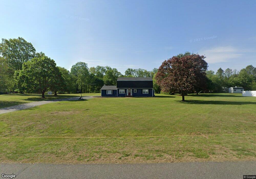
76 Cole Rd Townsend, DE 19734
Estimated Value: $488,978 - $567,000
3
Beds
3
Baths
2,820
Sq Ft
$187/Sq Ft
Est. Value
About This Home
This home is located at 76 Cole Rd, Townsend, DE 19734 and is currently estimated at $527,245, approximately $186 per square foot. 76 Cole Rd is a home located in New Castle County with nearby schools including Bunker Hill Elementary School, Cantwell's Bridge Middle School, and Odessa High School.
Ownership History
Date
Name
Owned For
Owner Type
Purchase Details
Closed on
Feb 7, 2022
Sold by
Sheppard Campbell Iii William
Bought by
Campbell William S
Current Estimated Value
Home Financials for this Owner
Home Financials are based on the most recent Mortgage that was taken out on this home.
Original Mortgage
$300,000
Outstanding Balance
$276,228
Interest Rate
3.92%
Mortgage Type
New Conventional
Estimated Equity
$251,017
Purchase Details
Closed on
Oct 1, 1979
Bought by
Zaborowski Francis and Zaborowski Vera D
Create a Home Valuation Report for This Property
The Home Valuation Report is an in-depth analysis detailing your home's value as well as a comparison with similar homes in the area
Home Values in the Area
Average Home Value in this Area
Purchase History
We collect this data history from publicly available records. To have your information removed, we recommend requesting removal directly through your county’s website.
| Date | Buyer | Sale Price | Title Company |
|---|---|---|---|
| Campbell William S | $36,000 | None Listed On Document | |
| Zaborowski Francis | $57,900 | -- |
Source: Public Records
Mortgage History
We collect this data history from publicly available records. To have your information removed, we recommend requesting removal directly through your county’s website.
| Date | Status | Borrower | Loan Amount |
|---|---|---|---|
| Open | Campbell William S | $300,000 |
Source: Public Records
Tax History
| Year | Tax Paid | Tax Assessment Tax Assessment Total Assessment is a certain percentage of the fair market value that is determined by local assessors to be the total taxable value of land and additions on the property. | Land | Improvement |
|---|---|---|---|---|
| 2025 | $4,327 | $557,400 | $140,000 | $417,400 |
| 2024 | $4,097 | $97,900 | $13,900 | $84,000 |
| 2023 | $3,481 | $97,900 | $13,900 | $84,000 |
| 2022 | $3,507 | $97,900 | $13,900 | $84,000 |
| 2021 | $3,464 | $97,900 | $13,900 | $84,000 |
| 2020 | $3,424 | $97,900 | $13,900 | $84,000 |
| 2019 | $3,171 | $97,900 | $13,900 | $84,000 |
| 2018 | $3,052 | $97,900 | $13,900 | $84,000 |
| 2017 | $2,922 | $97,900 | $13,900 | $84,000 |
| 2016 | $2,670 | $97,900 | $13,900 | $84,000 |
| 2015 | -- | $97,900 | $13,900 | $84,000 |
| 2014 | $2,591 | $97,900 | $13,900 | $84,000 |
Source: Public Records
Map
Nearby Homes
- 114 Hagerty Place
- 335 Helen Dr
- 735 Tracy Cir
- 102 Edgar Rd
- 444 Dogtown Rd
- 631 Commerce St
- 306 Lattomus St
- 131 Log Yard Ln
- 308 Gray St
- 0 Dexter Corner Rd Unit DENC2075584
- 345 Sunnyside Ln
- 1146 E Founds St
- 342 Coralroot Dr
- 341 Coralroot Dr
- 135 Main St
- 0 Blackbird Station Rd Unit DENC2096526
- 422 Bellflower Way Unit CHALFONT PLAN
- 420 Bellflower Way Unit MERION PLAN
- 418 Bellflower Way Unit MONTCHANIN PLAN
- 0 Lot 6 Ratledge Rd
Your Personal Tour Guide
Ask me questions while you tour the home.