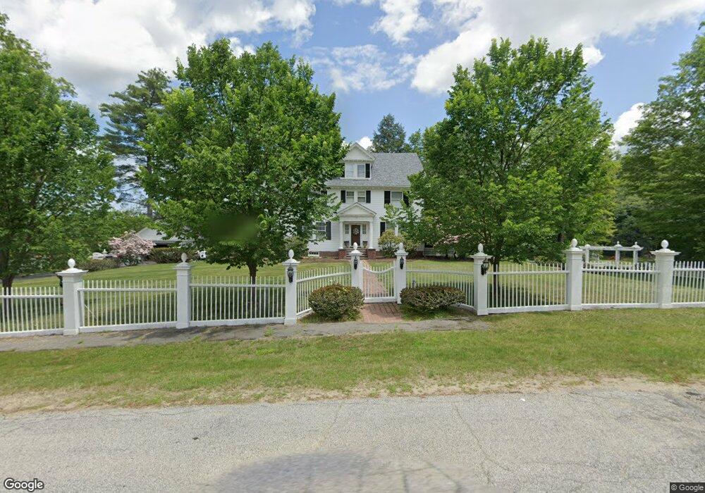
76 Elm Ave Franklin, NH 03235
Estimated Value: $426,000 - $641,398
5
Beds
4
Baths
4,179
Sq Ft
$133/Sq Ft
Est. Value
About This Home
This home is located at 76 Elm Ave, Franklin, NH 03235 and is currently estimated at $556,350, approximately $133 per square foot. 76 Elm Ave is a home located in Merrimack County with nearby schools including Paul A. Smith School, Franklin Middle School, and Franklin High School.
Ownership History
Date
Name
Owned For
Owner Type
Purchase Details
Closed on
Jan 18, 2017
Sold by
Poisson Carolyn L Ret and Poisson David T
Bought by
Sheedy Christine A
Current Estimated Value
Home Financials for this Owner
Home Financials are based on the most recent Mortgage that was taken out on this home.
Original Mortgage
$239,000
Outstanding Balance
$197,014
Interest Rate
4.13%
Mortgage Type
Purchase Money Mortgage
Estimated Equity
$359,336
Purchase Details
Closed on
Dec 17, 2002
Sold by
Lakes Christian Ctr
Bought by
Poisson David T and Poisson Carolyn L
Home Financials for this Owner
Home Financials are based on the most recent Mortgage that was taken out on this home.
Original Mortgage
$142,000
Interest Rate
6.17%
Purchase Details
Closed on
Aug 12, 1998
Sold by
Jean H Terhune Tr
Bought by
Lakes Christian Ctr
Create a Home Valuation Report for This Property
The Home Valuation Report is an in-depth analysis detailing your home's value as well as a comparison with similar homes in the area
Home Values in the Area
Average Home Value in this Area
Purchase History
| Date | Buyer | Sale Price | Title Company |
|---|---|---|---|
| Sheedy Christine A | $299,000 | -- | |
| Poisson David T | $224,000 | -- | |
| Lakes Christian Ctr | $167,000 | -- |
Source: Public Records
Mortgage History
| Date | Status | Borrower | Loan Amount |
|---|---|---|---|
| Open | Sheedy Christine A | $239,000 | |
| Previous Owner | Lakes Christian Ctr | $142,000 |
Source: Public Records
Tax History Compared to Growth
Tax History
| Year | Tax Paid | Tax Assessment Tax Assessment Total Assessment is a certain percentage of the fair market value that is determined by local assessors to be the total taxable value of land and additions on the property. | Land | Improvement |
|---|---|---|---|---|
| 2024 | $9,745 | $568,200 | $89,600 | $478,600 |
| 2023 | $9,239 | $568,200 | $89,600 | $478,600 |
| 2022 | $8,139 | $333,700 | $73,800 | $259,900 |
| 2021 | $7,745 | $333,700 | $73,800 | $259,900 |
| 2020 | $7,622 | $333,700 | $73,800 | $259,900 |
| 2019 | $7,498 | $333,700 | $73,800 | $259,900 |
| 2018 | $7,251 | $330,200 | $73,800 | $256,400 |
| 2017 | $5,547 | $217,000 | $34,500 | $182,500 |
| 2016 | $5,475 | $217,000 | $34,500 | $182,500 |
| 2015 | $3,771 | $151,130 | $24,150 | $126,980 |
| 2011 | $5,621 | $261,200 | $40,300 | $220,900 |
Source: Public Records
Map
Nearby Homes
- 152 Prospect St
- 99 Pleasant St
- 28 Leach Ave
- 88 Franklin St
- 82-84 Woodridge Rd
- 123 Franklin St
- 135 Franklin St
- 75 School St
- 416 Central St
- 624 Central St
- 28 Maple Square
- 721 Central St
- 46 Sanborn St
- 24 Munroe St Unit 2
- 24 Munroe St Unit 1&2
- 24 Munroe St Unit 1
- 48 Millstone Dr Unit 58
- 50 Millstone Dr Unit 57
- 180 Kendall St
- 12 Village Way Unit 38