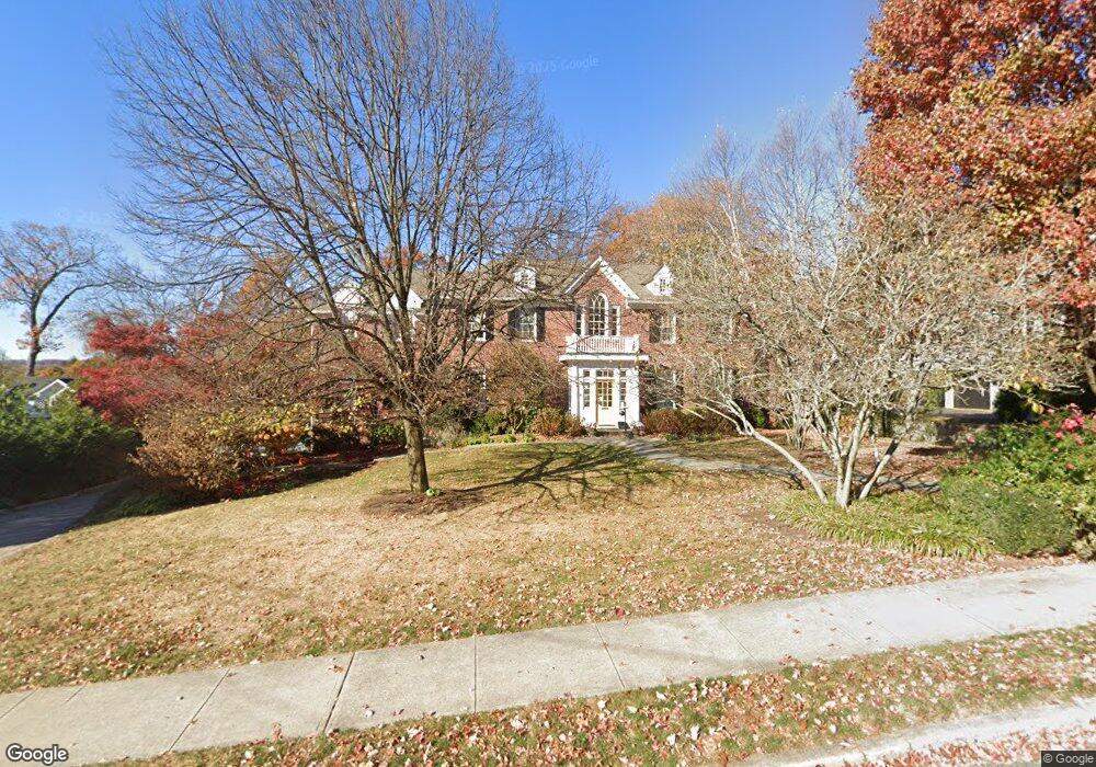
76 Heights Rd Ridgewood, NJ 07450
Estimated Value: $3,582,022 - $6,433,000
--
Bed
--
Bath
5,823
Sq Ft
$788/Sq Ft
Est. Value
About This Home
This home is located at 76 Heights Rd, Ridgewood, NJ 07450 and is currently estimated at $4,588,506, approximately $787 per square foot. 76 Heights Rd is a home located in Bergen County with nearby schools including Ridgewood High School, Little Crane Montessori School, and Holmstead School.
Ownership History
Date
Name
Owned For
Owner Type
Purchase Details
Closed on
Aug 14, 2013
Sold by
Epstein Mark L and Epstein Wendy B
Bought by
Albano Michael J and Albano Alina Gail
Current Estimated Value
Home Financials for this Owner
Home Financials are based on the most recent Mortgage that was taken out on this home.
Original Mortgage
$385,000
Outstanding Balance
$276,761
Interest Rate
3.5%
Mortgage Type
Unknown
Estimated Equity
$4,311,745
Purchase Details
Closed on
Apr 16, 1998
Sold by
Jones Hilary N and Nocka Carlo
Bought by
Epstein Mark I and Epstein Wendy B
Home Financials for this Owner
Home Financials are based on the most recent Mortgage that was taken out on this home.
Original Mortgage
$520,000
Interest Rate
7.11%
Create a Home Valuation Report for This Property
The Home Valuation Report is an in-depth analysis detailing your home's value as well as a comparison with similar homes in the area
Home Values in the Area
Average Home Value in this Area
Purchase History
| Date | Buyer | Sale Price | Title Company |
|---|---|---|---|
| Albano Michael J | $2,780,000 | -- | |
| Epstein Mark I | $650,000 | -- |
Source: Public Records
Mortgage History
| Date | Status | Borrower | Loan Amount |
|---|---|---|---|
| Open | Albano Michael J | $385,000 | |
| Open | Albano Michael J | $2,000,000 | |
| Previous Owner | Epstein Mark I | $520,000 |
Source: Public Records
Tax History Compared to Growth
Tax History
| Year | Tax Paid | Tax Assessment Tax Assessment Total Assessment is a certain percentage of the fair market value that is determined by local assessors to be the total taxable value of land and additions on the property. | Land | Improvement |
|---|---|---|---|---|
| 2025 | $71,627 | $2,496,600 | $764,300 | $1,732,300 |
| 2024 | $70,005 | $2,496,600 | $764,300 | $1,732,300 |
| 2023 | $68,232 | $2,496,600 | $764,300 | $1,732,300 |
| 2022 | $68,232 | $2,496,600 | $764,300 | $1,732,300 |
| 2021 | $67,608 | $2,496,600 | $764,300 | $1,732,300 |
| 2020 | $65,835 | $2,496,600 | $764,300 | $1,732,300 |
| 2019 | $64,837 | $2,496,600 | $764,300 | $1,732,300 |
| 2018 | $64,038 | $2,496,600 | $764,300 | $1,732,300 |
| 2017 | $63,364 | $2,496,600 | $764,300 | $1,732,300 |
| 2016 | $61,816 | $2,496,600 | $764,300 | $1,732,300 |
| 2015 | $60,742 | $2,496,600 | $764,300 | $1,732,300 |
| 2014 | $59,544 | $2,496,600 | $764,300 | $1,732,300 |
Source: Public Records
Map
Nearby Homes
- 200 Madison Place
- 27-33 Corsa Terrace Unit 3B
- 136 Crest Rd
- 10 N Hillside Place
- 44 Washington Place
- 80 Washington Place
- 334 Heights Rd
- 23 Brautigam Ln
- 222 S Broad St Unit 16
- 21 Richmond Ave
- 162 W Glen Ave
- 181 Dayton St
- 208 N Maple Ave
- 208 Busteed Dr
- 202 Melrose Place
- 6 Christopher Place
- 442 Summit St
- 33 E Glen Ave
- 211 Walton St
- 211 Doremus Ave