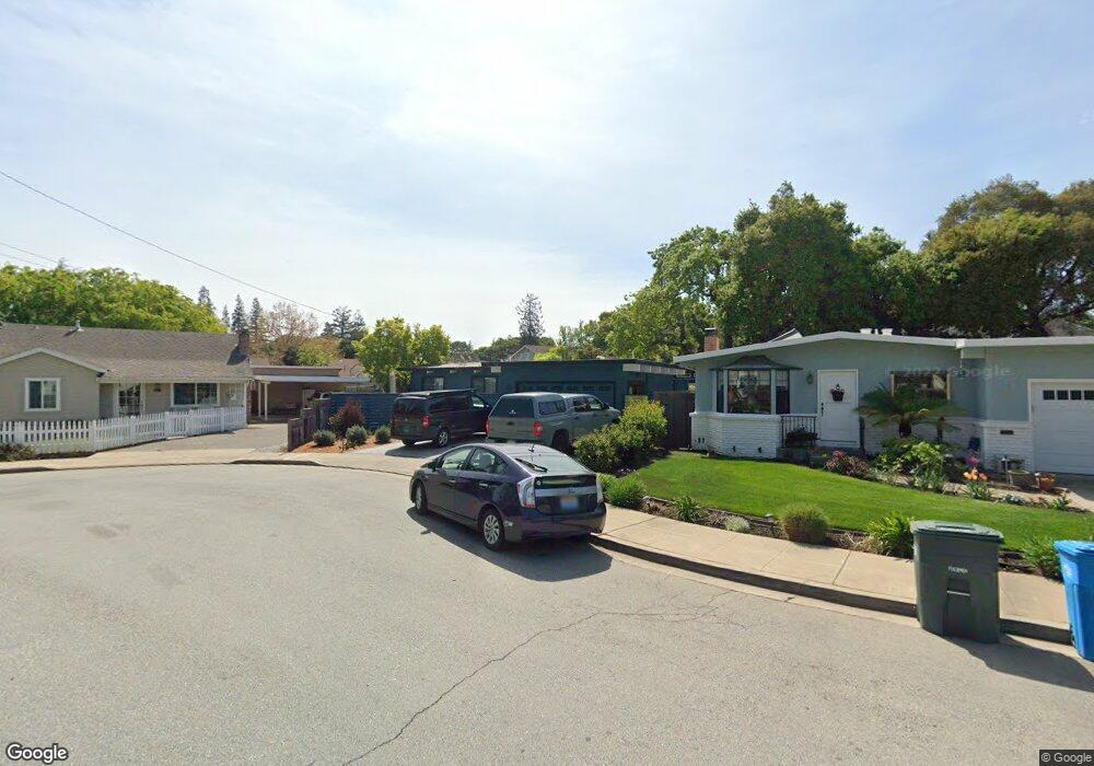
76 Lorelei Ln Menlo Park, CA 94025
Flood Park NeighborhoodEstimated Value: $1,831,744 - $2,064,000
3
Beds
2
Baths
1,100
Sq Ft
$1,799/Sq Ft
Est. Value
About This Home
This home is located at 76 Lorelei Ln, Menlo Park, CA 94025 and is currently estimated at $1,978,436, approximately $1,798 per square foot. 76 Lorelei Ln is a home located in San Mateo County with nearby schools including Encinal Elementary School, Hillview Middle School, and Menlo-Atherton High School.
Ownership History
Date
Name
Owned For
Owner Type
Purchase Details
Closed on
Jul 2, 2021
Sold by
Fox Amanda M
Bought by
Amanda M Fox Trust and Fox
Current Estimated Value
Purchase Details
Closed on
Nov 23, 2020
Sold by
Hui Ulysses S T and Fox Amanda M
Bought by
Fox Amanda M
Purchase Details
Closed on
Sep 9, 2013
Sold by
Hui Ulysses S T and Fox Amanda M
Bought by
Hui Ulysses S T and Fox Amanda M
Home Financials for this Owner
Home Financials are based on the most recent Mortgage that was taken out on this home.
Original Mortgage
$500,000
Interest Rate
3.25%
Mortgage Type
Credit Line Revolving
Purchase Details
Closed on
Mar 15, 2007
Sold by
Hui Ulysses S T and Fox Amanda M
Bought by
Hui Ulysses S T and Fox Amanda M
Purchase Details
Closed on
Jul 16, 2002
Sold by
Fox Amanda M
Bought by
Fox Amanda M and Hui Ulysses S T
Home Financials for this Owner
Home Financials are based on the most recent Mortgage that was taken out on this home.
Original Mortgage
$480,000
Interest Rate
5.75%
Purchase Details
Closed on
Aug 24, 2001
Sold by
Fox Amanda M and Hui Ulysses T
Bought by
Fox Amanda M and Amanda Fox Family Trust
Home Financials for this Owner
Home Financials are based on the most recent Mortgage that was taken out on this home.
Original Mortgage
$380,000
Interest Rate
7.14%
Purchase Details
Closed on
Jun 25, 2001
Sold by
Caballero Frank and Caballero Denise
Bought by
Hui Ulysses S T and Fox Amanda M
Home Financials for this Owner
Home Financials are based on the most recent Mortgage that was taken out on this home.
Original Mortgage
$380,000
Interest Rate
7.14%
Purchase Details
Closed on
May 30, 1995
Sold by
Shuba Henry J and Shuba Marijane V
Bought by
Caballero Frank and Caballero Denise
Home Financials for this Owner
Home Financials are based on the most recent Mortgage that was taken out on this home.
Original Mortgage
$202,500
Interest Rate
8.36%
Purchase Details
Closed on
Apr 7, 1995
Sold by
Shuba Henry J and Shuba Marijane V
Bought by
John 1995 Henry and Marijane Verna Shuba R
Home Financials for this Owner
Home Financials are based on the most recent Mortgage that was taken out on this home.
Original Mortgage
$202,500
Interest Rate
8.36%
Create a Home Valuation Report for This Property
The Home Valuation Report is an in-depth analysis detailing your home's value as well as a comparison with similar homes in the area
Home Values in the Area
Average Home Value in this Area
Purchase History
| Date | Buyer | Sale Price | Title Company |
|---|---|---|---|
| Amanda M Fox Trust | -- | None Listed On Document | |
| Fox Amanda M | -- | None Available | |
| Hui Ulysses S T | -- | Old Republic Title Company | |
| Hui Ulysses S T | -- | None Available | |
| Hui Ulysses S T | -- | None Available | |
| Fox Amanda M | -- | North American Title Co | |
| Fox Amanda M | -- | -- | |
| Hui Ulysses S T | $475,000 | Bridgespan Title Company | |
| Caballero Frank | $270,000 | American Title Insurance Co | |
| John 1995 Henry | -- | -- |
Source: Public Records
Mortgage History
| Date | Status | Borrower | Loan Amount |
|---|---|---|---|
| Previous Owner | Hui Ulysses S T | $500,000 | |
| Previous Owner | Fox Amanda M | $480,000 | |
| Previous Owner | Hui Ulysses S T | $380,000 | |
| Previous Owner | Caballero Frank | $202,500 | |
| Closed | Hui Ulysses S T | $95,000 |
Source: Public Records
Tax History
| Year | Tax Paid | Tax Assessment Tax Assessment Total Assessment is a certain percentage of the fair market value that is determined by local assessors to be the total taxable value of land and additions on the property. | Land | Improvement |
|---|---|---|---|---|
| 2025 | $10,569 | $715,736 | $357,868 | $357,868 |
| 2023 | $10,569 | $687,944 | $343,972 | $343,972 |
| 2022 | $10,032 | $674,456 | $337,228 | $337,228 |
| 2021 | $9,674 | $661,232 | $330,616 | $330,616 |
| 2020 | $9,573 | $654,452 | $327,226 | $327,226 |
| 2019 | $9,421 | $641,620 | $320,810 | $320,810 |
| 2018 | $9,158 | $629,040 | $314,520 | $314,520 |
| 2017 | $8,976 | $616,706 | $308,353 | $308,353 |
| 2016 | $8,609 | $604,614 | $302,307 | $302,307 |
| 2015 | $8,481 | $595,534 | $297,767 | $297,767 |
| 2014 | $8,287 | $583,870 | $291,935 | $291,935 |
Source: Public Records
Map
Nearby Homes
- 58 Deodora Dr
- 1149 18th Ave
- 1064 15th Ave
- 55 Irving Ave
- 754 15th Ave
- 77 Flood Cir
- 3519 Hoover St
- 1049 Haven Ave
- 3354 Page St
- 642 14th Ave
- 3336 Spring St
- 3499 E Bayshore Rd Unit 112
- 3499 E Bayshore Rd Unit 13
- 3499 E Bayshore Rd Unit 86
- 3234 Hoover St
- 563 Encina Ave
- 746 6th Ave
- 74 Middlefield Rd
- 212 Oak Grove Ave
- 732 4th Ave
Your Personal Tour Guide
Ask me questions while you tour the home.