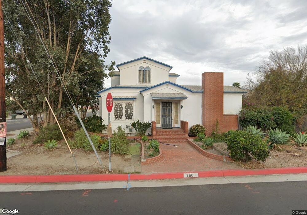
760 N West St Anaheim, CA 92801
The Colony NeighborhoodEstimated Value: $697,000 - $1,193,950
4
Beds
2
Baths
2,199
Sq Ft
$447/Sq Ft
Est. Value
About This Home
This home is located at 760 N West St, Anaheim, CA 92801 and is currently estimated at $982,988, approximately $447 per square foot. 760 N West St is a home located in Orange County with nearby schools including Westmont Elementary School, Sycamore Junior High School, and Anaheim High School.
Ownership History
Date
Name
Owned For
Owner Type
Purchase Details
Closed on
Oct 10, 2023
Sold by
Laura Hargreaves Separate Property Trust and Hargreaves Laura
Bought by
Paula Pirok-White Living Trust and Pirok-White
Current Estimated Value
Purchase Details
Closed on
Aug 24, 2021
Sold by
Pirok White Paula and Hargreaves Laura
Bought by
Pirok White Paula and Paula Pirok White Living Trust
Purchase Details
Closed on
Feb 14, 1995
Sold by
Toner John J and Toner Steven
Bought by
Pirok Laura L and Pirok Paula L
Create a Home Valuation Report for This Property
The Home Valuation Report is an in-depth analysis detailing your home's value as well as a comparison with similar homes in the area
Home Values in the Area
Average Home Value in this Area
Purchase History
| Date | Buyer | Sale Price | Title Company |
|---|---|---|---|
| Paula Pirok-White Living Trust | $550,000 | Wfg National Title | |
| Pirok White Paula | -- | None Available | |
| Pirok Laura L | $140,000 | -- |
Source: Public Records
Tax History Compared to Growth
Tax History
| Year | Tax Paid | Tax Assessment Tax Assessment Total Assessment is a certain percentage of the fair market value that is determined by local assessors to be the total taxable value of land and additions on the property. | Land | Improvement |
|---|---|---|---|---|
| 2025 | $8,368 | $747,457 | $659,221 | $88,236 |
| 2024 | $8,368 | $732,801 | $646,295 | $86,506 |
| 2023 | $4,238 | $358,434 | $274,780 | $83,654 |
| 2022 | $4,182 | $351,406 | $269,392 | $82,014 |
| 2021 | $4,187 | $344,516 | $264,110 | $80,406 |
| 2020 | $4,168 | $340,984 | $261,402 | $79,582 |
| 2019 | $4,045 | $334,299 | $256,277 | $78,022 |
| 2018 | $3,961 | $327,745 | $251,252 | $76,493 |
| 2017 | $3,805 | $321,319 | $246,325 | $74,994 |
| 2016 | $3,793 | $315,019 | $241,495 | $73,524 |
| 2015 | $3,758 | $310,288 | $237,868 | $72,420 |
| 2014 | $3,527 | $304,210 | $233,208 | $71,002 |
Source: Public Records
Map
Nearby Homes
- 700 N Westwood Place
- 849 N Lenz Dr
- 917 W Alberta St
- 609 N Dwyer Dr
- 1417 W James Way
- 945 N Summer St
- 625 W La Verne St
- 1235 W Pearl St
- 278 N Wilshire Ave Unit 156
- 278 N Wilshire Ave Unit B21
- 1125 N Mayfair Ave
- 1173 N Mayfair Ave
- 243 S Sand Dr
- 1093 N Harbor Blvd
- 246 S Cascade Palm Dr
- 1097 N Harbor Blvd
- Plan 1420 at Palm Court
- Plan 1693 at Palm Court
- Plan 1149 at Palm Court
- 1649 W Lincoln Ave Unit 101
- 1014 W North St
- 1010 W North St
- 757 N West St
- 1021 W North St
- 1105 W Park Ave
- 1015 W North St
- 740 N West St
- 1002 W North St
- 1009 W North St
- 1104 W North St
- 1003 W North St
- 1113 W Park Ave
- 1020 W Karen Place
- 1014 W Karen Place
- 928 W North St Unit A
- 928 W North St
- 1102 W Park Ave
- 735 N Westwood Place
- 1101 W North St
- 930 W North St