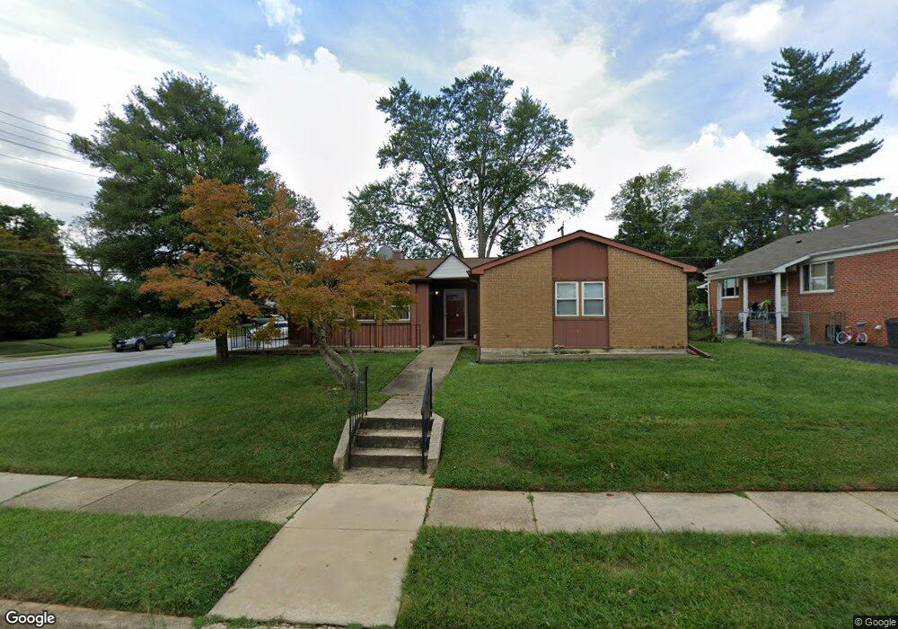
7600 Lorry Ln Pikesville, MD 21208
Estimated Value: $414,000 - $477,000
Studio
3
Baths
1,462
Sq Ft
$305/Sq Ft
Est. Value
About This Home
This home is located at 7600 Lorry Ln, Pikesville, MD 21208 and is currently estimated at $446,571, approximately $305 per square foot. 7600 Lorry Ln is a home located in Baltimore County with nearby schools including Wellwood International Elementary, Pikesville Middle School, and Pikesville High School.
Ownership History
Date
Name
Owned For
Owner Type
Purchase Details
Closed on
May 8, 2025
Sold by
Segan-Kohanim Mordechai and Segan-Kohanim Dora Margalit
Bought by
Mordechai And Dora Segan-Kohanim Revocable Tr and Segan-Kohanim
Current Estimated Value
Purchase Details
Closed on
Mar 29, 2006
Sold by
Kohanim Houman
Purchase Details
Closed on
Mar 22, 2006
Sold by
Kohanim Houman
Purchase Details
Closed on
Jan 31, 2003
Sold by
Alvarez Leslie
Bought by
Kohanim Houman
Purchase Details
Closed on
May 28, 1997
Sold by
Satossky Sander
Bought by
Alvarez Leslie
Create a Home Valuation Report for This Property
The Home Valuation Report is an in-depth analysis detailing your home's value as well as a comparison with similar homes in the area
Home Values in the Area
Average Home Value in this Area
Purchase History
| Date | Buyer | Sale Price | Title Company |
|---|---|---|---|
| Mordechai And Dora Segan-Kohanim Revocable Tr | -- | None Listed On Document | |
| -- | -- | -- | |
| -- | -- | -- | |
| -- | -- | -- | |
| -- | -- | -- | |
| Kohanim Houman | $159,900 | -- | |
| Alvarez Leslie | $110,000 | -- |
Source: Public Records
Tax History
| Year | Tax Paid | Tax Assessment Tax Assessment Total Assessment is a certain percentage of the fair market value that is determined by local assessors to be the total taxable value of land and additions on the property. | Land | Improvement |
|---|---|---|---|---|
| 2025 | $4,600 | $317,500 | $82,000 | $235,500 |
| 2024 | $4,600 | $298,767 | -- | -- |
| 2023 | $2,158 | $280,033 | $0 | $0 |
| 2022 | $3,977 | $261,300 | $82,000 | $179,300 |
| 2021 | $3,769 | $250,667 | $0 | $0 |
| 2020 | $3,769 | $240,033 | $0 | $0 |
| 2019 | $3,643 | $229,400 | $82,000 | $147,400 |
| 2018 | $3,533 | $229,400 | $82,000 | $147,400 |
| 2017 | $3,459 | $229,400 | $0 | $0 |
| 2016 | $2,648 | $233,400 | $0 | $0 |
| 2015 | $2,648 | $233,400 | $0 | $0 |
| 2014 | $2,648 | $233,400 | $0 | $0 |
Source: Public Records
Map
Nearby Homes
- 3306 Greenvale Rd
- 7617 Seven Mile Ln
- 3215 Northbrook Rd
- 7618 Carla Rd
- 3312 Bonnie Rd
- 3102 Hatton Rd
- 7420 Park Heights Ave
- 3309 Olympia Ave
- 7240 Park Heights Ave Unit 209
- 7111 Park Heights Ave Unit 104
- 7111 Park Heights Ave Unit 305
- 7111 Park Heights Ave Unit 709
- 7111 Park Heights Ave Unit 812
- 1 Slade Ave Unit 304
- 1 Slade Ave Unit 203
- 7121 Park Heights Ave Unit 210
- 7121 Park Heights Ave Unit 707
- 7121 Park Heights Ave Unit 603
- 7121 Park Heights Ave Unit 310
- 7121 Park Heights Ave Unit 501
Your Personal Tour Guide
Ask me questions while you tour the home.