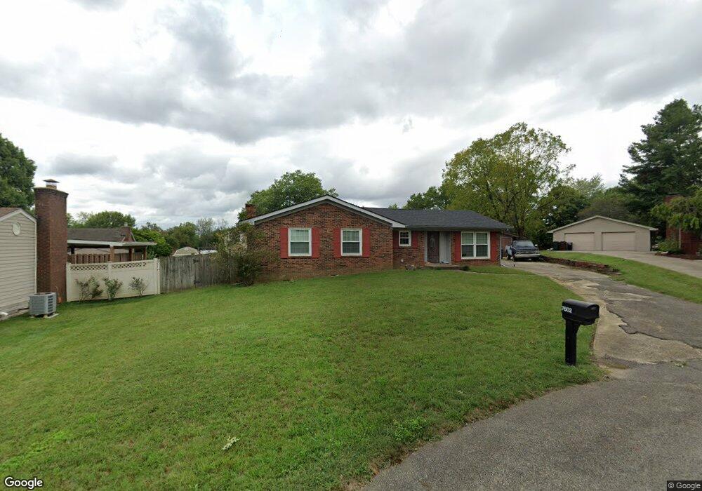
7602 Washington State Ct Louisville, KY 40228
Highview NeighborhoodEstimated Value: $264,418 - $303,000
3
Beds
2
Baths
1,721
Sq Ft
$166/Sq Ft
Est. Value
About This Home
This home is located at 7602 Washington State Ct, Louisville, KY 40228 and is currently estimated at $285,855, approximately $166 per square foot. 7602 Washington State Ct is a home located in Jefferson County with nearby schools including Smyrna Elementary School, Hartstern Elementary School, and Luhr Elementary School.
Ownership History
Date
Name
Owned For
Owner Type
Purchase Details
Closed on
Feb 8, 2011
Sold by
Deutsche Bank National Trust Company
Bought by
Franklin Scott D
Current Estimated Value
Home Financials for this Owner
Home Financials are based on the most recent Mortgage that was taken out on this home.
Original Mortgage
$118,750
Outstanding Balance
$81,219
Interest Rate
4.77%
Mortgage Type
New Conventional
Estimated Equity
$204,636
Purchase Details
Closed on
Sep 19, 2005
Sold by
Barnes Michael D
Bought by
Gilbert Melissa
Home Financials for this Owner
Home Financials are based on the most recent Mortgage that was taken out on this home.
Original Mortgage
$144,000
Interest Rate
8.12%
Mortgage Type
Purchase Money Mortgage
Create a Home Valuation Report for This Property
The Home Valuation Report is an in-depth analysis detailing your home's value as well as a comparison with similar homes in the area
Home Values in the Area
Average Home Value in this Area
Purchase History
| Date | Buyer | Sale Price | Title Company |
|---|---|---|---|
| Franklin Scott D | $125,000 | None Available | |
| Gilbert Melissa | $134,500 | None Available |
Source: Public Records
Mortgage History
| Date | Status | Borrower | Loan Amount |
|---|---|---|---|
| Open | Franklin Scott D | $118,750 | |
| Previous Owner | Gilbert Melissa | $144,000 |
Source: Public Records
Tax History Compared to Growth
Tax History
| Year | Tax Paid | Tax Assessment Tax Assessment Total Assessment is a certain percentage of the fair market value that is determined by local assessors to be the total taxable value of land and additions on the property. | Land | Improvement |
|---|---|---|---|---|
| 2024 | $2,176 | $190,060 | $41,200 | $148,860 |
| 2023 | $2,239 | $190,060 | $41,200 | $148,860 |
| 2022 | $2,247 | $139,850 | $35,000 | $104,850 |
| 2021 | $1,783 | $139,850 | $35,000 | $104,850 |
| 2020 | $1,660 | $139,850 | $35,000 | $104,850 |
| 2019 | $1,516 | $139,850 | $35,000 | $104,850 |
| 2018 | $1,497 | $139,850 | $35,000 | $104,850 |
| 2017 | $1,468 | $139,850 | $35,000 | $104,850 |
| 2013 | $1,250 | $125,000 | $25,000 | $100,000 |
Source: Public Records
Map
Nearby Homes
- 7802 Appleview Ln
- 7807 Apple Valley Dr
- 7804 Apple Valley Dr
- 7401 Rambo Way
- 7301 Duchess Dr
- 7215 Applegate Ln
- 7507 Braeburn Cir
- 8208 Roseborough Rd
- 8213 Roseborough Rd
- 8118 Arthur Goins Blvd
- 7339 Fox Hollow Way Unit 23
- 8100 Arthur Goins Blvd Unit 8100
- 7333 Fox Hollow Way Unit 26
- 8120 Shobe Ln
- 6913 Janes Farm Dr Unit 6913
- 8117 Ardenia Ln
- 8531 Aspen Glen Way
- 7239 Correll Place Dr Unit 7239
- 8431 Arbor Meadow Way
- 8001 Mary Sue Dr
- 7600 Washington State Ct
- 7603 Northern Spy Ct
- 7604 Washington State Ct
- 7601 Northern Spy Ct
- 7605 Northern Spy Ct
- 7601 Washington State Ct
- 7605 Washington State Ct
- 8001 Cortland Dr
- 8003 Cortland Dr
- 7606 Washington State Ct
- 7600 Northern Spy Ct
- 7911 Cortland Dr
- 8002 Northern Spy Dr
- 7909 Cortland Dr
- 8005 Cortland Dr
- 7912 Northern Spy Dr
- 7607 Northern Spy Ct
- 7907 Cortland Dr
- 7602 Northern Spy Ct
- 8007 Cortland Dr