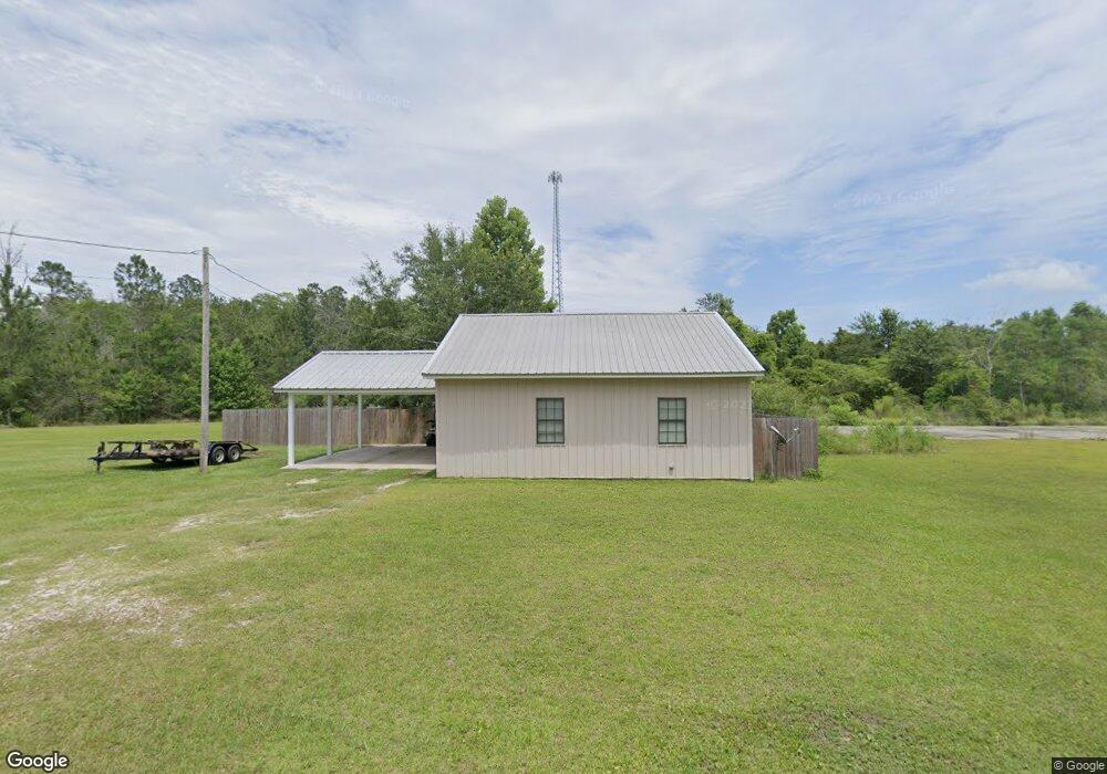
7610 Brinkman Rd Moss Point, MS 39562
Estimated Value: $116,122 - $278,000
--
Bed
--
Bath
960
Sq Ft
$197/Sq Ft
Est. Value
About This Home
This home is located at 7610 Brinkman Rd, Moss Point, MS 39562 and is currently estimated at $188,781, approximately $196 per square foot. 7610 Brinkman Rd is a home with nearby schools including East Central Lower Elementary School, East Central Upper Elementary School, and East Central Middle School.
Ownership History
Date
Name
Owned For
Owner Type
Purchase Details
Closed on
Feb 26, 2021
Sold by
Pittman Robert L
Bought by
Willis Tyler S
Current Estimated Value
Home Financials for this Owner
Home Financials are based on the most recent Mortgage that was taken out on this home.
Original Mortgage
$68,800
Outstanding Balance
$61,674
Interest Rate
2.7%
Mortgage Type
Stand Alone Refi Refinance Of Original Loan
Estimated Equity
$127,107
Purchase Details
Closed on
Dec 20, 2017
Sold by
Mixon Kacy L
Bought by
Pittman Robert Logan
Purchase Details
Closed on
Oct 1, 2013
Sold by
Busby Sandra M
Bought by
Busby Paul H
Create a Home Valuation Report for This Property
The Home Valuation Report is an in-depth analysis detailing your home's value as well as a comparison with similar homes in the area
Home Values in the Area
Average Home Value in this Area
Purchase History
| Date | Buyer | Sale Price | Title Company |
|---|---|---|---|
| Willis Tyler S | -- | None Available | |
| Pittman Robert Logan | -- | None Available | |
| Busby Paul H | -- | -- |
Source: Public Records
Mortgage History
| Date | Status | Borrower | Loan Amount |
|---|---|---|---|
| Open | Willis Tyler S | $68,800 |
Source: Public Records
Tax History Compared to Growth
Tax History
| Year | Tax Paid | Tax Assessment Tax Assessment Total Assessment is a certain percentage of the fair market value that is determined by local assessors to be the total taxable value of land and additions on the property. | Land | Improvement |
|---|---|---|---|---|
| 2024 | $495 | $6,226 | $1,675 | $4,551 |
| 2023 | $495 | $6,226 | $1,675 | $4,551 |
| 2022 | $1,089 | $9,340 | $2,513 | $6,827 |
| 2021 | $477 | $6,305 | $1,675 | $4,630 |
| 2020 | $482 | $6,026 | $1,551 | $4,475 |
| 2019 | $474 | $6,026 | $1,551 | $4,475 |
| 2018 | $488 | $6,026 | $1,551 | $4,475 |
| 2017 | $1,088 | $8,783 | $2,327 | $6,456 |
| 2016 | $401 | $3,370 | $2,327 | $1,043 |
| 2015 | $392 | $21,840 | $15,510 | $6,330 |
| 2014 | $385 | $3,277 | $2,327 | $950 |
Source: Public Records
Map
Nearby Homes
- 27 Acres Brinkman Rd E
- 0 R B Dickerson Rd
- 8200 Butler Rd
- 18517 Goff Farm Rd
- 7605 Methodist Church Rd
- 17500 Goff Farm Rd
- 01 Dap Rd E
- 0 Dap Rd E
- 7805 Songbird Ln
- -0- Rayford Shumock Rd
- 0 Rayford Shumock Rd Unit 24406728
- 0 Rayford Shumock Rd Unit 4121875
- 0 Ms-613 Hwy Unit 4116583
- 0 Ms-613 Hwy Unit 4107607
- 0 Ms-613 Hwy Unit 4107612
- 0 Ms-613 Hwy Unit 4116582
- 0 Ms-613 Hwy Unit 4131540
- 14416 Lily Orchard Rd
- 0 Big Point Unit 4125782
- 21217 E Trails End Rd
- 7608 Brinkman Rd
- 7608 Brinkman Rd
- 17508 Highway 613
- 7500 Brinkman Rd
- 7450 Brinkman Rd
- 17428 Highway 613
- 7409 Brinkman Rd
- 17700 Highway 613
- 17328 Highway 613
- 17425 Highway 613
- 7521 R B Dickerson Rd
- 17316 Highway 613
- 17732 Highway 613
- 17629 Highway 613
- 7301 Worth Goff Rd
- 17325 Highway 613
- 17820 Highway 613
- 17236 Highway 613
- 17401 Worth Goff Rd E
- 17511 Highway 613