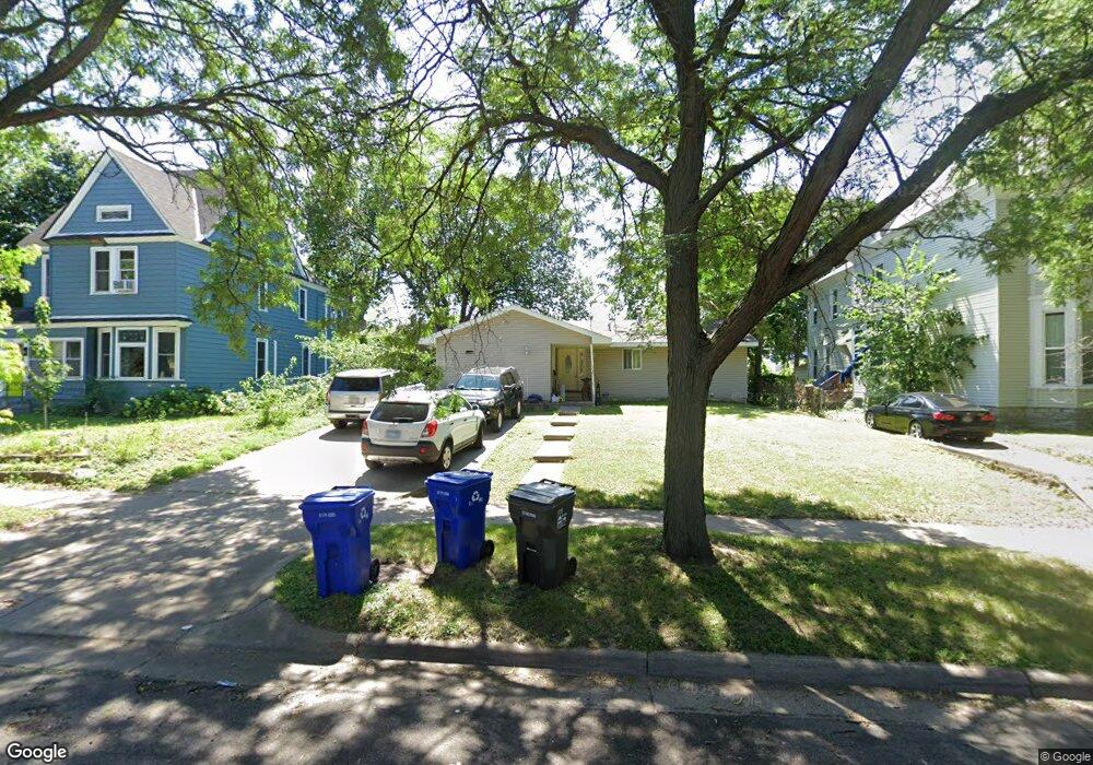
764 Carroll Ave Saint Paul, MN 55104
Summit-University NeighborhoodEstimated Value: $284,000 - $304,000
3
Beds
1
Bath
1,388
Sq Ft
$209/Sq Ft
Est. Value
About This Home
This home is located at 764 Carroll Ave, Saint Paul, MN 55104 and is currently estimated at $290,772, approximately $209 per square foot. 764 Carroll Ave is a home located in Ramsey County with nearby schools including Maxfield Magnet Elementary School, Hidden River Middle School, and Central Senior High School.
Ownership History
Date
Name
Owned For
Owner Type
Purchase Details
Closed on
Mar 12, 2020
Sold by
Csm Investors Inc
Bought by
B9 Polar Westgate Llc
Current Estimated Value
Home Financials for this Owner
Home Financials are based on the most recent Mortgage that was taken out on this home.
Original Mortgage
$158,000
Outstanding Balance
$139,665
Interest Rate
3.4%
Mortgage Type
New Conventional
Estimated Equity
$151,107
Purchase Details
Closed on
Jul 29, 1997
Sold by
Hud
Bought by
Binns Michael A
Create a Home Valuation Report for This Property
The Home Valuation Report is an in-depth analysis detailing your home's value as well as a comparison with similar homes in the area
Home Values in the Area
Average Home Value in this Area
Purchase History
| Date | Buyer | Sale Price | Title Company |
|---|---|---|---|
| B9 Polar Westgate Llc | $7,400,000 | None Available | |
| Binns Michael A | $65,000 | -- |
Source: Public Records
Mortgage History
| Date | Status | Borrower | Loan Amount |
|---|---|---|---|
| Open | B9 Polar Westgate Llc | $158,000 |
Source: Public Records
Tax History Compared to Growth
Tax History
| Year | Tax Paid | Tax Assessment Tax Assessment Total Assessment is a certain percentage of the fair market value that is determined by local assessors to be the total taxable value of land and additions on the property. | Land | Improvement |
|---|---|---|---|---|
| 2025 | $4,376 | $295,000 | $56,900 | $238,100 |
| 2023 | $4,376 | $275,400 | $56,900 | $218,500 |
| 2022 | $2,978 | $221,300 | $56,900 | $164,400 |
| 2021 | $3,202 | $184,400 | $56,900 | $127,500 |
| 2020 | $3,622 | $207,700 | $56,900 | $150,800 |
| 2019 | $2,792 | $218,600 | $56,900 | $161,700 |
| 2018 | $2,388 | $179,700 | $56,900 | $122,800 |
| 2017 | $2,574 | $154,800 | $56,900 | $97,900 |
| 2016 | $2,266 | $0 | $0 | $0 |
| 2015 | $2,400 | $137,200 | $45,500 | $91,700 |
| 2014 | $2,470 | $0 | $0 | $0 |
Source: Public Records
Map
Nearby Homes
- 298 Avon St N
- 287 Avon St N
- 797 Iglehart Ave
- 786 Iglehart Ave
- 291 Fisk St
- 663 Iglehart Ave
- 681 Dayton Ave
- 853 Iglehart Ave
- 652 Dayton Ave
- 783 Hague Ave
- 861 Saint Anthony Ave
- 742 Hague Ave
- 909 Marshall Ave
- 811 Ashland Ave
- 929 Selby Ave
- 915 Fuller Ave
- 676 Ashland Ave Unit 6
- 969 Carroll Ave
- 818 Sherburne Ave
- 563 Laurel Ave Unit 9
- 768 Carroll Ave
- 756 Carroll Ave
- 752 Carroll Ave
- 288 Avon St N
- 286 N Avon St
- 773 Iglehart Ave
- 295 Grotto St N
- 777 Iglehart Ave
- 283 Grotto St N
- 779 Carroll Ave
- 745 Iglehart Ave
- 299 Avon St N
- 283 Avon St N
- 783 Iglehart Ave
- 783 Carroll Ave
- 785 Iglehart Ave
- 766 Iglehart Ave
- 770 Iglehart Ave
- 792 Carroll Ave
- 774 Iglehart Ave