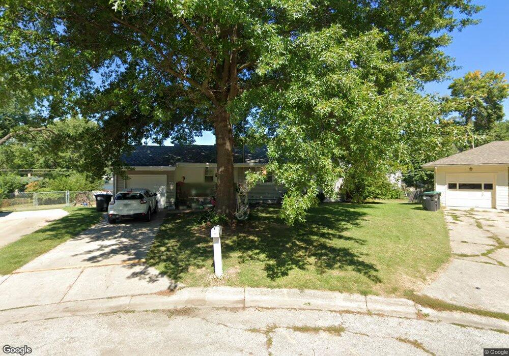
7640 Davis Omaha Cir Omaha, NE 68134
Benson Gardens NeighborhoodEstimated Value: $201,658 - $231,000
4
Beds
4
Baths
1,856
Sq Ft
$116/Sq Ft
Est. Value
About This Home
This home is located at 7640 Davis Omaha Cir, Omaha, NE 68134 and is currently estimated at $215,415, approximately $116 per square foot. 7640 Davis Omaha Cir is a home located in Douglas County with nearby schools including Adams Elementary School, Monroe Middle School, and Northwest High School.
Ownership History
Date
Name
Owned For
Owner Type
Purchase Details
Closed on
May 10, 2017
Sold by
Kastendick Sara L
Bought by
Lind Phillip E
Current Estimated Value
Home Financials for this Owner
Home Financials are based on the most recent Mortgage that was taken out on this home.
Original Mortgage
$6,550
Outstanding Balance
$5,431
Interest Rate
4.08%
Mortgage Type
Stand Alone Second
Estimated Equity
$209,984
Purchase Details
Closed on
Mar 19, 2007
Sold by
Osborn Brian
Bought by
Hinspater Janice K
Purchase Details
Closed on
May 20, 2002
Sold by
First Union National Bank
Bought by
Wallace Jeff A
Home Financials for this Owner
Home Financials are based on the most recent Mortgage that was taken out on this home.
Original Mortgage
$72,200
Interest Rate
5.75%
Purchase Details
Closed on
Feb 11, 2002
Sold by
Prichard Roger R and Prichard Lavonne Jean
Bought by
First Union National Bank
Create a Home Valuation Report for This Property
The Home Valuation Report is an in-depth analysis detailing your home's value as well as a comparison with similar homes in the area
Home Values in the Area
Average Home Value in this Area
Purchase History
| Date | Buyer | Sale Price | Title Company |
|---|---|---|---|
| Lind Phillip E | $131,000 | Aksarben Title & Escrow | |
| Hinspater Janice K | $115,000 | -- | |
| Wallace Jeff A | $77,000 | -- | |
| First Union National Bank | $103,642 | -- |
Source: Public Records
Mortgage History
| Date | Status | Borrower | Loan Amount |
|---|---|---|---|
| Open | Lind Phillip E | $6,550 | |
| Previous Owner | Wallace Jeff A | $72,200 |
Source: Public Records
Tax History
| Year | Tax Paid | Tax Assessment Tax Assessment Total Assessment is a certain percentage of the fair market value that is determined by local assessors to be the total taxable value of land and additions on the property. | Land | Improvement |
|---|---|---|---|---|
| 2025 | $2,858 | $173,500 | $18,600 | $154,900 |
| 2024 | $3,291 | $173,500 | $18,600 | $154,900 |
| 2023 | $3,291 | $156,000 | $18,600 | $137,400 |
| 2022 | $3,330 | $156,000 | $18,600 | $137,400 |
| 2021 | $2,908 | $137,400 | $18,600 | $118,800 |
| 2020 | $2,672 | $124,800 | $18,600 | $106,200 |
| 2019 | $2,407 | $112,100 | $18,600 | $93,500 |
| 2018 | $2,286 | $106,300 | $18,600 | $87,700 |
| 2017 | $2,031 | $94,000 | $18,600 | $75,400 |
Source: Public Records
Map
Nearby Homes
- 7605 Richmond Dr
- 7602 Davis Cir
- 7516 Richmond Dr
- 7343 Lake St
- 2012 Benson Gardens Blvd
- 1506 N 76th St
- 7905 Bowie Dr
- 7634 Maple St
- 2007 N 71st St
- 1829 Robertson Dr
- 2509 N 71st St
- 2513 N 71st St
- 7707 Lafayette Ave
- 7624 Wirt St
- 1038 N 75th St
- 2330 N 69th St
- 1010 N 76th St
- 6656 Decatur St
- 2307 N 68th St
- 6779 Franklin St
- 7640 Davis Cir
- 7644 Davis Cir
- 7636 Davis Cir
- 7601 Richmond Dr
- 7559 Richmond Dr
- 7630 Davis Cir
- 7648 Davis Cir
- 7611 Richmond Dr
- 7553 Richmond Dr
- 7619 Richmond Dr
- 7650 Davis Cir
- 7703 Richmond Dr
- 7549 Richmond Dr
- 7624 Davis Cir
- 7660 Davis Cir
- 7711 Richmond Dr
- 7545 Richmond Dr
- 7717 Richmond Dr
- 7741 Richmond Dr
- 7633 Davis Cir
Your Personal Tour Guide
Ask me questions while you tour the home.