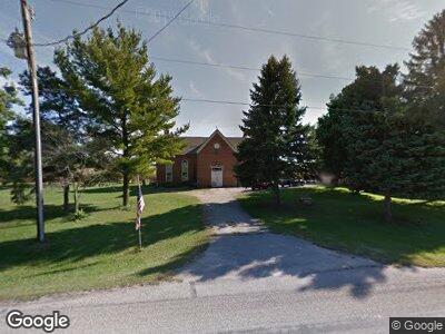
7647 State Route 722 Arcanum, OH 45304
Estimated Value: $176,000 - $244,000
3
Beds
2
Baths
1,701
Sq Ft
$120/Sq Ft
Est. Value
About This Home
This home is located at 7647 State Route 722, Arcanum, OH 45304 and is currently estimated at $204,344, approximately $120 per square foot. 7647 State Route 722 is a home located in Darke County with nearby schools including Arcanum Elementary School, Butler Middle School, and Arcanum High School.
Ownership History
Date
Name
Owned For
Owner Type
Purchase Details
Closed on
Jul 1, 2024
Sold by
Davis Roger B
Bought by
Davis David S and Davis Julia L
Current Estimated Value
Purchase Details
Closed on
Jun 10, 2008
Sold by
Garner Karl and Garner Helen
Bought by
Davis Roger B
Home Financials for this Owner
Home Financials are based on the most recent Mortgage that was taken out on this home.
Original Mortgage
$84,028
Interest Rate
5.62%
Mortgage Type
Unknown
Create a Home Valuation Report for This Property
The Home Valuation Report is an in-depth analysis detailing your home's value as well as a comparison with similar homes in the area
Home Values in the Area
Average Home Value in this Area
Purchase History
| Date | Buyer | Sale Price | Title Company |
|---|---|---|---|
| Davis David S | -- | None Listed On Document | |
| Davis Roger B | $82,000 | Attorney |
Source: Public Records
Mortgage History
| Date | Status | Borrower | Loan Amount |
|---|---|---|---|
| Previous Owner | Davis Roger D | $84,028 |
Source: Public Records
Tax History Compared to Growth
Tax History
| Year | Tax Paid | Tax Assessment Tax Assessment Total Assessment is a certain percentage of the fair market value that is determined by local assessors to be the total taxable value of land and additions on the property. | Land | Improvement |
|---|---|---|---|---|
| 2024 | $1,832 | $52,850 | $8,560 | $44,290 |
| 2023 | $1,875 | $53,970 | $9,680 | $44,290 |
| 2022 | $1,726 | $44,680 | $8,280 | $36,400 |
| 2021 | $1,740 | $44,680 | $8,280 | $36,400 |
| 2020 | $1,686 | $44,680 | $8,280 | $36,400 |
| 2019 | $1,454 | $38,610 | $8,280 | $30,330 |
| 2018 | $1,443 | $38,610 | $8,280 | $30,330 |
| 2017 | $1,287 | $38,610 | $8,280 | $30,330 |
| 2016 | $1,288 | $36,400 | $7,540 | $28,860 |
| 2015 | $1,288 | $36,400 | $7,540 | $28,860 |
| 2014 | $1,304 | $36,400 | $7,540 | $28,860 |
| 2013 | $1,368 | $36,120 | $7,260 | $28,860 |
Source: Public Records
Map
Nearby Homes
- 0 Ohio 722
- 0 Friday Rd
- 7143 Georgetown Verona Rd
- 11483 Preble County Line Rd
- 4805 Georgetown Verona Rd
- 6429 Ohio 722
- 1852 State Route 49
- 6051 Sonora Rd
- 10609 Verona Rd Unit EPMA
- 1973 Arcanum-Ithaca Rd
- 2169 State Route 49
- 7498 Alternate State Route 49
- 7488 Alternate State Route 49
- 406 S Main St
- 306 S High St
- 305 E 1st St
- 210 E South St
- 302 W 1st St
- 509 W George St
- 5104 Pundt Rd
- 7647 State Route 722
- 7668 State Route 722
- 7637 State Route 722
- 7577 State Route 722
- 7750 State Route 722
- 7774 State Route 722
- 429 Gordon Landis Rd
- 7820 State Route 722
- 508 Pearl St
- 7821 N 7821 North N
- 505 North St
- 500 North St
- 501 North St
- 501 North St
- 204 Railroad St
- 424 North St
- 208 Railroad St
- 417 North St
- 212 Railroad St
- 420 North St