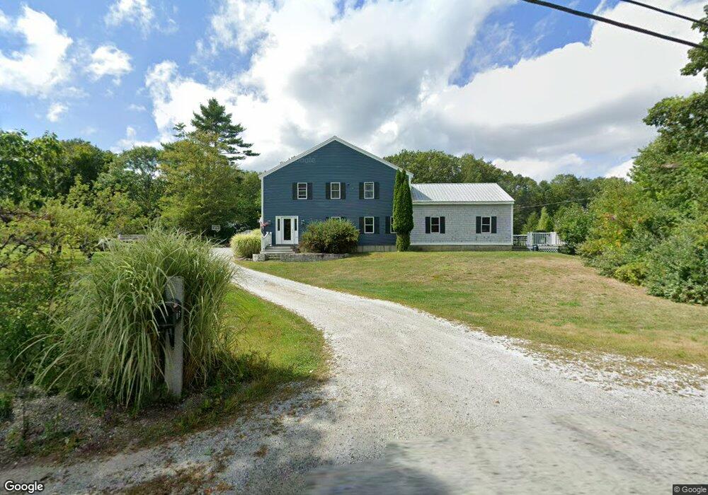
765 Center Rd Lyndeborough, NH 03082
Estimated Value: $377,000 - $1,063,000
5
Beds
4
Baths
5,200
Sq Ft
$139/Sq Ft
Est. Value
About This Home
This home is located at 765 Center Rd, Lyndeborough, NH 03082 and is currently estimated at $723,499, approximately $139 per square foot. 765 Center Rd is a home located in Hillsborough County with nearby schools including Lyndeborough Central School, Wilton-Lyndeborough Cooperative Middle School, and Wilton-Lyndeborough Cooperative High School.
Ownership History
Date
Name
Owned For
Owner Type
Purchase Details
Closed on
Mar 13, 2017
Sold by
Crombie Michael A
Bought by
Crombie Michael A
Current Estimated Value
Home Financials for this Owner
Home Financials are based on the most recent Mortgage that was taken out on this home.
Original Mortgage
$257,000
Outstanding Balance
$213,237
Interest Rate
4.19%
Mortgage Type
New Conventional
Estimated Equity
$510,262
Purchase Details
Closed on
Apr 16, 2002
Sold by
Mcewan John L
Bought by
Crombie Michael A and Crombie Judy E
Home Financials for this Owner
Home Financials are based on the most recent Mortgage that was taken out on this home.
Original Mortgage
$194,800
Interest Rate
6.84%
Create a Home Valuation Report for This Property
The Home Valuation Report is an in-depth analysis detailing your home's value as well as a comparison with similar homes in the area
Home Values in the Area
Average Home Value in this Area
Purchase History
| Date | Buyer | Sale Price | Title Company |
|---|---|---|---|
| Crombie Michael A | -- | -- | |
| Crombie Michael A | $140,000 | -- |
Source: Public Records
Mortgage History
| Date | Status | Borrower | Loan Amount |
|---|---|---|---|
| Open | Crombie Michael A | $257,000 | |
| Previous Owner | Crombie Michael A | $209,300 | |
| Previous Owner | Crombie Michael A | $100,000 | |
| Previous Owner | Crombie Michael A | $194,800 |
Source: Public Records
Tax History Compared to Growth
Tax History
| Year | Tax Paid | Tax Assessment Tax Assessment Total Assessment is a certain percentage of the fair market value that is determined by local assessors to be the total taxable value of land and additions on the property. | Land | Improvement |
|---|---|---|---|---|
| 2024 | $11,722 | $453,300 | $94,200 | $359,100 |
| 2023 | $10,775 | $453,300 | $94,200 | $359,100 |
| 2022 | $10,018 | $453,300 | $94,200 | $359,100 |
| 2021 | $10,018 | $453,300 | $94,200 | $359,100 |
| 2020 | $9,673 | $453,300 | $94,200 | $359,100 |
| 2019 | $10,624 | $364,600 | $96,100 | $268,500 |
| 2018 | $10,218 | $362,200 | $96,100 | $266,100 |
| 2017 | $9,640 | $347,500 | $96,100 | $251,400 |
| 2016 | $9,640 | $347,500 | $96,100 | $251,400 |
| 2015 | $6,914 | $273,400 | $96,100 | $177,300 |
| 2013 | $7,027 | $292,800 | $102,800 | $190,000 |
Source: Public Records
Map
Nearby Homes
- 80 Salisbury Rd
- 24 Glass Factory Rd
- 222 Forest Rd
- 79 Salisbury Rd
- 2 Wallace Ln
- 69 Purgatory Rd
- 57 Richardson Rd
- 8 Maple St
- 10 Mill St
- 27 Island St
- 134 Falcon Ridge Rd Unit 23
- A 66 Burton Hwy
- 4 Trow Rd
- 31 Cross Rd
- 8 Francestown Turnpike
- 81 Abbot Hill Acres
- 26 N Main St Unit 7
- 26 N Main St Unit 9
- F/88-5 McGettigan Rd
- F/88-4 McGettigan Rd