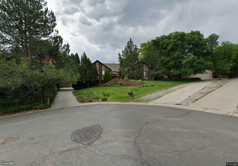
7662 S Davis Peak Littleton, CO 80127
Estimated Value: $967,000 - $1,078,000
5
Beds
3
Baths
4,802
Sq Ft
$214/Sq Ft
Est. Value
About This Home
This home is located at 7662 S Davis Peak, Littleton, CO 80127 and is currently estimated at $1,028,425, approximately $214 per square foot. 7662 S Davis Peak is a home located in Jefferson County with nearby schools including Shaffer Elementary School, Falcon Bluffs Middle School, and Chatfield High School.
Ownership History
Date
Name
Owned For
Owner Type
Purchase Details
Closed on
Jun 5, 2020
Sold by
Dinneen John G and Dinneen Dianne V
Bought by
Sulkko John
Current Estimated Value
Home Financials for this Owner
Home Financials are based on the most recent Mortgage that was taken out on this home.
Original Mortgage
$510,400
Outstanding Balance
$452,431
Interest Rate
3.2%
Mortgage Type
New Conventional
Estimated Equity
$575,994
Purchase Details
Closed on
Oct 18, 2004
Sold by
Ries David J and Ries Sheila A
Bought by
Dinneen John G and Dinneen Dianne
Create a Home Valuation Report for This Property
The Home Valuation Report is an in-depth analysis detailing your home's value as well as a comparison with similar homes in the area
Home Values in the Area
Average Home Value in this Area
Purchase History
| Date | Buyer | Sale Price | Title Company |
|---|---|---|---|
| Sulkko John | $705,500 | Land Title Guarantee | |
| Dinneen John G | $539,900 | Cpr Title |
Source: Public Records
Mortgage History
| Date | Status | Borrower | Loan Amount |
|---|---|---|---|
| Open | Sulkko John | $510,400 |
Source: Public Records
Tax History Compared to Growth
Tax History
| Year | Tax Paid | Tax Assessment Tax Assessment Total Assessment is a certain percentage of the fair market value that is determined by local assessors to be the total taxable value of land and additions on the property. | Land | Improvement |
|---|---|---|---|---|
| 2024 | $6,481 | $60,540 | $22,909 | $37,631 |
| 2023 | $6,481 | $60,540 | $22,909 | $37,631 |
| 2022 | $5,370 | $49,060 | $18,959 | $30,101 |
| 2021 | $5,453 | $50,471 | $19,504 | $30,967 |
| 2020 | $4,126 | $45,460 | $17,530 | $27,930 |
| 2019 | $4,076 | $45,460 | $17,530 | $27,930 |
| 2018 | $4,118 | $44,575 | $14,048 | $30,527 |
| 2017 | $3,830 | $44,575 | $14,048 | $30,527 |
| 2016 | $3,927 | $44,232 | $13,674 | $30,558 |
| 2015 | $4,461 | $44,232 | $13,674 | $30,558 |
| 2014 | $4,461 | $38,828 | $11,844 | $26,984 |
Source: Public Records
Map
Nearby Homes
- 7646 S Bear Mountain
- 11235 San Joaquin Ridge
- 7462 S Quail Cir Unit 426
- 11673 Elk Head Range Rd
- 11703 Elk Head Range Rd
- 7433 S Quail Cir Unit 1924
- 11710 Elk Head Range Rd
- 8140 S Storm King Peak
- 7413 S Quail Cir Unit 1422
- 7413 S Quail Cir Unit 1435
- 11872 Elk Head Range Rd
- 7825 Sand Mountain
- 7369 S Gore Range Rd Unit 208
- 8196 S Spring Creek Pass
- 7474 S Alkire St Unit 203
- 7339 S Gore Range Rd
- 10645 W Sundance Mountain
- 10866 W Half Moon Pass
- 11851 Canyon Ave
- 11434 W Roxbury Dr
- 7672 S Davis Peak
- 7652 S Davis Peak
- 7649 S Hahns Peak
- 7629 S Hahns Peak
- 7663 S Davis Peak
- 7673 S Davis Peak
- 7642 S Davis Peak
- 7643 S Davis Peak
- 7622 S Davis Peak
- 7639 S Hahns Peak
- 7659 S Hahns Peak
- 7619 S Hahns Peak
- 7636 S Bear Mountain
- 7633 S Davis Peak
- 11321 Main Range Trail
- 7609 S Hahns Peak
- 11341 Main Range Trail
- 7626 S Bear Mountain
- 11301 Main Range Trail
- 11351 Main Range Trail