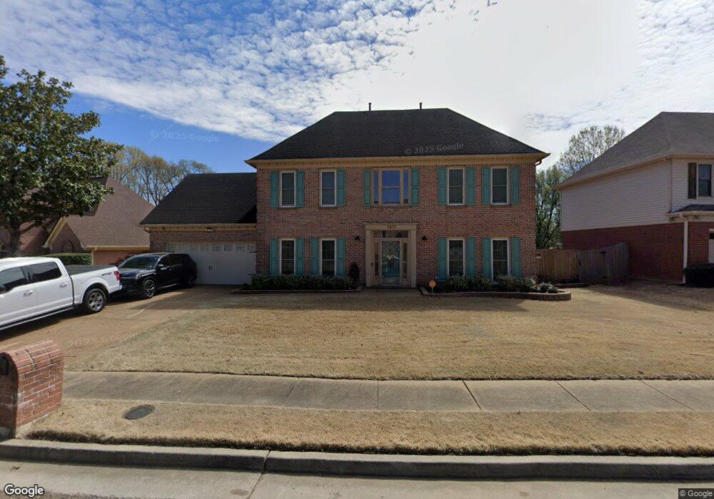
7675 Richmond Cir N Memphis, TN 38125
Southern Shelby County NeighborhoodEstimated Value: $307,000 - $369,000
4
Beds
3
Baths
3,344
Sq Ft
$98/Sq Ft
Est. Value
About This Home
This home is located at 7675 Richmond Cir N, Memphis, TN 38125 and is currently estimated at $328,324, approximately $98 per square foot. 7675 Richmond Cir N is a home located in Shelby County with nearby schools including Lowrance Elementary School, Southwind High School, and Power Center Academy - Southeast.
Ownership History
Date
Name
Owned For
Owner Type
Purchase Details
Closed on
Nov 21, 1997
Sold by
Dutch Tad Anthony and Shanahan Teresa L
Bought by
Ward Lewis E and Ward Louesia M
Current Estimated Value
Home Financials for this Owner
Home Financials are based on the most recent Mortgage that was taken out on this home.
Original Mortgage
$144,050
Outstanding Balance
$23,850
Interest Rate
7.38%
Estimated Equity
$304,474
Purchase Details
Closed on
Mar 15, 1995
Bought by
Shanahan Teresa L
Create a Home Valuation Report for This Property
The Home Valuation Report is an in-depth analysis detailing your home's value as well as a comparison with similar homes in the area
Home Values in the Area
Average Home Value in this Area
Purchase History
| Date | Buyer | Sale Price | Title Company |
|---|---|---|---|
| Ward Lewis E | $169,500 | Southern Escrow Title Compan | |
| Shanahan Teresa L | $174,900 | -- |
Source: Public Records
Mortgage History
| Date | Status | Borrower | Loan Amount |
|---|---|---|---|
| Open | Ward Lewis E | $144,050 |
Source: Public Records
Tax History Compared to Growth
Tax History
| Year | Tax Paid | Tax Assessment Tax Assessment Total Assessment is a certain percentage of the fair market value that is determined by local assessors to be the total taxable value of land and additions on the property. | Land | Improvement |
|---|---|---|---|---|
| 2025 | $1,937 | $75,450 | $12,000 | $63,450 |
| 2024 | $1,937 | $57,150 | $8,300 | $48,850 |
| 2023 | $1,937 | $57,150 | $8,300 | $48,850 |
| 2022 | $1,937 | $57,150 | $8,300 | $48,850 |
| 2021 | $1,972 | $57,150 | $8,300 | $48,850 |
| 2020 | $1,709 | $42,200 | $8,300 | $33,900 |
| 2019 | $1,709 | $42,200 | $8,300 | $33,900 |
| 2018 | $1,709 | $42,200 | $8,300 | $33,900 |
| 2017 | $1,734 | $42,200 | $8,300 | $33,900 |
| 2016 | $1,731 | $39,600 | $0 | $0 |
| 2014 | $1,731 | $39,600 | $0 | $0 |
Source: Public Records
Map
Nearby Homes
- 4294 Thunderstone Cir W
- 4471 Hughes Meadow Dr
- 7527 Wilsford Cove
- 4419 Berkley Woods Dr
- 7561 Shelby Cross Cir
- 4316 Barry Meadows Cove
- 7421 Richmond Rd
- 4646 Sweet Whisper Ln
- 4028 Long Creek Rd
- 4310 Coral Creek Ln
- 7579 Baysweet Dr
- 7286 New Britain Dr
- 3912 Autumn Harvest Ln
- 7321 Stonington Dr
- 4768 Gertrude Dr
- 4350 Oak Chase Cove
- 4512 S Germantown Rd
- 4764 Buttermilk Dr
- 4569 Cardiff Cove
- 4826 Callaway Hills Dr
- 7685 Richmond Cir N
- 7663 Richmond Cir N
- 7644 Carter Creek Cove
- 7657 Richmond Cir N
- 7695 Richmond Cir N
- 7674 Richmond Cir N
- 7647 Carter Creek Cove
- 7680 Richmond Cir N
- 7664 Richmond Cir N
- 7686 Richmond Cir N
- 7648 Carter Creek Cove
- 7658 Richmond Rd
- 7694 Richmond Cir N
- 7701 Richmond Cir N
- 4340 Long Creek Rd
- 7651 Carter Creek Cove
- 4348 Long Creek Rd
- 7700 Richmond Cir N
- 4322 Long Creek Rd
- 7654 Carter Creek Cove