Estimated Value: $265,000 - $383,000
3
Beds
2
Baths
1,360
Sq Ft
$248/Sq Ft
Est. Value
About This Home
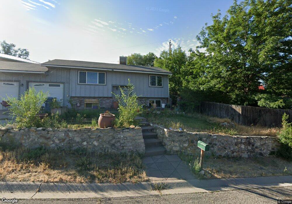
This home is located at 769 Clarkson Ave, Rifle, CO 81650 and is currently estimated at $337,754, approximately $248 per square foot. 769 Clarkson Ave is a home located in Garfield County with nearby schools including Highland Elementary School, Rifle Middle School, and Rifle High School.
Ownership History
Date
Name
Owned For
Owner Type
Purchase Details
Closed on
Jun 19, 2017
Sold by
Garcia Elvis and Garcia Maria R
Bought by
Flores Sergio I and Flores Jeanette
Current Estimated Value
Purchase Details
Closed on
Jan 9, 2015
Sold by
Dechomai Asset Trust Number Two Llc
Bought by
Garcia Elvis and Garcia Maria R
Home Financials for this Owner
Home Financials are based on the most recent Mortgage that was taken out on this home.
Original Mortgage
$65,000
Interest Rate
3.83%
Mortgage Type
New Conventional
Purchase Details
Closed on
Jul 24, 1987
Create a Home Valuation Report for This Property
The Home Valuation Report is an in-depth analysis detailing your home's value as well as a comparison with similar homes in the area
Home Values in the Area
Average Home Value in this Area
Purchase History
| Date | Buyer | Sale Price | Title Company |
|---|---|---|---|
| Flores Sergio I | -- | None Available | |
| Garcia Elvis | $86,000 | None Available | |
| -- | $21,000 | -- |
Source: Public Records
Mortgage History
| Date | Status | Borrower | Loan Amount |
|---|---|---|---|
| Previous Owner | Garcia Elvis | $65,000 |
Source: Public Records
Tax History Compared to Growth
Tax History
| Year | Tax Paid | Tax Assessment Tax Assessment Total Assessment is a certain percentage of the fair market value that is determined by local assessors to be the total taxable value of land and additions on the property. | Land | Improvement |
|---|---|---|---|---|
| 2024 | $1,002 | $13,140 | $1,470 | $11,670 |
| 2023 | $1,002 | $13,140 | $1,470 | $11,670 |
| 2022 | $770 | $10,760 | $1,250 | $9,510 |
| 2021 | $886 | $11,080 | $1,290 | $9,790 |
| 2020 | $738 | $10,090 | $1,220 | $8,870 |
| 2019 | $698 | $10,090 | $1,220 | $8,870 |
| 2018 | $563 | $7,950 | $1,150 | $6,800 |
| 2017 | $509 | $7,950 | $1,150 | $6,800 |
| 2016 | $409 | $7,240 | $880 | $6,360 |
| 2015 | $378 | $7,240 | $880 | $6,360 |
| 2014 | $279 | $5,300 | $800 | $4,500 |
Source: Public Records
Map
Nearby Homes
- 1342 Munro Ave
- 749 Munro Ave
- 716 Clarkson Ave
- 629 Whiteriver Ave
- 337 E 5th St
- 440 Whiteriver Ave
- 758 Railroad Ave
- 450 E 10th St
- 1036 Clarkson Ave
- 1012 East Ave Unit 2
- 1018 East Ave Unit 5
- Tract 1 Whiteriver Ave
- 520 Aspen Ave
- 327 E 3rd St
- 435 Arbor Ln
- 712 E 3rd St
- 742 E 3rd St
- 415 E 2nd St
- 235 Ash Ave
- 216 E 1st St
- 763 Clarkson Ave
- 755 Clarkson Ave
- 747 Clarkson Ave
- 776 Munro Ave
- 431 Harmony Dr
- 739 Clarkson Ave
- 451 Harmony Dr
- 781 Clarkson Ave
- 779 Clarkson Ave
- 742 Munro Ave
- 471 Harmony Dr
- 731 Clarkson Ave
- 725 Clarkson Ave
- 724 Munro Ave
- 491 Harmony Dr
- 814 Munro Ave
- 426 Harmony Dr
- 761 Munro Ave
- 440 Harmony Dr
- 805 Munro Ave