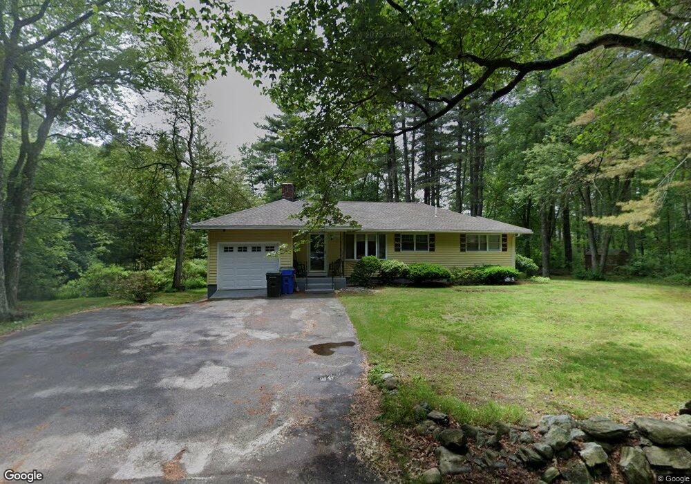
77 Adams Rd Londonderry, NH 03053
Estimated Value: $557,784 - $612,000
3
Beds
3
Baths
1,317
Sq Ft
$440/Sq Ft
Est. Value
About This Home
This home is located at 77 Adams Rd, Londonderry, NH 03053 and is currently estimated at $579,446, approximately $439 per square foot. 77 Adams Rd is a home with nearby schools including Matthew Thornton Elementary School, Londonderry Middle School, and Londonderry Senior High School.
Ownership History
Date
Name
Owned For
Owner Type
Purchase Details
Closed on
Jul 21, 2022
Sold by
Rosenberg Richard L and Cohn-Rosenberg Linda
Bought by
Rosenberg Ft
Current Estimated Value
Purchase Details
Closed on
May 31, 2001
Sold by
Campaiola Carmine R and Campaiola Janice S
Bought by
Rosenberg Richard L and Rosenberg Linda C
Home Financials for this Owner
Home Financials are based on the most recent Mortgage that was taken out on this home.
Original Mortgage
$179,920
Interest Rate
7.09%
Create a Home Valuation Report for This Property
The Home Valuation Report is an in-depth analysis detailing your home's value as well as a comparison with similar homes in the area
Home Values in the Area
Average Home Value in this Area
Purchase History
| Date | Buyer | Sale Price | Title Company |
|---|---|---|---|
| Rosenberg Ft | -- | None Available | |
| Rosenberg Richard L | $224,900 | -- |
Source: Public Records
Mortgage History
| Date | Status | Borrower | Loan Amount |
|---|---|---|---|
| Previous Owner | Rosenberg Richard L | $30,600 | |
| Previous Owner | Rosenberg Richard L | $187,000 | |
| Previous Owner | Rosenberg Richard L | $179,920 |
Source: Public Records
Tax History Compared to Growth
Tax History
| Year | Tax Paid | Tax Assessment Tax Assessment Total Assessment is a certain percentage of the fair market value that is determined by local assessors to be the total taxable value of land and additions on the property. | Land | Improvement |
|---|---|---|---|---|
| 2024 | $7,702 | $477,200 | $208,900 | $268,300 |
| 2023 | $7,468 | $477,200 | $208,900 | $268,300 |
| 2022 | $6,976 | $377,500 | $157,000 | $220,500 |
| 2021 | $6,938 | $377,500 | $157,000 | $220,500 |
| 2020 | $6,823 | $339,300 | $130,900 | $208,400 |
| 2019 | $6,579 | $339,300 | $130,900 | $208,400 |
| 2018 | $5,858 | $268,700 | $110,000 | $158,700 |
| 2017 | $5,807 | $268,700 | $110,000 | $158,700 |
| 2016 | $5,777 | $268,700 | $110,000 | $158,700 |
| 2015 | $5,648 | $268,700 | $110,000 | $158,700 |
| 2014 | $5,667 | $268,700 | $110,000 | $158,700 |
| 2011 | -- | $272,900 | $110,000 | $162,900 |
Source: Public Records
Map
Nearby Homes
- 79 Adams Rd
- 80 Adams Rd
- 73 Adams Rd
- 74 Adams Rd
- 81 Adams Rd
- 82 Adams Rd
- 84 Adams Rd
- 83 Adams Rd
- 69 Adams Rd
- 86 Adams Rd Unit 86 A Adams Rd.
- 86 Adams Rd Unit 86 B Adams Rd.
- 86 Adams Rd
- 24 Falling Leaf Dr Unit 157
- 68 Adams Rd
- 65 Adams Rd
- 87 Adams Rd
- 66 Adams Rd
- 12 Falling Leaf Dr Unit 87
- 10 Falling Leaf Dr Unit 86
- 90 Adams Rd