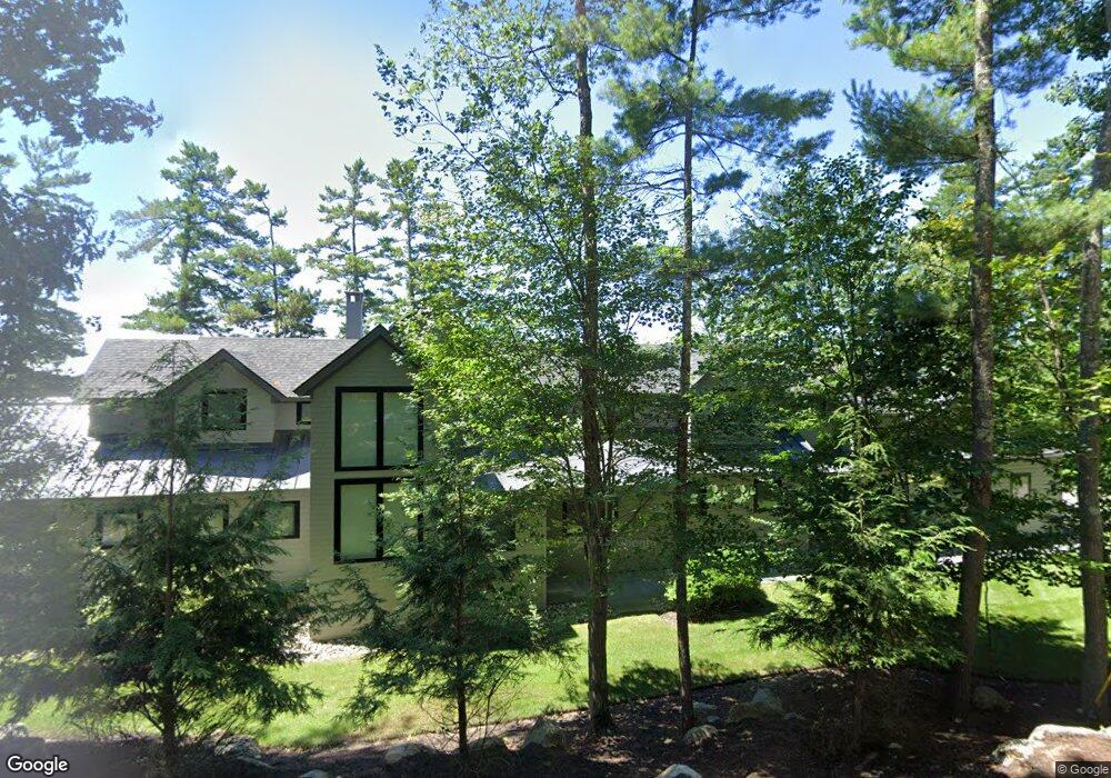
77 Old Hubbard Rd Meredith, NH 03253
Estimated Value: $3,750,922 - $5,177,000
5
Beds
8
Baths
5,580
Sq Ft
$842/Sq Ft
Est. Value
About This Home
This home is located at 77 Old Hubbard Rd, Meredith, NH 03253 and is currently estimated at $4,697,974, approximately $841 per square foot. 77 Old Hubbard Rd is a home located in Belknap County with nearby schools including Inter-Lakes Elementary School.
Ownership History
Date
Name
Owned For
Owner Type
Purchase Details
Closed on
Dec 1, 2020
Sold by
Stephen S Silk Ft
Bought by
77 Hubbard Road Rt
Current Estimated Value
Purchase Details
Closed on
Sep 22, 2016
Sold by
Rowlings Lynn C
Bought by
Stephens Silk Ft
Create a Home Valuation Report for This Property
The Home Valuation Report is an in-depth analysis detailing your home's value as well as a comparison with similar homes in the area
Home Values in the Area
Average Home Value in this Area
Purchase History
| Date | Buyer | Sale Price | Title Company |
|---|---|---|---|
| 77 Hubbard Road Rt | -- | None Available | |
| Stephens Silk Ft | $1,100,000 | -- |
Source: Public Records
Tax History Compared to Growth
Tax History
| Year | Tax Paid | Tax Assessment Tax Assessment Total Assessment is a certain percentage of the fair market value that is determined by local assessors to be the total taxable value of land and additions on the property. | Land | Improvement |
|---|---|---|---|---|
| 2024 | $45,575 | $4,442,000 | $2,268,100 | $2,173,900 |
| 2023 | $43,931 | $4,442,000 | $2,268,100 | $2,173,900 |
| 2022 | $39,411 | $2,821,100 | $1,159,400 | $1,661,700 |
| 2021 | $37,887 | $2,821,100 | $1,159,400 | $1,661,700 |
| 2020 | $39,333 | $2,805,500 | $1,159,400 | $1,646,100 |
| 2019 | $42,763 | $2,691,200 | $937,800 | $1,753,400 |
| 2018 | $27,232 | $1,743,400 | $937,800 | $805,600 |
| 2016 | $13,708 | $879,300 | $768,600 | $110,700 |
| 2015 | $13,365 | $879,300 | $768,600 | $110,700 |
| 2014 | $13,036 | $879,000 | $768,600 | $110,400 |
| 2013 | $12,666 | $879,000 | $768,600 | $110,400 |
Source: Public Records
Map
Nearby Homes
- 11 Quimby Rd
- Lot 21 Cummings Cove Rd
- Lot 22 Cummings Cove Rd
- 39 Lake Country Rd
- 103 Meredith Neck Rd
- 113-117 Pinnacle Park Rd
- 765 Scenic Rd
- 75 Neal Shore Rd
- 37
- 45 Stern Castle Place Unit 32
- 106 Needle Eye Rd
- 38 Stern Castle Place Unit 30
- 00 Nh Rte 132 Route
- 598 Scenic Rd Unit 2
- 598 Scenic Rd Unit 1
- Lot 12-3 Needle Eye Rd
- Lot 12-5 Needle Eye Rd
- 97 Soleil Mountain Unit 82
- 94 Soleil Mountain Unit 8
- 164 Edgewater Dr
- 76 Old Hubbard Rd
- 71 Old Hubbard Rd
- 81 Old Hubbard Rd
- 82 Old Hubbard Rd
- 52 Stonedam Island Rd
- 67 Old Hubbard Rd
- 50 Stonedam Island Rd
- 58 Stonedam Island Rd
- 65 Old Hubbard Rd
- 87 Old Hubbard Rd
- 56 Stonedam Island Rd
- 55 Stonedam Island Rd
- 0 Stonedam Island Rd
- 63 Old Hubbard Rd
- 91 Old Hubbard Rd
- 61 Old Hubbard Rd
- 60 Stonedam Island Rd
- 4 Stonedam Cir
- 62 Old Hubbard Rd
- 62 Old Hubbard Rd Unit 62