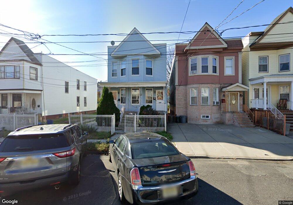
77 Pearsall Ave Jersey City, NJ 07305
Greenville NeighborhoodEstimated Value: $711,025 - $808,000
6
Beds
2
Baths
2,276
Sq Ft
$332/Sq Ft
Est. Value
About This Home
This home is located at 77 Pearsall Ave, Jersey City, NJ 07305 and is currently estimated at $756,006, approximately $332 per square foot. 77 Pearsall Ave is a home located in Hudson County with nearby schools including Number 20 Elementary School, Ezra L. Nolan Middle School, and Henry Snyder High School.
Ownership History
Date
Name
Owned For
Owner Type
Purchase Details
Closed on
Aug 14, 2017
Sold by
Rodriguez Radames and Rodriguez Isabel G
Bought by
Roth Azriel Yehuda
Current Estimated Value
Home Financials for this Owner
Home Financials are based on the most recent Mortgage that was taken out on this home.
Original Mortgage
$345,000
Outstanding Balance
$288,418
Interest Rate
4.03%
Mortgage Type
New Conventional
Estimated Equity
$467,588
Purchase Details
Closed on
Jan 8, 1993
Bought by
Rodriguez Rodriguez R and Rodriguez Rodriguez
Create a Home Valuation Report for This Property
The Home Valuation Report is an in-depth analysis detailing your home's value as well as a comparison with similar homes in the area
Home Values in the Area
Average Home Value in this Area
Purchase History
| Date | Buyer | Sale Price | Title Company |
|---|---|---|---|
| Roth Azriel Yehuda | $460,000 | None Available | |
| Rodriguez Rodriguez R | $150,000 | -- |
Source: Public Records
Mortgage History
| Date | Status | Borrower | Loan Amount |
|---|---|---|---|
| Open | Roth Azriel Yehuda | $345,000 |
Source: Public Records
Tax History Compared to Growth
Tax History
| Year | Tax Paid | Tax Assessment Tax Assessment Total Assessment is a certain percentage of the fair market value that is determined by local assessors to be the total taxable value of land and additions on the property. | Land | Improvement |
|---|---|---|---|---|
| 2025 | $9,323 | $417,500 | $117,500 | $300,000 |
| 2024 | $9,381 | $417,500 | $117,500 | $300,000 |
| 2023 | $9,381 | $417,500 | $117,500 | $300,000 |
| 2022 | $8,843 | $417,500 | $117,500 | $300,000 |
| 2021 | $6,697 | $417,500 | $117,500 | $300,000 |
| 2020 | $6,722 | $417,500 | $117,500 | $300,000 |
| 2019 | $6,430 | $417,500 | $117,500 | $300,000 |
| 2018 | $1,192 | $417,500 | $117,500 | $300,000 |
| 2017 | $6,248 | $80,100 | $40,000 | $40,100 |
| 2016 | $6,169 | $80,100 | $40,000 | $40,100 |
Source: Public Records
Map
Nearby Homes
- 93 Pearsall Ave Unit 1-2
- 8 Albert Place
- 22 Bartholdi Ave
- 87 Linden Ave
- 236 Garfield Ave
- 78 Linden Ave
- 115 Winfield Ave
- 94A Linden Ave
- 40 Linden Ave Unit 40
- 15 Linden Ave
- 68 Danforth Ave
- 171 Old Bergen Rd Unit 201
- 171 Old Bergen Rd Unit 1
- 167 Pearsall Ave
- 18 Winfield Ave
- 86 Bartholdi Ave
- 195 Winfield Ave
- 203 Pearsall Ave
- 59 Ocean Ave
- 81 Pearsall Ave
- 79 Pearsall Ave
- 83 Pearsall Ave
- 85 Pearsall Ave
- 85 Pearsall Ave Unit 1
- 85 Pearsall Ave Unit Entire House
- 89 Pearsall Ave Unit 5
- 89 Pearsall Ave Unit 3R
- 89 Pearsall Ave
- 73 Pearsall Ave
- 73 Pearsall Ave Unit 2
- 91 Pearsall Ave Unit 1
- 91 Pearsall Ave
- 78 Pearsall Ave
- 82 Pearsall Ave
- 80 Pearsall Ave
- 84 Pearsall Ave
- 71 Pearsall Ave
- 76 Pearsall Ave
- 76 Pearsall Ave Unit 2