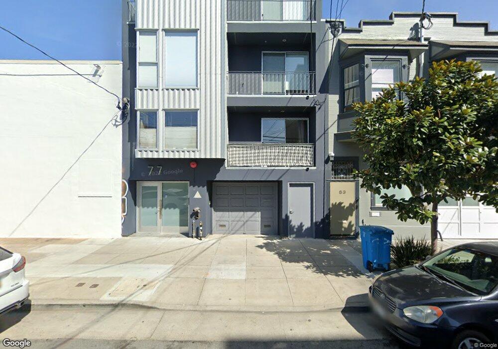
77 Shotwell St Unit 79 San Francisco, CA 94103
Inner Mission NeighborhoodEstimated Value: $1,179,030 - $1,465,000
3
Beds
3
Baths
1,823
Sq Ft
$698/Sq Ft
Est. Value
About This Home
This home is located at 77 Shotwell St Unit 79, San Francisco, CA 94103 and is currently estimated at $1,272,258, approximately $697 per square foot. 77 Shotwell St Unit 79 is a home located in San Francisco County with nearby schools including George Moscone Elementary, Hoover (Herbert) Middle School, and La Scuola International School Elementary School Campus.
Ownership History
Date
Name
Owned For
Owner Type
Purchase Details
Closed on
Oct 4, 2018
Sold by
Woolf Anthony and Lesinski Rhonda
Bought by
Woolf Anthony Wallace and Lesinski Rhonda Kae
Current Estimated Value
Purchase Details
Closed on
Jul 21, 2004
Sold by
Mcmahon Denis and Mcmahon Christina
Bought by
Woolf Anthony and Lesinski Rhonda
Home Financials for this Owner
Home Financials are based on the most recent Mortgage that was taken out on this home.
Original Mortgage
$502,500
Interest Rate
5.25%
Mortgage Type
Purchase Money Mortgage
Create a Home Valuation Report for This Property
The Home Valuation Report is an in-depth analysis detailing your home's value as well as a comparison with similar homes in the area
Home Values in the Area
Average Home Value in this Area
Purchase History
| Date | Buyer | Sale Price | Title Company |
|---|---|---|---|
| Woolf Anthony Wallace | -- | None Available | |
| Woolf Anthony | $829,000 | Fidelity National Title Co |
Source: Public Records
Mortgage History
| Date | Status | Borrower | Loan Amount |
|---|---|---|---|
| Previous Owner | Woolf Anthony | $502,500 |
Source: Public Records
Tax History Compared to Growth
Tax History
| Year | Tax Paid | Tax Assessment Tax Assessment Total Assessment is a certain percentage of the fair market value that is determined by local assessors to be the total taxable value of land and additions on the property. | Land | Improvement |
|---|---|---|---|---|
| 2025 | $14,060 | $1,155,534 | $577,767 | $577,767 |
| 2024 | $14,060 | $1,132,878 | $566,439 | $566,439 |
| 2023 | $13,846 | $1,110,666 | $555,333 | $555,333 |
| 2022 | $13,579 | $1,088,890 | $544,445 | $544,445 |
| 2021 | $13,337 | $1,067,540 | $533,770 | $533,770 |
| 2020 | $13,453 | $1,056,594 | $528,297 | $528,297 |
| 2019 | $12,945 | $1,035,878 | $517,939 | $517,939 |
| 2018 | $12,509 | $1,015,556 | $507,778 | $507,778 |
| 2017 | $12,064 | $995,644 | $497,822 | $497,822 |
| 2016 | $11,862 | $976,124 | $488,062 | $488,062 |
| 2015 | $11,716 | $961,464 | $480,732 | $480,732 |
| 2014 | $11,408 | $942,632 | $471,316 | $471,316 |
Source: Public Records
Map
Nearby Homes
- 473 S Van Ness Ave
- 233 14th St
- 1875 Mission St Unit 109
- 1875 Mission St Unit 304
- 550 S Van Ness Ave Unit 207
- 9 Bernice St
- 1608 Folsom St
- 3214 17th St
- 173 Julian Ave
- 1586 Folsom St
- 49 Norfolk St
- 140 S Van Ness Ave Unit 340
- 140 S Van Ness Ave Unit 704
- 140 S Van Ness Ave Unit 430
- 85 Duboce Ave Unit 301
- 88 Hoff St Unit 101
- 88 Hoff St Unit 108
- 301 11th St Unit 2B
- 2130 Harrison St Unit 10
- 3118 18th St Unit 6
- 77 Shotwell St Unit 3
- 77 Shotwell St Unit 2
- 77 Shotwell St Unit 79
- 77 Shotwell St Unit 79
- 83 Shotwell St
- 1410 15th St
- 1412 15th St
- 1406 15th St
- 1408 15th St
- 1404 15th St Unit 1404
- 64A Shotwell St
- 62 Shotwell St
- 74 Shotwell St
- 1450 15th St
- 68 Shotwell St
- 58 Shotwell St Unit 60
- 54 Shotwell St
- 48 Shotwell St Unit 50
- 1417 15th St
- 1900 Folsom St