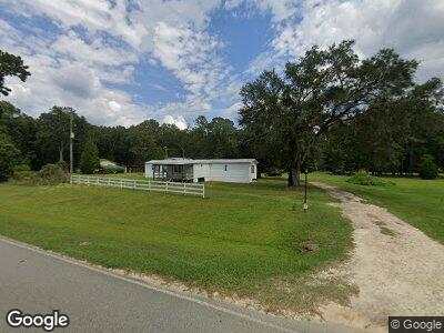
77 Walker Ln Boston, GA 31626
Estimated Value: $132,059 - $153,000
--
Bed
1
Bath
720
Sq Ft
$196/Sq Ft
Est. Value
About This Home
This home is located at 77 Walker Ln, Boston, GA 31626 and is currently estimated at $141,020, approximately $195 per square foot. 77 Walker Ln is a home located in Thomas County with nearby schools including Hand in Hand Primary School, Garrison-Pilcher Elementary School, and Cross Creek Elementary School.
Ownership History
Date
Name
Owned For
Owner Type
Purchase Details
Closed on
Jul 20, 2023
Sold by
Walker Ronald
Bought by
Brown Rhonda and Brown Mark
Current Estimated Value
Purchase Details
Closed on
Nov 17, 2003
Sold by
Pendleton Juanita and Pendleton
Bought by
Walker Ronald and Walker Shirley
Purchase Details
Closed on
Feb 15, 2002
Sold by
Pendleton Juanita
Bought by
Pendleton Juanita and Pendleton
Purchase Details
Closed on
Apr 5, 1996
Bought by
Pendleton Juanita
Create a Home Valuation Report for This Property
The Home Valuation Report is an in-depth analysis detailing your home's value as well as a comparison with similar homes in the area
Home Values in the Area
Average Home Value in this Area
Purchase History
| Date | Buyer | Sale Price | Title Company |
|---|---|---|---|
| Brown Rhonda | -- | -- | |
| Walker Ronald | -- | -- | |
| Pendleton Juanita | -- | -- | |
| Pendleton Juanita | -- | -- |
Source: Public Records
Tax History Compared to Growth
Tax History
| Year | Tax Paid | Tax Assessment Tax Assessment Total Assessment is a certain percentage of the fair market value that is determined by local assessors to be the total taxable value of land and additions on the property. | Land | Improvement |
|---|---|---|---|---|
| 2024 | $876 | $42,463 | $19,842 | $22,621 |
| 2023 | $620 | $37,524 | $15,874 | $21,650 |
| 2022 | $621 | $34,671 | $15,874 | $18,797 |
| 2021 | $571 | $30,039 | $13,803 | $16,236 |
| 2020 | $585 | $30,023 | $13,803 | $16,220 |
| 2019 | $592 | $30,023 | $13,803 | $16,220 |
| 2018 | $601 | $29,887 | $13,803 | $16,084 |
| 2017 | $587 | $28,974 | $13,803 | $15,171 |
| 2016 | $605 | $29,488 | $13,803 | $15,685 |
| 2015 | -- | $30,736 | $13,803 | $16,932 |
| 2014 | -- | $29,570 | $13,803 | $15,766 |
Source: Public Records
Map
Nearby Homes
- 2672 Fulford Rd
- 228 Grooverville Rd
- 608 S Main St
- 403 E Jefferson St Unit BN
- 4130 Lower Boston Rd
- 1165 Dills Rd
- 4131 N Jefferson Hwy
- 3873 N Jefferson St
- 3827 N Jefferson St
- 215 Plantation Ln
- 265 Still Rd
- 7500 U S 19
- 8820 Grooverville Rd
- 290 Oetinger Rd
- 4014 Ashville Hwy
- 339 Silver Lake Rd
- 203 Pine Cone Dr
- 0 Tarn Way Unit 380408
- 0 Tarn Way Unit 380407
- 52 Mire Ct
