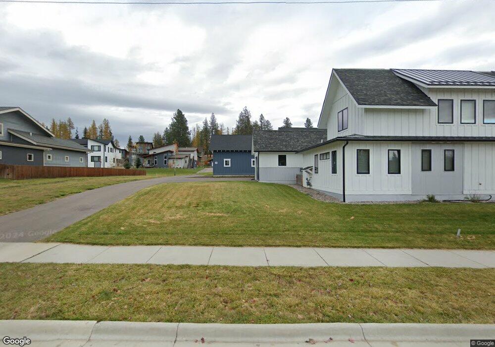
77 Wild Rose Ln Whitefish, MT 59937
Estimated Value: $1,121,000 - $1,338,001
3
Beds
3
Baths
2,396
Sq Ft
$507/Sq Ft
Est. Value
About This Home
This home is located at 77 Wild Rose Ln, Whitefish, MT 59937 and is currently estimated at $1,214,667, approximately $506 per square foot. 77 Wild Rose Ln is a home located in Flathead County with nearby schools including L.A. Muldown School, Whitefish Middle School, and Whitefish High School.
Ownership History
Date
Name
Owned For
Owner Type
Purchase Details
Closed on
Jun 20, 2018
Sold by
Whitefish Llc
Bought by
Heslop Benjamin P and Heslop Anne L
Current Estimated Value
Home Financials for this Owner
Home Financials are based on the most recent Mortgage that was taken out on this home.
Original Mortgage
$445,600
Outstanding Balance
$385,369
Interest Rate
4.5%
Mortgage Type
New Conventional
Estimated Equity
$829,298
Purchase Details
Closed on
Aug 29, 2017
Sold by
High Point On 2Nd Llc
Bought by
Whitefish Llc
Create a Home Valuation Report for This Property
The Home Valuation Report is an in-depth analysis detailing your home's value as well as a comparison with similar homes in the area
Home Values in the Area
Average Home Value in this Area
Purchase History
| Date | Buyer | Sale Price | Title Company |
|---|---|---|---|
| Heslop Benjamin P | -- | Fidelity National Title | |
| Whitefish Llc | -- | Fidelity National Title |
Source: Public Records
Mortgage History
| Date | Status | Borrower | Loan Amount |
|---|---|---|---|
| Open | Heslop Benjamin P | $445,600 |
Source: Public Records
Tax History Compared to Growth
Tax History
| Year | Tax Paid | Tax Assessment Tax Assessment Total Assessment is a certain percentage of the fair market value that is determined by local assessors to be the total taxable value of land and additions on the property. | Land | Improvement |
|---|---|---|---|---|
| 2025 | $5,034 | $1,320,200 | $0 | $0 |
| 2024 | $4,881 | $972,800 | $0 | $0 |
| 2023 | $5,102 | $972,800 | $0 | $0 |
| 2022 | $4,406 | $575,700 | $0 | $0 |
| 2021 | $4,763 | $575,700 | $0 | $0 |
| 2020 | $4,112 | $480,100 | $0 | $0 |
| 2019 | $4,416 | $480,100 | $0 | $0 |
| 2018 | $1,113 | $98,796 | $0 | $0 |
| 2017 | $987 | $98,796 | $0 | $0 |
Source: Public Records
Map
Nearby Homes
- 89 Armory Rd
- 162 Armory Rd
- 1319 3rd St
- 169 Mountain Brook Ln
- 111 Wedgewood Ln
- 916 2nd St E
- 533 Park Ave
- 424 Somers Ave
- 1017 Creekview Dr
- 625 Columbia Ave
- 327 Spokane Ave
- 5150 U S 93
- 345 Spokane Ave
- 633 Kalispell Ave
- 317 Central Ave Unit 304
- 317 Central Ave Unit 302
- 317 Central Ave Unit 301
- 815 Waverly Place
- 560 Spokane Ave
- 919 Columbia Ave Unit A
- 77 Wild Rose Ln Unit Lot 25
- 71 Wild Rose Ln
- 71 Wild Rose Ln Unit Lot 24
- 92 Armory Rd Unit Lot 26
- 92 Armory Rd
- 98 Armory Rd Unit Lot 27
- 98 Armory Rd
- 91 Wild Rose Ln Unit Lot 22
- 91 Wild Rose Ln
- 84 Armory Rd Unit Lot 28
- 84 Armory Rd
- 1481 2nd St
- 76 Armory Rd Unit Lot 29
- 76 Armory Rd
- 1489 2nd St
- 99 Wild Rose Ln Unit Lot 21
- 99 Wild Rose Ln
- 99 Wild Rose Ln
- 100 Armory Rd
- 68 Armory Rd Unit Lot 30