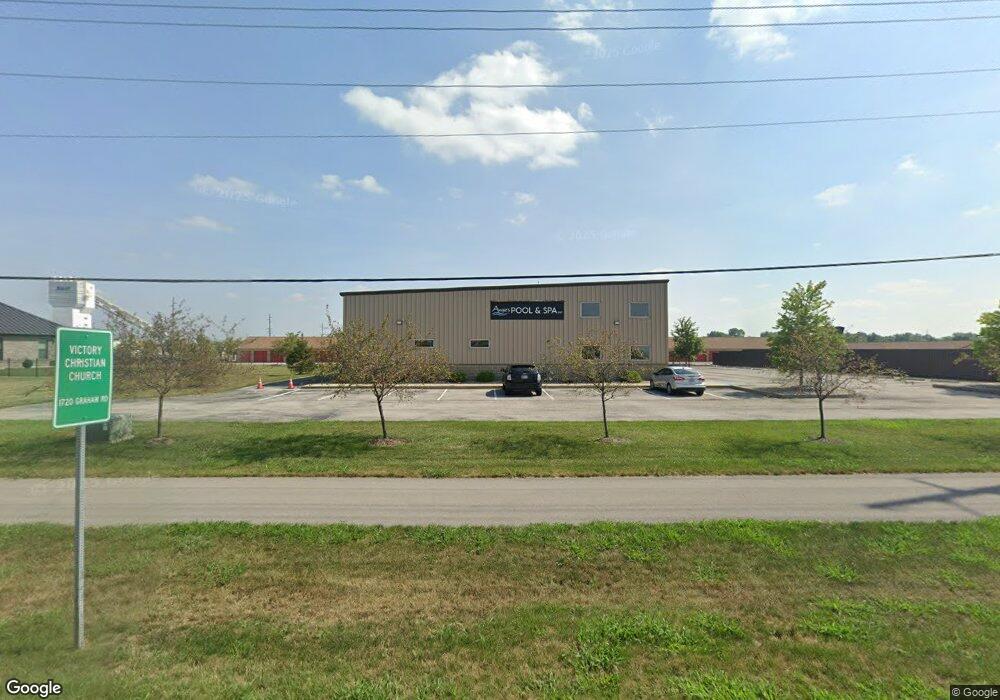
771 Commerce Dr Franklin, IN 46131
Estimated Value: $1,137,253
--
Bed
--
Bath
9,800
Sq Ft
$116/Sq Ft
Est. Value
About This Home
This home is located at 771 Commerce Dr, Franklin, IN 46131 and is currently estimated at $1,137,253, approximately $116 per square foot. 771 Commerce Dr is a home located in Johnson County with nearby schools including Northwood Elementary School, Franklin Community Middle School, and Custer Baker Intermediate School.
Ownership History
Date
Name
Owned For
Owner Type
Purchase Details
Closed on
Aug 10, 2023
Sold by
Lauth Holdings Llc
Bought by
Lauth Holdings Llc
Current Estimated Value
Purchase Details
Closed on
Nov 18, 2021
Sold by
771 Properties Llc
Bought by
Lauth Properties Llc
Home Financials for this Owner
Home Financials are based on the most recent Mortgage that was taken out on this home.
Original Mortgage
$719,200
Interest Rate
3.09%
Mortgage Type
New Conventional
Create a Home Valuation Report for This Property
The Home Valuation Report is an in-depth analysis detailing your home's value as well as a comparison with similar homes in the area
Home Values in the Area
Average Home Value in this Area
Purchase History
| Date | Buyer | Sale Price | Title Company |
|---|---|---|---|
| Lauth Holdings Llc | -- | Denali Title | |
| Lauth Properties Llc | -- | None Available |
Source: Public Records
Mortgage History
| Date | Status | Borrower | Loan Amount |
|---|---|---|---|
| Previous Owner | Lauth Properties Llc | $719,200 |
Source: Public Records
Tax History Compared to Growth
Tax History
| Year | Tax Paid | Tax Assessment Tax Assessment Total Assessment is a certain percentage of the fair market value that is determined by local assessors to be the total taxable value of land and additions on the property. | Land | Improvement |
|---|---|---|---|---|
| 2025 | $26,256 | $971,100 | $453,000 | $518,100 |
| 2024 | $26,256 | $914,200 | $453,000 | $461,200 |
| 2023 | $20,052 | $692,200 | $231,000 | $461,200 |
| 2022 | $17,660 | $576,700 | $115,500 | $461,200 |
| 2021 | $16,014 | $495,800 | $115,500 | $380,300 |
| 2020 | $15,217 | $471,100 | $108,000 | $363,100 |
| 2019 | $14,399 | $445,800 | $100,000 | $345,800 |
| 2018 | $14,892 | $483,000 | $100,000 | $383,000 |
| 2017 | $15,283 | $509,100 | $100,000 | $409,100 |
| 2016 | $60 | $662,500 | $139,900 | $522,600 |
| 2014 | $60 | $2,000 | $2,000 | $0 |
| 2013 | $60 | $1,600 | $1,600 | $0 |
Source: Public Records
Map
Nearby Homes
- 1860 Churchill Rd
- 2258 Bridlewood Dr
- 1624 Roberts Rd
- 2458 Bristol Dr
- 2425 Bristol Dr
- 2485 Bristol Dr
- 2388 Cedarmill Dr
- 2292 Hampton Dr
- 2268 Hampton Dr
- 2265 Hampton Dr
- 2103 Cedarmill Dr
- 1450 Roberts Rd
- 991 Ravine Dr
- 123 14th St
- 2159 Somerset Dr
- 2135 Somerset Dr
- 2707 Muirfield St
- 1099 Winterfield Blvd
- 2638 Fielding Ct
- 1098 Winterfield Blvd
- LOT 6 County Road 250 E
- LOT 4 County Road 250 E
- LOT 3 County Road 250 E
- 5652 County Road 250 E
- 0 County Road 250 E
- 0 Graham Rd Unit 2868027
- 0 Graham Rd Unit 2868026
- 0 Graham Rd Unit 21102354
- 0 Graham Rd Unit 21102159
- 0 Graham Rd Unit D,E,F 21334396
- 0 Graham Rd Unit MBR2306088
- 0 Graham Rd Unit MBR2775459
- 0 Graham Rd Unit MBR2775453
- 1762 N Graham Rd
- 1762 N Graham Rd
- 2277 N Graham Rd
- 2121 Younce St
- 2101 Younce St
- 2081 Younce St
- 2305 N Graham Rd