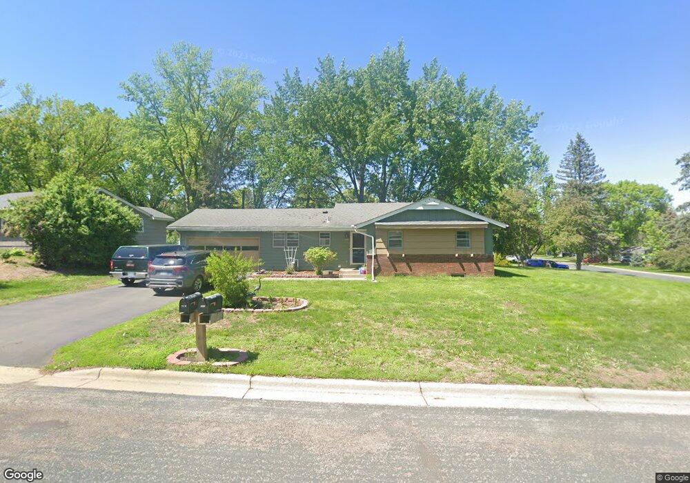
771 Keokuk Ln Saint Paul, MN 55120
Estimated Value: $351,628 - $394,000
3
Beds
2
Baths
1,122
Sq Ft
$331/Sq Ft
Est. Value
About This Home
This home is located at 771 Keokuk Ln, Saint Paul, MN 55120 and is currently estimated at $371,657, approximately $331 per square foot. 771 Keokuk Ln is a home located in Dakota County with nearby schools including Mendota Elementary School, Friendly Hills Middle School, and Two Rivers High School.
Ownership History
Date
Name
Owned For
Owner Type
Purchase Details
Closed on
Aug 6, 2004
Sold by
Harrell Stephen P
Bought by
True David K and True Sandra L
Current Estimated Value
Purchase Details
Closed on
Sep 3, 1998
Sold by
Estate Of Robert C Gruenenfelder
Bought by
Harvell Stephen P
Create a Home Valuation Report for This Property
The Home Valuation Report is an in-depth analysis detailing your home's value as well as a comparison with similar homes in the area
Home Values in the Area
Average Home Value in this Area
Purchase History
| Date | Buyer | Sale Price | Title Company |
|---|---|---|---|
| True David K | $215,000 | -- | |
| Harvell Stephen P | $114,900 | -- |
Source: Public Records
Tax History
| Year | Tax Paid | Tax Assessment Tax Assessment Total Assessment is a certain percentage of the fair market value that is determined by local assessors to be the total taxable value of land and additions on the property. | Land | Improvement |
|---|---|---|---|---|
| 2024 | $2,686 | $311,300 | $83,400 | $227,900 |
| 2023 | $2,686 | $297,400 | $81,600 | $215,800 |
| 2022 | $2,426 | $302,400 | $81,400 | $221,000 |
| 2021 | $2,426 | $254,800 | $70,800 | $184,000 |
| 2020 | $2,450 | $251,800 | $67,400 | $184,400 |
| 2019 | $2,351 | $245,600 | $64,200 | $181,400 |
| 2018 | $2,009 | $226,400 | $60,000 | $166,400 |
| 2017 | $1,981 | $204,100 | $57,100 | $147,000 |
| 2016 | $1,942 | $195,600 | $54,400 | $141,200 |
| 2015 | $1,832 | $173,893 | $48,837 | $125,056 |
| 2014 | -- | $157,325 | $45,214 | $112,111 |
| 2013 | -- | $165,173 | $44,295 | $120,878 |
Source: Public Records
Map
Nearby Homes
- 2300 Pagel Rd
- 809 Wagon Wheel Trail
- 750 Mohican Ln
- 2381 Pagel Rd
- 901 Cheri Ln
- 2123 Fox Place
- 791 Creek Ave
- 2545 Concord Way Unit 115
- 610 Watersedge Terrace
- 2572 Lockwood Dr Unit 68
- 2556 Lockwood Dr Unit 59
- 2600 Lockwood Dr
- 2571 Bedford Ct
- 2498 Pond Cir E
- 708 Linden St
- 2194 Charlton Rd
- 585 High Ridge Cir
- 1850 Eagle Ridge Dr Unit E205
- 2158 Charlton Rd
- 1925 Walsh Ln
Your Personal Tour Guide
Ask me questions while you tour the home.