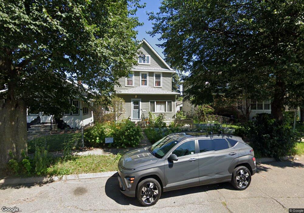
771 Saint Anthony Ave Saint Paul, MN 55104
Summit-University NeighborhoodEstimated Value: $274,000 - $330,000
4
Beds
2
Baths
921
Sq Ft
$334/Sq Ft
Est. Value
About This Home
This home is located at 771 Saint Anthony Ave, Saint Paul, MN 55104 and is currently estimated at $307,491, approximately $333 per square foot. 771 Saint Anthony Ave is a home located in Ramsey County with nearby schools including Maxfield Magnet Elementary School, Hidden River Middle School, and Central Senior High School.
Ownership History
Date
Name
Owned For
Owner Type
Purchase Details
Closed on
May 26, 2020
Sold by
Paulson Brian R and Hartwig Jacquelyn R
Bought by
Barta Korin V
Current Estimated Value
Home Financials for this Owner
Home Financials are based on the most recent Mortgage that was taken out on this home.
Original Mortgage
$251,363
Outstanding Balance
$223,229
Interest Rate
3.3%
Mortgage Type
FHA
Estimated Equity
$84,262
Purchase Details
Closed on
May 30, 2014
Sold by
Litzenberg Aaron W and Litzenberg Allison
Bought by
Heinzen Larrie G and Heinzen Patricia A
Home Financials for this Owner
Home Financials are based on the most recent Mortgage that was taken out on this home.
Original Mortgage
$121,500
Interest Rate
4.2%
Mortgage Type
New Conventional
Create a Home Valuation Report for This Property
The Home Valuation Report is an in-depth analysis detailing your home's value as well as a comparison with similar homes in the area
Home Values in the Area
Average Home Value in this Area
Purchase History
| Date | Buyer | Sale Price | Title Company |
|---|---|---|---|
| Barta Korin V | $256,000 | Multiple | |
| Heinzen Larrie G | $166,909 | Home Title |
Source: Public Records
Mortgage History
| Date | Status | Borrower | Loan Amount |
|---|---|---|---|
| Open | Barta Korin V | $251,363 | |
| Previous Owner | Heinzen Larrie G | $121,500 |
Source: Public Records
Tax History Compared to Growth
Tax History
| Year | Tax Paid | Tax Assessment Tax Assessment Total Assessment is a certain percentage of the fair market value that is determined by local assessors to be the total taxable value of land and additions on the property. | Land | Improvement |
|---|---|---|---|---|
| 2025 | $5,414 | $321,600 | $18,800 | $302,800 |
| 2023 | $5,414 | $296,700 | $18,800 | $277,900 |
| 2022 | $4,974 | $288,000 | $18,800 | $269,200 |
| 2021 | $2,494 | $236,100 | $18,800 | $217,300 |
| 2020 | $2,126 | $165,000 | $18,800 | $146,200 |
| 2019 | $1,976 | $144,700 | $18,800 | $125,900 |
| 2018 | $1,512 | $125,800 | $18,800 | $107,000 |
| 2017 | $1,646 | $104,800 | $18,800 | $86,000 |
| 2016 | $1,428 | $0 | $0 | $0 |
| 2015 | $1,206 | $93,200 | $15,000 | $78,200 |
| 2014 | $1,312 | $0 | $0 | $0 |
Source: Public Records
Map
Nearby Homes
- 298 Avon St N
- 287 Avon St N
- 861 Saint Anthony Ave
- 797 Iglehart Ave
- 291 Fisk St
- 786 Iglehart Ave
- 853 Iglehart Ave
- 818 Sherburne Ave
- 915 Fuller Ave
- 838 Sherburne Ave
- 846 Sherburne Ave
- 934 Central Ave W
- 909 Marshall Ave
- 681 Dayton Ave
- 723 Charles Ave
- 950 Aurora Ave
- 876 Charles Ave
- 784 Edmund Ave
- 816 Edmund Ave
- 818 Edmund Ave
- 767 Saint Anthony Ave
- 775 Saint Anthony Ave
- 763 Saint Anthony Ave
- 779 Saint Anthony Ave
- 761 Saint Anthony Ave
- 770 Central Ave W
- 768 Central Ave W
- 382 Avon St N
- 757 Saint Anthony Ave
- 762 Central Ave W
- 753 Saint Anthony Ave
- 756 Central Ave W
- 749 Saint Anthony Ave
- 747 Saint Anthony Ave
- 741 Saint Anthony Ave
- 779 Central Ave W
- 769 Central Ave W
- 773 Central Ave W
- 765 Central Ave W
- 761 Central Ave W