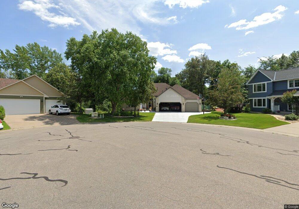
7721 44th St N Saint Paul, MN 55128
Estimated Value: $516,000 - $628,000
4
Beds
3
Baths
1,650
Sq Ft
$336/Sq Ft
Est. Value
About This Home
This home is located at 7721 44th St N, Saint Paul, MN 55128 and is currently estimated at $554,495, approximately $336 per square foot. 7721 44th St N is a home located in Washington County with nearby schools including Castle Elementary School, Justice Alan Page Elementary, and John Glenn Middle School.
Ownership History
Date
Name
Owned For
Owner Type
Purchase Details
Closed on
Jan 12, 2021
Sold by
Dockendorf James N and Woodman Lynda M
Bought by
Dockendorf James N and Woodman Lynda M
Current Estimated Value
Purchase Details
Closed on
Jun 9, 2004
Sold by
Lavey Link R and Gupta Lavey Anju
Bought by
Dockendorf James N and Woodman Lynda M
Purchase Details
Closed on
Jan 26, 1996
Sold by
Sokolwski Daniel
Bought by
Lavey Link R
Create a Home Valuation Report for This Property
The Home Valuation Report is an in-depth analysis detailing your home's value as well as a comparison with similar homes in the area
Home Values in the Area
Average Home Value in this Area
Purchase History
| Date | Buyer | Sale Price | Title Company |
|---|---|---|---|
| Dockendorf James N | -- | New Title Company Name | |
| Dockendorf James N | $400,000 | -- | |
| Lavey Link R | $193,500 | -- |
Source: Public Records
Tax History Compared to Growth
Tax History
| Year | Tax Paid | Tax Assessment Tax Assessment Total Assessment is a certain percentage of the fair market value that is determined by local assessors to be the total taxable value of land and additions on the property. | Land | Improvement |
|---|---|---|---|---|
| 2024 | $5,538 | $472,400 | $116,500 | $355,900 |
| 2023 | $5,538 | $495,900 | $141,500 | $354,400 |
| 2022 | $4,566 | $445,800 | $127,500 | $318,300 |
| 2021 | $4,568 | $375,900 | $107,500 | $268,400 |
| 2020 | $4,606 | $374,700 | $110,000 | $264,700 |
| 2019 | $4,282 | $371,200 | $106,000 | $265,200 |
| 2018 | $4,016 | $347,500 | $100,000 | $247,500 |
| 2017 | $4,074 | $327,700 | $97,000 | $230,700 |
| 2016 | $3,646 | $315,800 | $85,000 | $230,800 |
| 2015 | $3,502 | $276,800 | $76,900 | $199,900 |
| 2013 | -- | $261,000 | $67,600 | $193,400 |
Source: Public Records
Map
Nearby Homes
- 7554 Upper 42nd St N
- 7557 Lower 42nd St N
- 7946 42nd St N
- 7942 42nd St N
- 7541 Lower 42nd St N
- 7544 Lower 42nd N
- Vanderbilt Plan at Willowbrooke - Discovery Collection
- Clearwater Plan at Willowbrooke - Discovery Collection
- Courtland II Plan at Willowbrooke - Heritage Collection
- 7632 40th St N
- Donovan Plan at Willowbrooke - Heritage Collection
- Courtland Plan at Willowbrooke - Heritage Collection
- Sinclair Plan at Willowbrooke - Discovery Collection
- McKinley Plan at Willowbrooke - Discovery Collection
- Alden II Plan at Willowbrooke - Heritage Collection
- Bristol Plan at Willowbrooke - Discovery Collection
- Foster Plan at Willowbrooke - Heritage Collection
- Carlsbad Plan at Willowbrooke - Venture Collection
- Lewis Plan at Willowbrooke - Discovery Collection
- 3906 Heath Ave N
- 7709 44th St N
- 4323 Helmo Ave N
- 7855 44th Street Ct N
- 7718 44th St N
- 7706 44th St N
- 4301 Helmo Ave N
- 4285 Helmo Ave N
- 4449 Hillvale Ave N
- 4441 Hillvale Ave N
- 7637 44th St N
- 4433 Hillvale Ave N
- 7644 43rd St N
- 4269 Helmo Ave N
- 7640 44th St N
- 4457 Hillvale Ave N
- 7865 44th Street Ct N
- 7623 44th St N
- 7630 43rd St N
- 7649 43rd St N
- 7622 44th St N