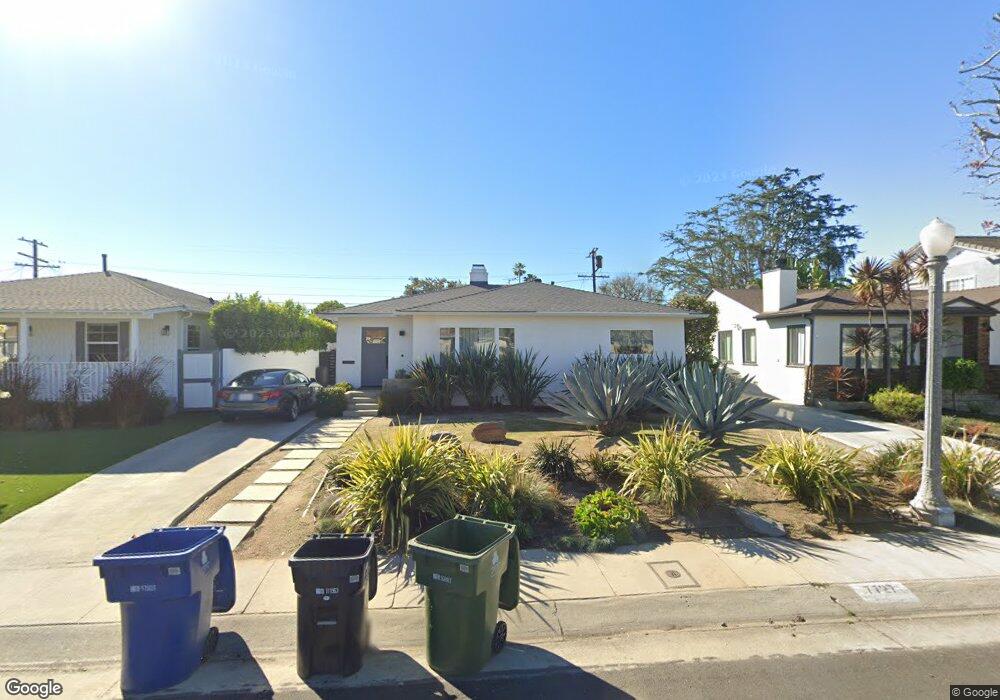
7727 Agnew Ave Los Angeles, CA 90045
Westchester NeighborhoodEstimated Value: $1,578,000 - $1,722,000
3
Beds
1
Bath
1,125
Sq Ft
$1,457/Sq Ft
Est. Value
About This Home
This home is located at 7727 Agnew Ave, Los Angeles, CA 90045 and is currently estimated at $1,639,522, approximately $1,457 per square foot. 7727 Agnew Ave is a home located in Los Angeles County with nearby schools including Cowan Avenue Elementary School, Wright Middle School STEAM Magnet, and Westchester Enriched Sciences Magnets.
Ownership History
Date
Name
Owned For
Owner Type
Purchase Details
Closed on
Jul 25, 2013
Sold by
Barnhart Billy Paul
Bought by
Barnhart Billy P and Michelle Murrata E
Current Estimated Value
Purchase Details
Closed on
Nov 29, 2005
Sold by
Koltun Molli
Bought by
Barnhart Billy Paul
Purchase Details
Closed on
Apr 18, 1995
Sold by
Lanis Gary S and Lanis Gloria J
Bought by
Koltun Molli
Home Financials for this Owner
Home Financials are based on the most recent Mortgage that was taken out on this home.
Original Mortgage
$229,500
Interest Rate
7.37%
Purchase Details
Closed on
Jan 26, 1994
Sold by
Lanis Gary S and Lanis Gloria J
Bought by
Lanis Gary S
Create a Home Valuation Report for This Property
The Home Valuation Report is an in-depth analysis detailing your home's value as well as a comparison with similar homes in the area
Home Values in the Area
Average Home Value in this Area
Purchase History
| Date | Buyer | Sale Price | Title Company |
|---|---|---|---|
| Barnhart Billy P | -- | None Available | |
| Barnhart Billy Paul | $799,000 | Fidelity National Title Comp | |
| Koltun Molli | $255,000 | -- | |
| Lanis Gary S | -- | -- |
Source: Public Records
Mortgage History
| Date | Status | Borrower | Loan Amount |
|---|---|---|---|
| Previous Owner | Koltun Molli | $229,500 |
Source: Public Records
Tax History
| Year | Tax Paid | Tax Assessment Tax Assessment Total Assessment is a certain percentage of the fair market value that is determined by local assessors to be the total taxable value of land and additions on the property. | Land | Improvement |
|---|---|---|---|---|
| 2025 | $14,338 | $1,198,488 | $873,512 | $324,976 |
| 2024 | $14,338 | $1,174,989 | $856,385 | $318,604 |
| 2023 | $14,062 | $1,151,951 | $839,594 | $312,357 |
| 2022 | $13,410 | $1,129,365 | $823,132 | $306,233 |
| 2021 | $13,244 | $1,107,222 | $806,993 | $300,229 |
| 2019 | $12,846 | $1,074,383 | $783,058 | $291,325 |
| 2018 | $12,759 | $1,053,317 | $767,704 | $285,613 |
| 2016 | $12,204 | $1,012,417 | $737,894 | $274,523 |
| 2015 | $8,321 | $688,000 | $551,000 | $137,000 |
| 2014 | $8,516 | $688,000 | $551,000 | $137,000 |
Source: Public Records
Map
Nearby Homes
- 7836 Dunbarton Ave
- 7737 Denrock Ave
- 7841 Stewart Ave
- 7501 Agnew Ave
- 7520 Stewart Ave
- 8025 Stewart Ave
- 8040 Agnew Ave
- 7975 Chase Ave
- 7324 Westlawn Ave
- 7403 Stewart Ave
- 6606 W 80th Place
- 8044 Cowan Ave
- 8308 Mcconnell Ave
- 8004 El Manor Ave
- 8008 El Manor Ave
- 7819 El Manor Ave
- 8328 Mcconnell Ave
- 8344 Kenyon Ave
- 8336 Stewart Ave
- 8333 Chase Ave
- 7721 Agnew Ave
- 7731 Agnew Ave
- 7717 Agnew Ave
- 7737 Agnew Ave
- 7728 Dunbarton Ave
- 7732 Dunbarton Ave
- 7722 Dunbarton Ave
- 7738 Dunbarton Ave
- 7741 Agnew Ave
- 7711 Agnew Ave
- 7716 Dunbarton Ave
- 7722 Agnew Ave
- 7728 Agnew Ave
- 7742 Dunbarton Ave
- 7716 Agnew Ave
- 7734 Agnew Ave
- 7712 Dunbarton Ave
- 7707 Agnew Ave
- 7801 Agnew Ave
- 7712 Agnew Ave
Your Personal Tour Guide
Ask me questions while you tour the home.