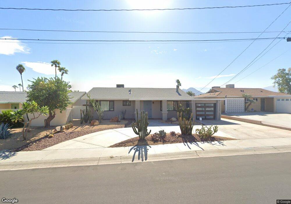
77395 Missouri Dr Palm Desert, CA 92211
Estimated Value: $411,000 - $528,000
3
Beds
3
Baths
1,634
Sq Ft
$303/Sq Ft
Est. Value
About This Home
This home is located at 77395 Missouri Dr, Palm Desert, CA 92211 and is currently estimated at $495,549, approximately $303 per square foot. 77395 Missouri Dr is a home located in Riverside County with nearby schools including Gerald R. Ford Elementary School, Colonel Mitchell Paige Middle School, and Palm Desert High School.
Ownership History
Date
Name
Owned For
Owner Type
Purchase Details
Closed on
Mar 8, 2019
Sold by
Grotsky Gary and Grotsky Kelly
Bought by
Dow Richard Andrew La and Dow Robin H La
Current Estimated Value
Home Financials for this Owner
Home Financials are based on the most recent Mortgage that was taken out on this home.
Original Mortgage
$267,600
Outstanding Balance
$234,787
Interest Rate
4.3%
Mortgage Type
New Conventional
Estimated Equity
$260,762
Purchase Details
Closed on
Jan 10, 2014
Sold by
Grotsky Kelly and Grotsky Gary
Bought by
Gary Grotsky and Kelly Grotsky Revocable T
Purchase Details
Closed on
Oct 21, 2009
Sold by
Missouri Dr Trust #77395
Bought by
Grotsky Kelly and Grotsky Gary
Home Financials for this Owner
Home Financials are based on the most recent Mortgage that was taken out on this home.
Original Mortgage
$171,830
Interest Rate
5.02%
Mortgage Type
FHA
Purchase Details
Closed on
Jun 9, 2009
Sold by
Olson Caren
Bought by
Missouri Dr Trust #77395 and Rpv Investment Group Llc
Purchase Details
Closed on
May 22, 2003
Sold by
Allen Mark and Tang Sherry
Bought by
Olson Caren
Home Financials for this Owner
Home Financials are based on the most recent Mortgage that was taken out on this home.
Original Mortgage
$186,400
Interest Rate
5.18%
Mortgage Type
Purchase Money Mortgage
Purchase Details
Closed on
Oct 23, 2002
Sold by
Kelly Charles V and Kelly Rosalie
Bought by
Allen Mark and Tang Sherry
Home Financials for this Owner
Home Financials are based on the most recent Mortgage that was taken out on this home.
Original Mortgage
$168,000
Interest Rate
5.89%
Purchase Details
Closed on
Nov 10, 1993
Sold by
Omeara Robert Michael
Bought by
Erbstoesser Donald T and Erbstoesser Sharon S
Home Financials for this Owner
Home Financials are based on the most recent Mortgage that was taken out on this home.
Original Mortgage
$85,000
Interest Rate
7.09%
Mortgage Type
Seller Take Back
Purchase Details
Closed on
Oct 29, 1993
Sold by
Erbstoesser Donald T and Erbstoesser Sharon S
Bought by
Kelly Charles and Kelly Rosalie
Home Financials for this Owner
Home Financials are based on the most recent Mortgage that was taken out on this home.
Original Mortgage
$85,000
Interest Rate
7.09%
Mortgage Type
Seller Take Back
Create a Home Valuation Report for This Property
The Home Valuation Report is an in-depth analysis detailing your home's value as well as a comparison with similar homes in the area
Home Values in the Area
Average Home Value in this Area
Purchase History
| Date | Buyer | Sale Price | Title Company |
|---|---|---|---|
| Dow Richard Andrew La | $334,500 | Lawyers Title Ie | |
| Gary Grotsky | -- | None Available | |
| Grotsky Kelly | $175,000 | Orange Coast Title Co | |
| Missouri Dr Trust #77395 | $129,965 | None Available | |
| Olson Caren | $233,000 | American Title Co | |
| Allen Mark | $218,000 | American | |
| Erbstoesser Donald T | $95,000 | Commonwealth Land Title Co | |
| Kelly Charles | $95,000 | Commonwealth Land Title Co |
Source: Public Records
Mortgage History
| Date | Status | Borrower | Loan Amount |
|---|---|---|---|
| Open | Dow Richard Andrew La | $267,600 | |
| Previous Owner | Grotsky Kelly | $171,830 | |
| Previous Owner | Olson Caren | $186,400 | |
| Previous Owner | Allen Mark | $168,000 | |
| Previous Owner | Kelly Charles | $85,000 |
Source: Public Records
Tax History Compared to Growth
Tax History
| Year | Tax Paid | Tax Assessment Tax Assessment Total Assessment is a certain percentage of the fair market value that is determined by local assessors to be the total taxable value of land and additions on the property. | Land | Improvement |
|---|---|---|---|---|
| 2025 | $5,239 | $373,136 | $35,136 | $338,000 |
| 2023 | $5,239 | $358,649 | $33,773 | $324,876 |
| 2022 | $4,921 | $351,617 | $33,111 | $318,506 |
| 2021 | $4,809 | $344,723 | $32,462 | $312,261 |
| 2020 | $4,726 | $341,190 | $32,130 | $309,060 |
| 2019 | $2,954 | $202,490 | $60,745 | $141,745 |
| 2018 | $2,901 | $198,520 | $59,554 | $138,966 |
| 2017 | $2,843 | $194,629 | $58,387 | $136,242 |
| 2016 | $2,780 | $190,814 | $57,243 | $133,571 |
| 2015 | $2,718 | $187,949 | $56,384 | $131,565 |
| 2014 | $2,586 | $184,270 | $55,281 | $128,989 |
Source: Public Records
Map
Nearby Homes
- 77560 California Dr
- 42639 Devonshire St
- 77265 California Dr
- 77322 Missouri Dr
- 77630 California Dr
- 43170 Warner Trail
- 77650 California Dr
- 77380 Minnesota Ave
- 42660 Iowa St
- 77645 Mountain View
- 77235 Minnesota Ave
- 43305 Illinois Ave
- 42585 Iowa St
- 77190 Minnesota Ave
- 42440 Kansas St
- 41823 Preston Trail
- 77583 Woodhaven Dr S Unit 832
- 42700 Wisconsin Ave
- 42660 Wisconsin Ave
- 77405 Colorado St
- 77385 Missouri Dr
- 77405 Missouri Dr
- 77375 Missouri Dr
- 42635 Warner Trail
- 42665 Warner Trail
- 77400 Missouri Dr
- 77390 Missouri Dr
- 77410 Missouri Dr
- 42705 Warner Trail
- 42605 Warner Trail
- 42755 Warner Trail
- 77361 Missouri Dr
- 77370 Missouri Dr
- 42565 Warner Trail
- 42785 Warner Trail
- 77395 California Dr
- 77360 Missouri Dr
- 77385 California Dr
- 77519 Missouri Dr