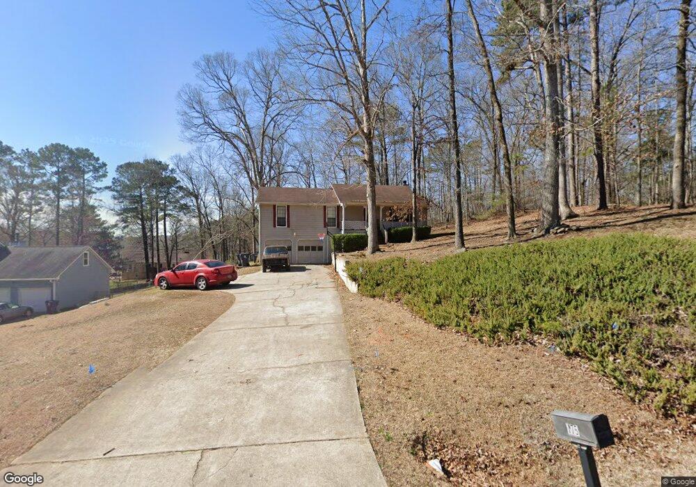
775 Flat Rock Rd Unit 1 Stockbridge, GA 30281
Estimated Value: $256,000 - $288,000
3
Beds
2
Baths
1,584
Sq Ft
$171/Sq Ft
Est. Value
About This Home
This home is located at 775 Flat Rock Rd Unit 1, Stockbridge, GA 30281 and is currently estimated at $271,525, approximately $171 per square foot. 775 Flat Rock Rd Unit 1 is a home located in Henry County with nearby schools including Cotton Indian Elementary School, Stockbridge Middle School, and Stockbridge High School.
Ownership History
Date
Name
Owned For
Owner Type
Purchase Details
Closed on
May 30, 2024
Sold by
Welshimer Llc
Bought by
Head Angela D and Head Steven Tyrone
Current Estimated Value
Purchase Details
Closed on
Aug 24, 2007
Sold by
Hsbc Bk Usa
Bought by
Welshimer Llc
Purchase Details
Closed on
Apr 3, 2007
Sold by
Morrow Jimmie L and Morrow Ofelara R
Bought by
Hsbc Bank Usa
Purchase Details
Closed on
Dec 6, 1999
Sold by
La-Vette Homes Inc
Bought by
Morrow Jimmie L and Morrow Ofelara R
Home Financials for this Owner
Home Financials are based on the most recent Mortgage that was taken out on this home.
Original Mortgage
$102,548
Interest Rate
12.13%
Mortgage Type
New Conventional
Create a Home Valuation Report for This Property
The Home Valuation Report is an in-depth analysis detailing your home's value as well as a comparison with similar homes in the area
Home Values in the Area
Average Home Value in this Area
Purchase History
| Date | Buyer | Sale Price | Title Company |
|---|---|---|---|
| Head Angela D | $128,000 | -- | |
| Welshimer Llc | $103,800 | -- | |
| Hsbc Bank Usa | $129,430 | -- | |
| Morrow Jimmie L | $120,700 | -- |
Source: Public Records
Mortgage History
| Date | Status | Borrower | Loan Amount |
|---|---|---|---|
| Previous Owner | Morrow Jimmie L | $102,548 |
Source: Public Records
Tax History Compared to Growth
Tax History
| Year | Tax Paid | Tax Assessment Tax Assessment Total Assessment is a certain percentage of the fair market value that is determined by local assessors to be the total taxable value of land and additions on the property. | Land | Improvement |
|---|---|---|---|---|
| 2025 | $3,941 | $108,828 | $14,000 | $94,828 |
| 2024 | $3,941 | $104,000 | $14,000 | $90,000 |
| 2023 | $4,315 | $111,440 | $10,000 | $101,440 |
| 2022 | $3,129 | $80,520 | $10,000 | $70,520 |
| 2021 | $2,582 | $66,280 | $10,000 | $56,280 |
| 2020 | $2,380 | $61,000 | $8,000 | $53,000 |
| 2019 | $2,239 | $57,320 | $8,000 | $49,320 |
| 2018 | $0 | $53,640 | $8,000 | $45,640 |
| 2016 | $1,880 | $47,960 | $8,000 | $39,960 |
| 2015 | $1,722 | $42,520 | $6,000 | $36,520 |
| 2014 | $1,622 | $39,520 | $4,800 | $34,720 |
Source: Public Records
Map
Nearby Homes
- 180 Cowan Dr
- 159 Brookwood Estates Trail
- 364 Sound Cir
- 0 Old Conyers Rd Unit 10574658
- 0 N Highway 42 Unit 10627424
- 0 Highway 155 N Unit 7649185
- 125 Johnsons Walk Unit 2
- 120 Montgomery Dr
- 104 Montgomery Dr
- 2581 Union Church Rd SW
- 278 Sound Cir
- 286 Sound Cir
- 1527 Old Conyers Rd Unit 4
- 0 W Hemphill Rd Unit 10295429
- 0 W Hemphill Rd Unit 10536232
- 242 Summerford Place
- 65 Wynfield Dr
- 95 Fern Ct
- 830 Anna Kathryn Dr
- 811 Anna Kathryn Dr
- 775 Flat Rock Rd
- 773 Flat Rock Rd
- 777 Flat Rock Rd
- 110 Brookwood Estates Ct Unit 1
- 110 Brookwood Estates Ct
- 100 Brookwood Estates Ct
- 114 Brookwood Estates Ct
- 114 Brookwood Estates Ct Unit 11
- 774 Flat Rock Rd Unit 1
- 776 Flat Rock Rd Unit 2
- 776 Flat Rock Rd
- 771 Flat Rock Rd
- 779 Flat Rock Rd
- 778 Flat Rock Rd
- 120 Brookwood Estates Ct Unit 3
- 202 Brookwood Way Unit 3
- 0 Brookwood Estates Ct Unit 7611377
- 19 Copeland Ln Unit 1
- 206 Brookwood Way
- 90 Brookwood Estates Ct