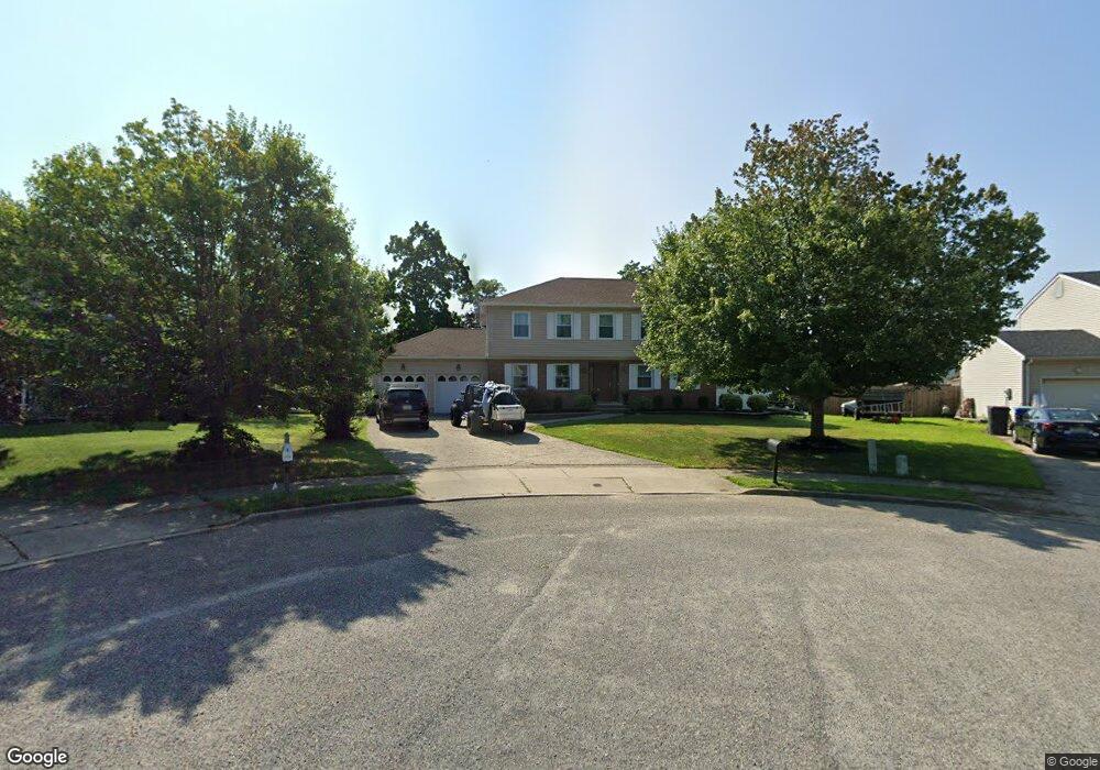
775 Hearthstone Rd Toms River, NJ 08753
Estimated Value: $677,534 - $827,000
4
Beds
3
Baths
2,223
Sq Ft
$325/Sq Ft
Est. Value
About This Home
This home is located at 775 Hearthstone Rd, Toms River, NJ 08753 and is currently estimated at $722,884, approximately $325 per square foot. 775 Hearthstone Rd is a home located in Ocean County with nearby schools including St Joseph Grade School and Donovan Catholic High School.
Ownership History
Date
Name
Owned For
Owner Type
Purchase Details
Closed on
Jan 11, 2002
Sold by
Briggs Family Trust
Bought by
Sacko Joseph and Sacko Mimi
Current Estimated Value
Home Financials for this Owner
Home Financials are based on the most recent Mortgage that was taken out on this home.
Original Mortgage
$200,000
Outstanding Balance
$82,368
Interest Rate
7.15%
Estimated Equity
$640,516
Create a Home Valuation Report for This Property
The Home Valuation Report is an in-depth analysis detailing your home's value as well as a comparison with similar homes in the area
Home Values in the Area
Average Home Value in this Area
Purchase History
| Date | Buyer | Sale Price | Title Company |
|---|---|---|---|
| Sacko Joseph | $250,000 | -- |
Source: Public Records
Mortgage History
| Date | Status | Borrower | Loan Amount |
|---|---|---|---|
| Open | Sacko Joseph | $200,000 |
Source: Public Records
Tax History Compared to Growth
Tax History
| Year | Tax Paid | Tax Assessment Tax Assessment Total Assessment is a certain percentage of the fair market value that is determined by local assessors to be the total taxable value of land and additions on the property. | Land | Improvement |
|---|---|---|---|---|
| 2025 | $8,947 | $491,300 | $181,000 | $310,300 |
| 2024 | $8,504 | $491,300 | $181,000 | $310,300 |
| 2023 | $8,200 | $491,300 | $181,000 | $310,300 |
| 2022 | $8,200 | $491,300 | $181,000 | $310,300 |
| 2021 | $8,199 | $327,300 | $102,800 | $224,500 |
| 2020 | $8,163 | $327,300 | $102,800 | $224,500 |
| 2019 | $7,809 | $327,300 | $102,800 | $224,500 |
| 2018 | $7,705 | $327,300 | $102,800 | $224,500 |
| 2017 | $7,639 | $327,300 | $102,800 | $224,500 |
| 2016 | $7,440 | $327,300 | $102,800 | $224,500 |
| 2015 | $7,158 | $327,300 | $102,800 | $224,500 |
| 2014 | $6,814 | $327,300 | $102,800 | $224,500 |
Source: Public Records
Map
Nearby Homes
- 846 Naryshkin Way
- 696 Schoolhouse Ln
- 837 Naryshkin Way
- 853 Naryshkin Way
- 845 Naryshkin Way
- 625 Greenwich Ct
- 600 Brookside Dr
- 612 Greenwich Ct
- 308 Tradewinds Ave
- 856 Somerset Dr
- 707 Cedar Point Ct
- 837 Raleigh Dr
- 507 Sloop Ct
- 830 Brookside Dr
- 883 Astoria Dr
- 679 Clifton Ave
- 548 Hill Rd
- 741 Spruce Hill Dr
- 918 Briar Ave
- 891 Raleigh Dr
- 779 Hearthstone Rd
- 774 Briar Ave
- 771 Hearthstone Rd
- 770 Briar Ave
- 680 Michael Dr
- 770 W Briar Ave
- 684 Michael Dr
- 676 Michael Dr
- 688 Michael Dr
- 778 Hearthstone Rd
- 774 Hearthstone Rd
- 692 Michael Dr
- 770 Hearthstone Rd
- 777 Briar Ave
- 676 Brookside Dr
- 680 Brookside Dr
- 672 Brookside Dr
- 684 Brookside Dr
- 675 Michael Dr
- 696 Michael Dr