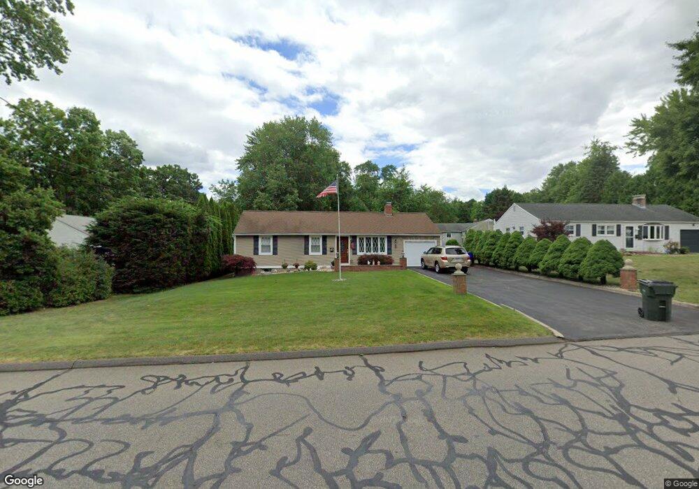
775 Nott St Wethersfield, CT 06109
Estimated Value: $315,000 - $373,759
3
Beds
2
Baths
960
Sq Ft
$369/Sq Ft
Est. Value
About This Home
This home is located at 775 Nott St, Wethersfield, CT 06109 and is currently estimated at $354,190, approximately $368 per square foot. 775 Nott St is a home located in Hartford County with nearby schools including Samuel B. Webb Elementary School, Silas Deane Middle School, and Wethersfield High School.
Create a Home Valuation Report for This Property
The Home Valuation Report is an in-depth analysis detailing your home's value as well as a comparison with similar homes in the area
Home Values in the Area
Average Home Value in this Area
Tax History
| Year | Tax Paid | Tax Assessment Tax Assessment Total Assessment is a certain percentage of the fair market value that is determined by local assessors to be the total taxable value of land and additions on the property. | Land | Improvement |
|---|---|---|---|---|
| 2025 | $10,175 | $246,850 | $97,020 | $149,830 |
| 2024 | $5,990 | $138,600 | $65,100 | $73,500 |
| 2023 | $5,791 | $138,600 | $65,100 | $73,500 |
| 2022 | $5,694 | $138,600 | $65,100 | $73,500 |
| 2021 | $5,637 | $138,600 | $65,100 | $73,500 |
| 2020 | $5,640 | $138,600 | $65,100 | $73,500 |
| 2019 | $5,647 | $138,600 | $65,100 | $73,500 |
| 2018 | $5,587 | $137,000 | $61,300 | $75,700 |
| 2017 | $5,448 | $137,000 | $61,300 | $75,700 |
| 2016 | $5,280 | $137,000 | $61,300 | $75,700 |
| 2015 | $5,232 | $137,000 | $61,300 | $75,700 |
| 2014 | $5,033 | $137,000 | $61,300 | $75,700 |
Source: Public Records
Map
Nearby Homes
- 173 Timber Trail
- 273 Forest Dr
- 129 Goff Rd
- 20 Forest Dr
- 295 Ridge Rd Unit 8
- 144 Brown St
- 15 Potter Crossing
- 62 Schoolhouse Crossing
- 25 Tinsmith Crossing
- 55 Rutledge Rd
- 1 Bristol St
- 764 Ridge Rd
- 19 Albert Ave
- 1 Brussels Ave
- 7 Barrington Dr Unit C
- 208 Mountain St
- 158 Dix Rd
- 79 Piper Brook Ave
- 32 Garvan St
- 42 Dunham St
Your Personal Tour Guide
Ask me questions while you tour the home.