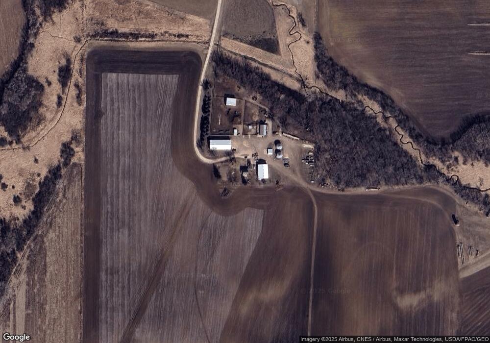
7750 290th St W Northfield, MN 55057
Estimated Value: $581,000 - $1,338,852
5
Beds
1
Bath
1,830
Sq Ft
$525/Sq Ft
Est. Value
About This Home
This home is located at 7750 290th St W, Northfield, MN 55057 and is currently estimated at $959,926, approximately $524 per square foot. 7750 290th St W is a home located in Dakota County with nearby schools including Greenvale Park Elementary School, Northfield Middle School, and Northfield Senior High School.
Ownership History
Date
Name
Owned For
Owner Type
Purchase Details
Closed on
Mar 21, 2025
Sold by
Swenson Donald J and Swenson Barbara A
Bought by
Swenson Aaron C and Swenson Stephanie J
Current Estimated Value
Purchase Details
Closed on
Feb 9, 1998
Sold by
Swenson Evelyn M
Bought by
Swenson Donald J and Swenson Barbara A
Create a Home Valuation Report for This Property
The Home Valuation Report is an in-depth analysis detailing your home's value as well as a comparison with similar homes in the area
Home Values in the Area
Average Home Value in this Area
Purchase History
| Date | Buyer | Sale Price | Title Company |
|---|---|---|---|
| Swenson Aaron C | $500 | None Listed On Document | |
| Swenson Donald J | $500 | None Listed On Document | |
| Swenson Donald J | $176,000 | -- |
Source: Public Records
Tax History Compared to Growth
Tax History
| Year | Tax Paid | Tax Assessment Tax Assessment Total Assessment is a certain percentage of the fair market value that is determined by local assessors to be the total taxable value of land and additions on the property. | Land | Improvement |
|---|---|---|---|---|
| 2024 | $4,504 | $1,178,300 | $684,200 | $494,100 |
| 2023 | $4,504 | $1,150,800 | $655,200 | $495,600 |
| 2022 | $3,982 | $1,025,200 | $559,000 | $466,200 |
| 2021 | $4,118 | $953,000 | $538,000 | $415,000 |
| 2020 | $4,418 | $918,200 | $512,700 | $405,500 |
| 2019 | $4,492 | $887,400 | $536,900 | $350,500 |
| 2018 | $4,912 | $872,700 | $534,400 | $338,300 |
| 2017 | $4,671 | $874,600 | $532,300 | $342,300 |
| 2016 | $4,842 | $911,600 | $579,500 | $332,100 |
| 2015 | $4,857 | $895,450 | $575,138 | $320,312 |
| 2014 | -- | $884,550 | $572,178 | $312,372 |
| 2013 | -- | $817,893 | $538,867 | $279,026 |
Source: Public Records
Map
Nearby Homes
- 8858 298th Ct W
- 31125 Jamaica Ave
- TBD 265th St W
- 27885 Delft Ave
- 25805 Fairgreen Ave
- TBD Hwy 19 / Lonsdal Lonsdale Blvd E
- 6415 Hazelwood Ave
- XXXXX 330th St
- 1507 Independence Dr
- 1504 Independence Dr Unit 603
- 10199 330th St W
- 11550 Deuce Rd
- 1105 Hawthorne Ct
- 10922 E 270th St
- 7243 Hazelwood Ave
- 1404 Lockwood Dr
- 1000 Cannon Valley Dr Unit 143
- 705 Grundhoefer Ct
- 1025 Summerfield Dr
- 601 Meldahl Ln
- 7256 290th St W
- 7150 292nd St
- 7253 290th St W
- 7792 285th St W
- 29776 Hayes Ave
- 29770 Hayes Ave
- 28639 Garrett Ave
- 29238 Holyoke Ave
- 8090 285th St W
- 29930 Hayes Ave
- 28800 Holyoke Ave
- 28645 Garrett Ave
- 29978 Hayes Ave
- 6948 290th St W
- xxxxx Holyoke Ave
- XXX Foliage
- 6905 290th St W
- 29242 Holyoke Ave
- 7232 285th St W
- 7171 300th St W
