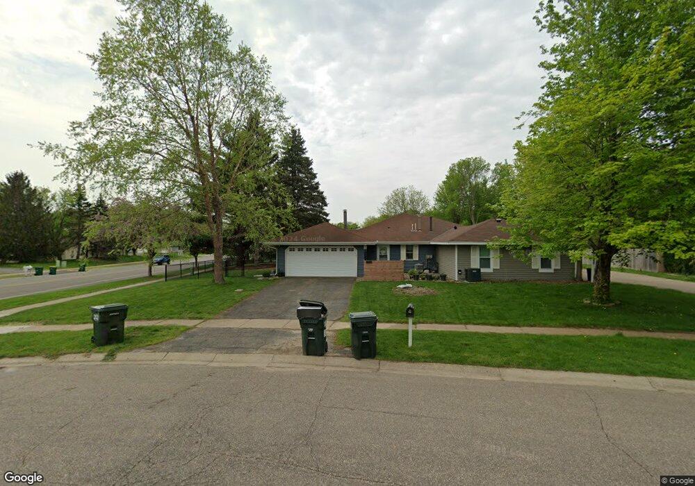
7754 142nd St W Saint Paul, MN 55124
Alimagnet NeighborhoodEstimated Value: $260,000 - $279,000
2
Beds
2
Baths
1,136
Sq Ft
$236/Sq Ft
Est. Value
About This Home
This home is located at 7754 142nd St W, Saint Paul, MN 55124 and is currently estimated at $267,861, approximately $235 per square foot. 7754 142nd St W is a home located in Dakota County with nearby schools including Westview Elementary School, Valley Middle School, and Apple Valley Senior High School.
Ownership History
Date
Name
Owned For
Owner Type
Purchase Details
Closed on
Aug 15, 2018
Sold by
Pierson Michael L and Pierson Vikki A
Bought by
Murry Haley Rae
Current Estimated Value
Home Financials for this Owner
Home Financials are based on the most recent Mortgage that was taken out on this home.
Original Mortgage
$211,105
Outstanding Balance
$185,752
Interest Rate
5.12%
Mortgage Type
FHA
Estimated Equity
$82,109
Purchase Details
Closed on
May 1, 2018
Sold by
Brule Jan M
Bought by
Pierson Michael L and Pierson Vikki A
Purchase Details
Closed on
Oct 15, 2003
Sold by
Duverge Hector E and Duverge Aracelis
Bought by
Brown Marian E
Purchase Details
Closed on
Aug 27, 1999
Sold by
Larson Deborah A
Bought by
Duverge Hector E and Badillo Aracelis
Create a Home Valuation Report for This Property
The Home Valuation Report is an in-depth analysis detailing your home's value as well as a comparison with similar homes in the area
Home Values in the Area
Average Home Value in this Area
Purchase History
| Date | Buyer | Sale Price | Title Company |
|---|---|---|---|
| Murry Haley Rae | $215,000 | Dca Title | |
| Pierson Michael L | $130,000 | Dca Title | |
| Brown Marian E | $169,700 | -- | |
| Duverge Hector E | $111,900 | -- |
Source: Public Records
Mortgage History
| Date | Status | Borrower | Loan Amount |
|---|---|---|---|
| Open | Murry Haley Rae | $211,105 |
Source: Public Records
Tax History Compared to Growth
Tax History
| Year | Tax Paid | Tax Assessment Tax Assessment Total Assessment is a certain percentage of the fair market value that is determined by local assessors to be the total taxable value of land and additions on the property. | Land | Improvement |
|---|---|---|---|---|
| 2024 | $2,272 | $216,300 | $56,700 | $159,600 |
| 2023 | $2,272 | $213,300 | $56,800 | $156,500 |
| 2022 | $1,984 | $213,100 | $56,600 | $156,500 |
| 2021 | $1,946 | $185,100 | $49,300 | $135,800 |
| 2020 | $1,890 | $178,500 | $46,900 | $131,600 |
| 2019 | $1,623 | $169,400 | $44,700 | $124,700 |
| 2018 | $1,493 | $155,600 | $42,600 | $113,000 |
| 2017 | $1,503 | $140,100 | $40,500 | $99,600 |
| 2016 | $1,587 | $135,000 | $38,600 | $96,400 |
| 2015 | $1,322 | $115,142 | $31,133 | $84,009 |
| 2014 | -- | $95,631 | $28,634 | $66,997 |
| 2013 | -- | $92,252 | $26,169 | $66,083 |
Source: Public Records
Map
Nearby Homes
- 14242 Glencove Trail
- 7662 142nd St W
- 14115 Pennock Ave Unit 301
- 14115 Pennock Ave Unit 303
- 13780 Hanover Way
- 7577 138th St W
- 13902 Herald Way
- 14208 Heritage Ln
- 13868 Glendale Ct
- 13910 Herald Ct
- 13715 Grafton Ct
- 13720 Georgia Dr
- 14620 Garrett Ave Unit 310
- 14620 Garrett Ave Unit 104
- 14132 Heywood Path
- 14786 Hallmark Dr
- 13420 Gull Ct
- 14461 Freesia Way
- 13761 Hollybrook Cir
- 441 Walnut Ln
- 7762 142nd St W
- 7759 Glenda Ct
- 7763 Glenda Ct
- 7770 142nd St W
- 7770 7770 142nd-Street-w
- 14220 Pennock Ave
- 7778 142nd St W
- 7775 Glenda Ct
- 14230 Pennock Ave
- 7755 Glenda Ct
- 7765 Glenda Ct
- 7785 Glenda Ct
- 7786 142nd St W
- 7793 Glenda Ct
- 14312 Glenda Dr
- 7813 Glenda Ct
- 14314 Glenda Dr
- 7794 142nd St W
- 7823 Glenda Ct
- 14318 Glenda Dr