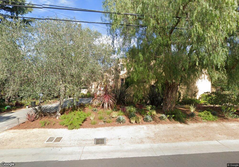
776 Cotton St Menlo Park, CA 94025
Central Menlo Park NeighborhoodEstimated Value: $9,405,000 - $10,383,349
4
Beds
4
Baths
5,766
Sq Ft
$1,694/Sq Ft
Est. Value
About This Home
This home is located at 776 Cotton St, Menlo Park, CA 94025 and is currently estimated at $9,769,783, approximately $1,694 per square foot. 776 Cotton St is a home located in San Mateo County with nearby schools including Oak Knoll Elementary School, Hillview Middle School, and Menlo-Atherton High School.
Ownership History
Date
Name
Owned For
Owner Type
Purchase Details
Closed on
Aug 9, 2001
Sold by
Maidens Duane and Maidens Michele G
Bought by
Schlein Ted E and Schlein Linda S
Current Estimated Value
Home Financials for this Owner
Home Financials are based on the most recent Mortgage that was taken out on this home.
Original Mortgage
$1,500,000
Outstanding Balance
$553,344
Interest Rate
6.4%
Estimated Equity
$9,216,439
Purchase Details
Closed on
Mar 12, 1998
Sold by
Brown Mabel E
Bought by
Maidens Duane and Maidens Michele G
Home Financials for this Owner
Home Financials are based on the most recent Mortgage that was taken out on this home.
Original Mortgage
$700,000
Interest Rate
7.37%
Create a Home Valuation Report for This Property
The Home Valuation Report is an in-depth analysis detailing your home's value as well as a comparison with similar homes in the area
Home Values in the Area
Average Home Value in this Area
Purchase History
| Date | Buyer | Sale Price | Title Company |
|---|---|---|---|
| Schlein Ted E | $5,800,000 | First American Title Co | |
| Maidens Duane | $1,000,454 | North American Title Insuran |
Source: Public Records
Mortgage History
| Date | Status | Borrower | Loan Amount |
|---|---|---|---|
| Open | Schlein Ted E | $1,500,000 | |
| Previous Owner | Maidens Duane | $700,000 |
Source: Public Records
Tax History Compared to Growth
Tax History
| Year | Tax Paid | Tax Assessment Tax Assessment Total Assessment is a certain percentage of the fair market value that is determined by local assessors to be the total taxable value of land and additions on the property. | Land | Improvement |
|---|---|---|---|---|
| 2025 | $94,774 | $8,601,764 | $4,284,186 | $4,317,578 |
| 2023 | $94,774 | $8,267,752 | $4,117,827 | $4,149,925 |
| 2022 | $90,637 | $8,105,641 | $4,037,086 | $4,068,555 |
| 2021 | $89,181 | $7,946,709 | $3,957,928 | $3,988,781 |
| 2020 | $88,823 | $7,865,227 | $3,917,345 | $3,947,882 |
| 2019 | $87,671 | $7,711,009 | $3,840,535 | $3,870,474 |
| 2018 | $85,612 | $7,559,815 | $3,765,231 | $3,794,584 |
| 2017 | $84,464 | $7,411,584 | $3,691,403 | $3,720,181 |
| 2016 | $82,626 | $7,266,260 | $3,619,023 | $3,647,237 |
| 2015 | $74,654 | $6,500,000 | $3,237,000 | $3,263,000 |
| 2014 | $74,957 | $6,500,000 | $3,237,000 | $3,263,000 |
Source: Public Records
Map
Nearby Homes
- 1100 Hobart St
- 455 San Mateo Dr
- 705 Evergreen St
- 905 Fremont Place
- 1224 Whitaker Way
- 1715 Bay Laurel Dr
- 1840 Santa Cruz Ave
- 308 Yale Rd
- 1357 Johnson St
- 83 Camino Por Los Arboles
- 93 Camino Por Los Arboles
- 83 & 93 Camino Por Los Arboles
- 841 Partridge Ave
- 1330 University Dr Unit 66
- 2030 Ashton Ave
- 2051 Gordon Ave
- 660 Roble Ave
- 7 Montana Ln
- 2030 Sand Hill Rd
- 1236 Hoover St