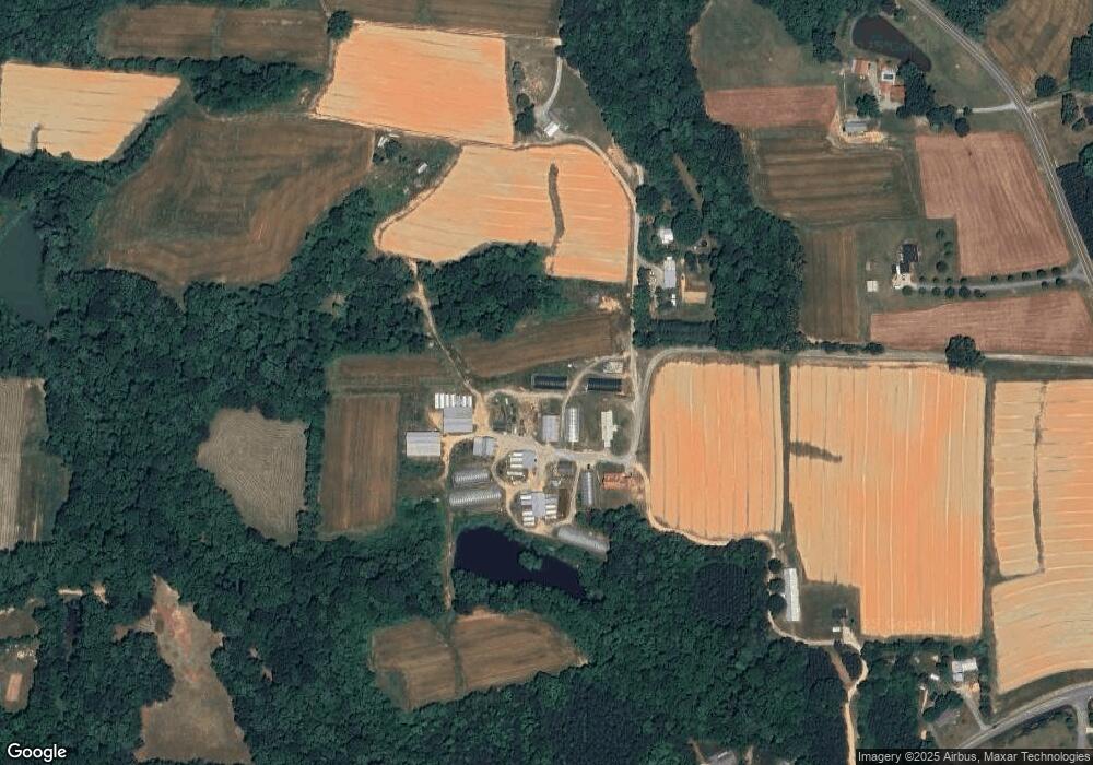
777 Hoover Rd Lexington, NC 27295
Estimated Value: $616,000
--
Bed
1
Bath
--
Sq Ft
42
Acres
About This Home
This home is located at 777 Hoover Rd, Lexington, NC 27295 and is currently estimated at $616,000. 777 Hoover Rd is a home located in Davidson County with nearby schools including Welcome Elementary School, North Davidson Middle School, and North Davidson High School.
Ownership History
Date
Name
Owned For
Owner Type
Purchase Details
Closed on
Nov 17, 2016
Sold by
Wood Clinton Ray and Wood Dorris L
Bought by
Clinton And Doris Wood Irrevocable Trust
Current Estimated Value
Purchase Details
Closed on
Mar 3, 2010
Sold by
Boner John W and Boner Rebecca H
Bought by
Wood Clinton R and Wood Jody C
Home Financials for this Owner
Home Financials are based on the most recent Mortgage that was taken out on this home.
Original Mortgage
$235,000
Interest Rate
4.97%
Mortgage Type
Purchase Money Mortgage
Purchase Details
Closed on
Sep 1, 1984
Create a Home Valuation Report for This Property
The Home Valuation Report is an in-depth analysis detailing your home's value as well as a comparison with similar homes in the area
Home Values in the Area
Average Home Value in this Area
Purchase History
| Date | Buyer | Sale Price | Title Company |
|---|---|---|---|
| Clinton And Doris Wood Irrevocable Trust | -- | None Available | |
| Wood Clinton R | $287,500 | None Available | |
| -- | -- | -- |
Source: Public Records
Mortgage History
| Date | Status | Borrower | Loan Amount |
|---|---|---|---|
| Closed | Wood Clinton R | $235,000 |
Source: Public Records
Tax History Compared to Growth
Tax History
| Year | Tax Paid | Tax Assessment Tax Assessment Total Assessment is a certain percentage of the fair market value that is determined by local assessors to be the total taxable value of land and additions on the property. | Land | Improvement |
|---|---|---|---|---|
| 2025 | $166 | $25,940 | $0 | $0 |
| 2024 | $166 | $25,940 | $0 | $0 |
| 2023 | $166 | $25,940 | $0 | $0 |
| 2022 | $166 | $25,940 | $0 | $0 |
| 2021 | $166 | $25,940 | $0 | $0 |
| 2020 | $102 | $15,920 | $0 | $0 |
| 2019 | $103 | $15,920 | $0 | $0 |
| 2018 | $103 | $15,920 | $0 | $0 |
| 2017 | $103 | $15,920 | $0 | $0 |
| 2016 | $585 | $89,970 | $0 | $0 |
| 2015 | $554 | $85,200 | $0 | $0 |
| 2014 | $717 | $111,960 | $0 | $0 |
Source: Public Records
Map
Nearby Homes
- 131 Kapstone Crossing
- 789 Kapstone Crossing
- 880 Kapstone Crossing
- 883 Kapstone Crossing
- 1055 Kapstone Crossing
- 1099 Kapstone Crossing
- 218 Salter Path
- 3268 N Nc Highway 150
- 167 Flossie Ln
- 4209 N Nc Highway 150
- 2906 Leonard Rd
- 0 Wesley St
- 5436 Old Us Highway 52
- 348 Patricia Ln
- 285 Stonybrook Dr
- 249 Lake Dr
- 6202 Old U S Highway 52
- 108 Jefferson St
- 148 Kyndall Run Dr Unit 39
- 176 Kyndall Run Dr Unit 37
- 253 Hoover Rd
- 251 Hoover Rd
- 779 Hoover Rd
- 325 Hoover Rd
- 3682 Arnold Rd
- 3624 Arnold Rd
- 505 Hoover Rd
- 3660 Arnold Rd
- 699 Hoover Rd
- 3554 Arnold Rd
- 3706 Arnold Rd
- 3738 Arnold Rd
- 3830 Arnold Rd
- 3762 Arnold Rd
- 111 Beebop Ln Unit 1
- 3595 Arnold Rd
- 164 Kapstone Crossing
- 3814 Arnold Rd
- 188 Kapstone Crossing
- 827 Hoover Rd
