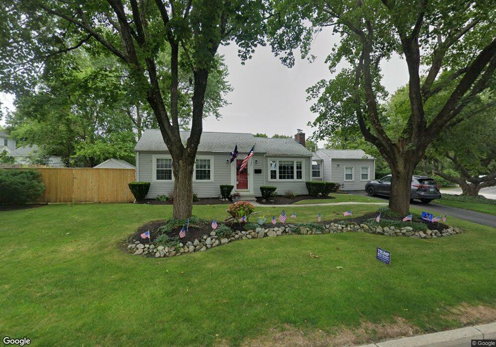
777 Narragansett Pkwy Warwick, RI 02888
Palace Garden NeighborhoodEstimated Value: $442,000 - $507,000
2
Beds
2
Baths
1,227
Sq Ft
$377/Sq Ft
Est. Value
About This Home
This home is located at 777 Narragansett Pkwy, Warwick, RI 02888 and is currently estimated at $462,735, approximately $377 per square foot. 777 Narragansett Pkwy is a home located in Kent County with nearby schools including St. Peter School and Saint Paul School.
Ownership History
Date
Name
Owned For
Owner Type
Purchase Details
Closed on
Nov 20, 2017
Sold by
Mccusker Gail
Bought by
Mccusker Gail and Mccusker Douglas
Current Estimated Value
Purchase Details
Closed on
Jun 25, 2004
Sold by
Campbell Janet L
Bought by
Crowell Gladys M
Purchase Details
Closed on
Nov 30, 1990
Sold by
Harris Eugene W
Bought by
Campbell Janet L
Home Financials for this Owner
Home Financials are based on the most recent Mortgage that was taken out on this home.
Original Mortgage
$93,100
Interest Rate
10.16%
Mortgage Type
Purchase Money Mortgage
Create a Home Valuation Report for This Property
The Home Valuation Report is an in-depth analysis detailing your home's value as well as a comparison with similar homes in the area
Home Values in the Area
Average Home Value in this Area
Purchase History
| Date | Buyer | Sale Price | Title Company |
|---|---|---|---|
| Mccusker Gail | -- | -- | |
| Mccusker Gail | $95,000 | -- | |
| Crowell Gladys M | $271,500 | -- | |
| Campbell Janet L | $98,000 | -- |
Source: Public Records
Mortgage History
| Date | Status | Borrower | Loan Amount |
|---|---|---|---|
| Previous Owner | Campbell Janet L | $90,000 | |
| Previous Owner | Campbell Janet L | $93,100 |
Source: Public Records
Tax History Compared to Growth
Tax History
| Year | Tax Paid | Tax Assessment Tax Assessment Total Assessment is a certain percentage of the fair market value that is determined by local assessors to be the total taxable value of land and additions on the property. | Land | Improvement |
|---|---|---|---|---|
| 2024 | $4,918 | $339,900 | $128,000 | $211,900 |
| 2023 | $4,823 | $339,900 | $128,000 | $211,900 |
| 2022 | $4,375 | $233,600 | $89,600 | $144,000 |
| 2021 | $4,375 | $233,600 | $89,600 | $144,000 |
| 2020 | $4,375 | $233,600 | $89,600 | $144,000 |
| 2019 | $4,375 | $233,600 | $89,600 | $144,000 |
| 2018 | $3,998 | $192,200 | $83,200 | $109,000 |
| 2017 | $3,890 | $192,200 | $83,200 | $109,000 |
| 2016 | $3,890 | $192,200 | $83,200 | $109,000 |
| 2015 | $3,772 | $181,800 | $90,600 | $91,200 |
| 2014 | $3,647 | $181,800 | $90,600 | $91,200 |
| 2013 | $3,582 | $181,000 | $90,600 | $90,400 |
Source: Public Records
Map
Nearby Homes
- 102 Howie Ave
- 88 General Hawkins Dr
- 292 Country Club Dr
- 8 Dartmouth Ave
- 108 Pleasant View Rd
- 162 N Country Club Dr
- 161 N Country Club Dr
- 3 Shadbush Rd
- 55 Longwood Ave
- 44 Crowfield Dr
- 165 Merrymount Dr
- 22 Madison St
- 56 Errol St
- 21 Madison St
- 68 Lane 5
- 86 Lane 5
- 28 Manchester St
- 19 Independence Dr
- 105 Kristen Ct
- 95 Roosevelt St
- 9 N Anderson Ave
- 780 Narragansett Pkwy
- 3 Anderson Ave
- 787 Narragansett Pkwy
- 50 Ann Mary Brown Dr
- 15 Anderson Ave
- 759 Narragansett Pkwy
- 788 Narragansett Pkwy
- 60 Ann Mary Brown Dr
- 760 Narragansett Pkwy
- 14 Anderson Ave
- 10 N Benson Ave
- 749 Narragansett Pkwy
- 34 Ann Mary Brown Dr
- 750 Narragansett Pkwy
- 4 Benson Ave
- 45 Ann Mary Brown Dr
- 51 Ann Mary Brown Dr
- 57 Ann Mary Brown Dr
- 14 Benson Ave