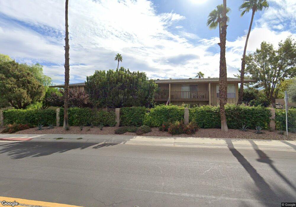
77815 California Dr Unit B12 Palm Desert, CA 92211
Palm Desert Country NeighborhoodEstimated Value: $193,000 - $222,000
1
Bed
1
Bath
750
Sq Ft
$281/Sq Ft
Est. Value
About This Home
This home is located at 77815 California Dr Unit B12, Palm Desert, CA 92211 and is currently estimated at $210,403, approximately $280 per square foot. 77815 California Dr Unit B12 is a home located in Riverside County with nearby schools including Gerald R. Ford Elementary School, Colonel Mitchell Paige Middle School, and Palm Desert High School.
Ownership History
Date
Name
Owned For
Owner Type
Purchase Details
Closed on
Sep 7, 2022
Sold by
Edward Salas
Bought by
Orourke Ellen K and Jackson Anthony
Current Estimated Value
Purchase Details
Closed on
Apr 2, 2012
Sold by
Us Bank National Association
Bought by
Salas Edward
Purchase Details
Closed on
May 18, 2011
Sold by
Berchtold Robert W
Bought by
Bank Of America National Association
Purchase Details
Closed on
Apr 28, 2006
Sold by
Benzinger Janell R and Benzinger Charles P
Bought by
Berchtold Robert W
Home Financials for this Owner
Home Financials are based on the most recent Mortgage that was taken out on this home.
Original Mortgage
$96,000
Interest Rate
7.64%
Mortgage Type
Negative Amortization
Purchase Details
Closed on
Dec 20, 2005
Sold by
Benzinger Janell R
Bought by
Benzinger Janell R and Benzinger Charles P
Create a Home Valuation Report for This Property
The Home Valuation Report is an in-depth analysis detailing your home's value as well as a comparison with similar homes in the area
Home Values in the Area
Average Home Value in this Area
Purchase History
| Date | Buyer | Sale Price | Title Company |
|---|---|---|---|
| Orourke Ellen K | $195,000 | Chicago Title | |
| Salas Edward | $31,500 | Ticor Title Company Of Ca | |
| Bank Of America National Association | $57,705 | Servicelink | |
| Berchtold Robert W | $120,000 | Chicago Title Company | |
| Benzinger Janell R | -- | -- |
Source: Public Records
Mortgage History
| Date | Status | Borrower | Loan Amount |
|---|---|---|---|
| Previous Owner | Berchtold Robert W | $96,000 |
Source: Public Records
Tax History Compared to Growth
Tax History
| Year | Tax Paid | Tax Assessment Tax Assessment Total Assessment is a certain percentage of the fair market value that is determined by local assessors to be the total taxable value of land and additions on the property. | Land | Improvement |
|---|---|---|---|---|
| 2025 | $2,820 | $202,878 | $36,414 | $166,464 |
| 2023 | $2,820 | $195,000 | $35,000 | $160,000 |
| 2022 | $964 | $44,966 | $11,829 | $33,137 |
| 2021 | $930 | $44,086 | $11,598 | $32,488 |
| 2020 | $919 | $43,635 | $11,480 | $32,155 |
| 2019 | $909 | $42,780 | $11,255 | $31,525 |
| 2018 | $898 | $41,942 | $11,035 | $30,907 |
| 2017 | $887 | $41,120 | $10,819 | $30,301 |
| 2016 | $879 | $40,314 | $10,607 | $29,707 |
| 2015 | $876 | $39,710 | $10,449 | $29,261 |
| 2014 | $875 | $38,935 | $10,246 | $28,689 |
Source: Public Records
Map
Nearby Homes
- 42639 Devonshire St
- 77650 California Dr
- 77630 California Dr
- 77590 California Dr
- 77575 California Dr
- 42605 Byron Place
- 78135 Calico Glen Dr
- 78150 Calico Glen Dr
- 77774 Woodhaven Dr S
- 77645 Mountain View
- 78179 Sombrero Ct
- 42935 Texas Ave
- 43170 Warner Trail
- 77583 Woodhaven Dr S Unit 832
- 77380 Minnesota Ave
- 42 Marricopa Ct
- 41644 Woodhaven Dr E
- 41823 Preston Trail
- 41690 Woodhaven Dr W
- 43140 Texas Ave
- 77815 California Dr Unit B6
- 77815 California Dr Unit B5
- 77815 California Dr Unit B4
- 77815 California Dr Unit B3
- 77815 California Dr Unit B2
- 77815 California Dr Unit B1
- 77815 California Dr Unit B10
- 77815 California Dr Unit B11
- 77815 California Dr Unit B12
- 77815 California Dr Unit B9
- 77815 California Dr Unit B8
- 77815 California Dr Unit B7
- 77815 California B-6 Dr Unit B6
- 77805 California Dr
- 77805 California Dr Unit A10
- 77805 California Dr Unit A11
- 77805 California Dr Unit A12
- 77805 California Dr Unit A8
- 77805 California Dr Unit A7
- 77805 California Dr Unit A6