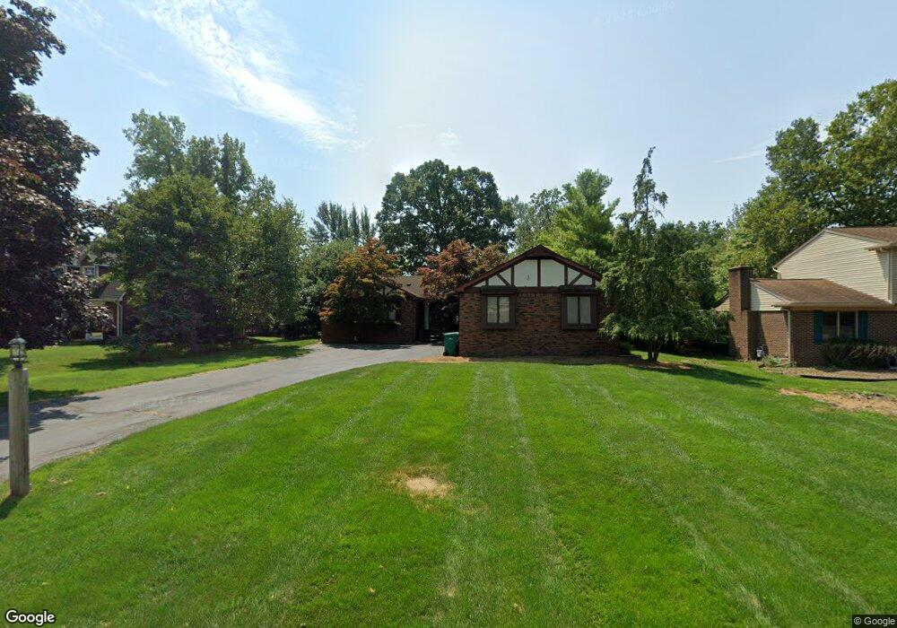
7789 Stout Ave Grosse Ile, MI 48138
Estimated Value: $374,554 - $401,000
3
Beds
3
Baths
1,742
Sq Ft
$220/Sq Ft
Est. Value
About This Home
This home is located at 7789 Stout Ave, Grosse Ile, MI 48138 and is currently estimated at $382,889, approximately $219 per square foot. 7789 Stout Ave is a home located in Wayne County.
Ownership History
Date
Name
Owned For
Owner Type
Purchase Details
Closed on
Mar 26, 2012
Sold by
Norton Gerald M and Norton Linda L
Bought by
Norton Gerald M and Norton Linda L
Current Estimated Value
Purchase Details
Closed on
Aug 24, 2001
Sold by
Crandal Jack Charlotte H
Bought by
Norton Gerald M
Create a Home Valuation Report for This Property
The Home Valuation Report is an in-depth analysis detailing your home's value as well as a comparison with similar homes in the area
Home Values in the Area
Average Home Value in this Area
Purchase History
| Date | Buyer | Sale Price | Title Company |
|---|---|---|---|
| Norton Gerald M | -- | None Available | |
| Norton Gerald M | -- | -- |
Source: Public Records
Tax History Compared to Growth
Tax History
| Year | Tax Paid | Tax Assessment Tax Assessment Total Assessment is a certain percentage of the fair market value that is determined by local assessors to be the total taxable value of land and additions on the property. | Land | Improvement |
|---|---|---|---|---|
| 2025 | $1,609 | $166,100 | $0 | $0 |
| 2024 | $1,609 | $153,100 | $0 | $0 |
| 2023 | $1,841 | $129,200 | $0 | $0 |
| 2022 | $4,284 | $120,200 | $0 | $0 |
| 2021 | $4,098 | $110,700 | $0 | $0 |
| 2019 | $4,064 | $95,900 | $0 | $0 |
| 2018 | $1,748 | $95,900 | $0 | $0 |
| 2017 | $4,513 | $91,300 | $0 | $0 |
| 2016 | $3,994 | $92,000 | $0 | $0 |
| 2015 | $8,506 | $89,100 | $0 | $0 |
| 2013 | $8,240 | $86,100 | $0 | $0 |
| 2012 | $1,747 | $82,000 | $16,500 | $65,500 |
Source: Public Records
Map
Nearby Homes
- 7806 Island Blvd
- 22220 E River Rd
- 22015 Ember Ct
- 8232 Island Blvd
- 21599 Parke Ln
- 8614 Island Blvd
- 21604 E River Rd
- 8258 Concord Rd
- 21644 Knudsen Dr
- Lot 503 Gi Pkwy
- 00000 Magnolia Ln
- VACANT Oriole Ave
- 8855 Ferry Rd
- 8842 Thorntree Dr
- 9000 Ferry Rd
- 22133 Meridian Rd
- 9281 Island Dr
- 0 Ferry Rd Unit 20250033371
- 21819 Meridian Rd
- 21321 Knudsen Dr
- 7775 Stout Ave
- 7807 Stout Ave
- 7761 Stout Ave
- 7903 Stout Ave
- 7854 Island Blvd
- 7780 Island Blvd
- 7802 Stout Ave
- 7770 Stout Ave
- 7908 Island Blvd
- 7860 Stout Ave
- 7747 Stout Ave
- 7760 Island Blvd
- 7930 Island Blvd
- 7920 Stout Ave
- 7723 Stout Ave
- 7953 Stout Ave
- 7748 Stout Ave Unit Bldg-Unit
- 7748 Stout Ave
- 7795 Island Blvd
- 7950 Island Blvd