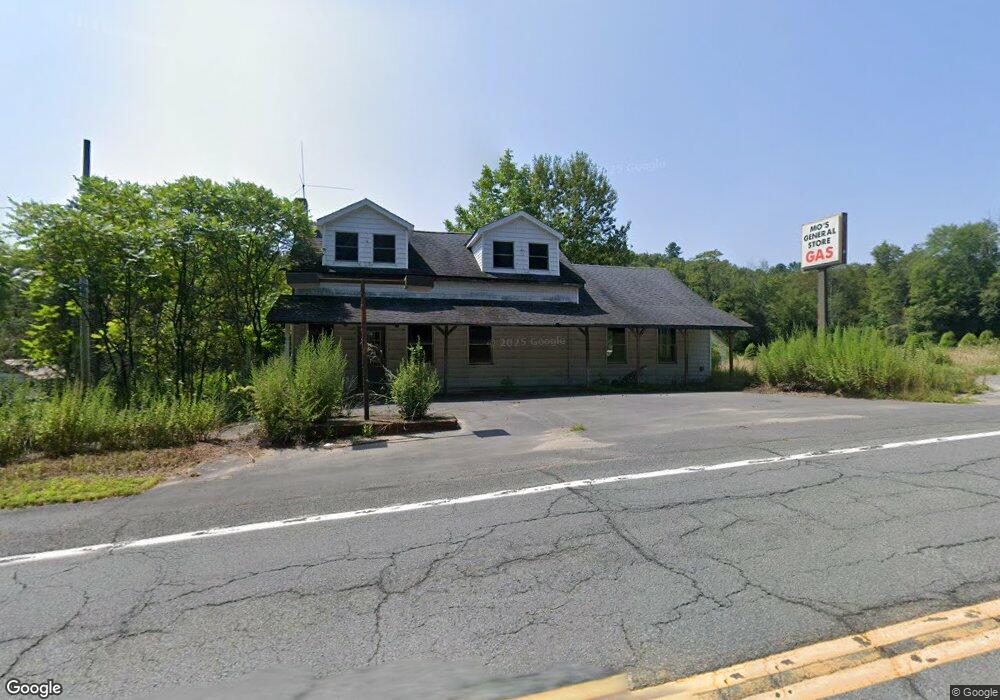
7792 State Route 55 Neversink, NY 12765
Estimated Value: $242,045
--
Bed
--
Bath
1,224
Sq Ft
$198/Sq Ft
Est. Value
About This Home
This home is located at 7792 State Route 55, Neversink, NY 12765 and is currently estimated at $242,045, approximately $197 per square foot. 7792 State Route 55 is a home located in Sullivan County with nearby schools including Tri-Valley Elementary School and Tri-Valley Secondary School.
Ownership History
Date
Name
Owned For
Owner Type
Purchase Details
Closed on
Apr 3, 2025
Sold by
Moloney Eileen and Moloney Seamus
Bought by
7792 Sr 55 Llc
Current Estimated Value
Purchase Details
Closed on
May 16, 2022
Sold by
Bab 55 Llc
Bought by
Moloney Eileen and Moloney Seamus
Purchase Details
Closed on
Apr 20, 2005
Purchase Details
Closed on
Jan 31, 2005
Sold by
Algabyali Mohamed
Bought by
Crupi Barry
Purchase Details
Closed on
Jun 6, 2002
Sold by
Coleman Robert W
Bought by
White Joanne Fraces
Purchase Details
Closed on
Apr 16, 2002
Sold by
Coleman Robert W
Bought by
Algabyali Mohamed
Create a Home Valuation Report for This Property
The Home Valuation Report is an in-depth analysis detailing your home's value as well as a comparison with similar homes in the area
Home Values in the Area
Average Home Value in this Area
Purchase History
| Date | Buyer | Sale Price | Title Company |
|---|---|---|---|
| 7792 Sr 55 Llc | -- | None Available | |
| Moloney Eileen | $70,000 | None Available | |
| -- | -- | -- | |
| -- | -- | -- | |
| Crupi Barry | $100,000 | Edward Delli Paoli | |
| Crupi Barry | $100,000 | Edward Delli Paoli | |
| White Joanne Fraces | -- | Brian Edwards | |
| White Joanne Fraces | -- | Brian Edwards | |
| Algabyali Mohamed | $92,500 | Mahesh Dave | |
| Algabyali Mohamed | $92,500 | Mahesh Dave |
Source: Public Records
Tax History Compared to Growth
Tax History
| Year | Tax Paid | Tax Assessment Tax Assessment Total Assessment is a certain percentage of the fair market value that is determined by local assessors to be the total taxable value of land and additions on the property. | Land | Improvement |
|---|---|---|---|---|
| 2024 | $3,489 | $4,000 | $600 | $3,400 |
| 2023 | $3,433 | $4,000 | $600 | $3,400 |
| 2022 | $3,605 | $4,000 | $600 | $3,400 |
| 2021 | $3,788 | $4,000 | $600 | $3,400 |
| 2020 | $3,797 | $4,000 | $600 | $3,400 |
| 2019 | $5,884 | $4,000 | $600 | $3,400 |
| 2018 | $5,884 | $4,000 | $600 | $3,400 |
| 2017 | $5,958 | $4,000 | $600 | $3,400 |
| 2016 | $5,856 | $4,000 | $600 | $3,400 |
| 2015 | -- | $4,000 | $600 | $3,400 |
| 2014 | -- | $4,000 | $600 | $3,400 |
Source: Public Records
Map
Nearby Homes
- 114 Wagners Rd
- 45 Overlook Rd
- 34 Overlook Rd
- 107 Overlook Rd
- 518 Myers Rd
- 1 Lake View Dr
- 497 Myers Rd
- 0 Benton Hollow Rd Unit KEY836200
- 15 Deans Way
- 32 Brookside Dr
- 109 Mutton Hill Rd
- 382 Benton Hollow Rd
- 650 Thunder Hill Rd
- 186 Schumway Rd
- 54 Davis Ln
- 442 Main St
- 203 Skyline Dr
- 94 Hastings Dr
- 0 Skyline Unit KEY873060
- 000 Little Hollow Rd
- 7798 State Route 55
- 8 Wagners Rd
- 7775 State Route 55
- 4 Slater Rd
- 13 Slater Rd
- 7822 State Route 55
- 7756 State Route 55
- 27 Slater Rd
- 10 Armstrong Rd
- 24 Slater Rd
- 7 Armstrong Rd
- 7832 State Route 55
- 34 Armstrong Rd
- 43 Slater Rd
- 23 Wagners Rd
- 23 Armstrong Rd
- 7752 State Route 55
- 7752 State Route 55
- 48 Wagners Rd
- 34 Slater Rd